Cartography from Bolerium Books Inc., ABAA/ILAB
New Arrivals

More Photos
Dai Nihon kokugun yochi zenzu 大日本國郡輿地全図
by Takashiba, Sanʼyu 高柴三雄
- Condition
- Used
- Published
- 1849
- Binding
- Paperback
- Quantity Available
- 1
- Seller
-
San Francisco, California, USA
- Item Price
-
€707.70
Show Details
Description:
Edo: Tsutaya Kichizo, 1849. Paperback. Approximately 57x29 inch map of Japan's prefectural divisions, folded in dark paper cover with title label, notes written with brush on rear cover. Some splits along the folds have old repairs to the rear, while other splits remain unbacked. A good candidate for professional rebacking. Small label of the bookseller J. Stanoff, a specialist… Read more about this item Item Price
€707.70

More Photos
Kanpan Jissoku Nihon chizu. Kinai, Tokai, Tosan, Hokuriku. 官板 実測日本地図. 畿内・東海・東山・北陸
- Condition
- Used
- Published
- n.d.
- Binding
- Map
- Quantity Available
- 1
- Seller
-
San Francisco, California, USA
- Item Price
-
€896.42
Show Details
Description:
n.p., n.d.. map. Large 61x90 inch map, folded into approximately 8.5x13 inch cloth-covered boards. One of four sheets published of this map of Japan based on the government's own highly accurate coastal surveillance (Kazutaka Unno, "Cartography in Japan," p. 453). No publisher's info on this quadrant of the map, but it appears to be the revised 1870 edition published… Read more about this item Item Price
€896.42

More Photos
Dai Nihon meisho ichiran 大日本名所一覧
by Kisai Risshō 喜斎立祥 (Hiroshige II)
- Condition
- Used
- Published
- 1866
- Quantity Available
- 1
- Seller
-
San Francisco, California, USA
- Item Price
-
€566.16
Show Details
Description:
Edo: Kinrindo Seishichi. 金鱗堂清七, 1866. Five prints joined together, mounted on a later scroll, total 48x14 inches. Numerous ownership seals, moderate spotting throughout, penultimate print has a rectangular stain at the center. A map-scroll depicting famous sites across the breadth of Japan. Item Price
€566.16

More Photos
Kokugun zenzu 國郡全圖
by Aou Tokei 青生東谿
- Condition
- Used
- Binding
- Paperback
- Quantity Available
- 1
- Seller
-
San Francisco, California, USA
- Item Price
-
€117.95
Show Details
Description:
Paperback. A Meiji or later reprint of the early 19th century atlas, in two volumes, 7.5x10.5 inches, bound with thread in traditional format, covers somewhat soiled, with bookseller's label. Item Price
€117.95
More Photos
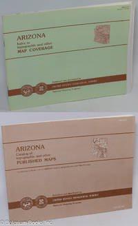
Arizona. Catalog of topographic and other Published Maps. Companion volume to the "Arizona Index to topographic and other Map Coverage" August 1987. [we offer the pair, AZ Catalog & AZ Index, together]
- Condition
- Used
- Published
- 1987
- Binding
- Pamphlet
- Quantity Available
- 1
- Seller
-
San Francisco, California, USA
- Item Price
-
€16.04
Show Details
Description:
Reston VA: Published and distributed by United States Geological Survey, National Mapping Programj. Department of the Interior, 1987. Pamphlet. Index: 37p., softbound, an oblong pamphlet measuring 8.5x11 inches, fine condition. Catalog: 56p., all available maps shown here vignette-size in green & blue monochromes, fine condition. The two paired items together, complete. Item Price
€16.04

More Photos
Utah. Catalog of topographic and other Published Maps. Companion volume to the "Utah Index to topographic and other Map Coverage" September 1986. [we offer the pair, Utah Catalog & Utah Index, together]
- Condition
- Used
- Published
- 1986
- Binding
- Pamphlet
- Quantity Available
- 1
- Seller
-
San Francisco, California, USA
- Item Price
-
€14.15
Show Details
Description:
Reston VA: Published and distributed by United States Geological Survey, National Mapping Programj. Department of the Interior, 1986. Pamphlet. Index: 29p., softbound, an oblong pamphlet measuring 8.5x11 inches, fine condition. Catalog: 43p., all available maps shown here vignette-size in green & blue monochromes, fine condition. The two paired items together, complete. Item Price
€14.15
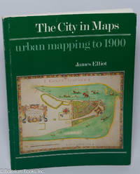
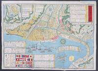
The City in Maps: urban mapping to 1900
by Elliot, James
- Condition
- Used
- Published
- 1987
- Binding
- Paperback
- Quantity Available
- 1
- Seller
-
San Francisco, California, USA
- Item Price
-
€20.76
Show Details
Description:
London: The British Library, 1987. Paperback. 88p., profuse b&w reproductions facing the running text or incorporating detailed captions, with eight (8) fullpage color facsimiles, semi-glazed alkaline paperstock softbound in 9.5x7.5 inch color wraps. Covers mildly edgeworn, clean within and unmarked except for a dealer's price in pencil to half-title, a very good copy of a handsome book. Commences with… Read more about this item Item Price
€20.76

Izu Shichitō zenzu 伊豆七島全圖 (Map of the Seven Islands of Izu)
by Tojo Kindai 東條琴臺, et al.
- Condition
- Used
- Published
- 1842
- Binding
- Map
- Quantity Available
- 1
- Seller
-
San Francisco, California, USA
- Item Price
-
€613.34
Show Details
Description:
n.pub, 1842. Map. 41x29.75 inch folded map with exterior boards; several splits along the folds, should be professionally re-backed. Date of publication is from the preface by Nagayama Choen. Oriented with north to the left. The Seven Islands of Izu are off the coast of Tokyo; an inset also depicts the Bonin Islands. Item Price
€613.34
![[Woodblock-printed map of the Kinki 近畿 area]](https://d3525k1ryd2155.cloudfront.net/h/309/790/1521790309.0.m.jpg)
[Woodblock-printed map of the Kinki 近畿 area]
by Tsutsui Shohachi 筒井庄八
- Condition
- Used
- Published
- 1879
- Binding
- Woodblock print
- Quantity Available
- 1
- Seller
-
San Francisco, California, USA
- Item Price
-
€330.26
Show Details
Description:
Suimon Village, Nara Prefecture: Tsutsui Shojiro, 1879. Woodblock print. Untitled 26x23.75 inch map of Kinki (the region around Osaka, Kyoto, and Nara), formed by linking four woodblock prints together. Fold-creased, a couple of tiny holes, generally very good. Item Price
€330.26

Manuscript map of Ōtsu 大津 (in modern day Shiga prefecture on Lake Biwa)
- Condition
- Used
- Published
- n.d.
- Binding
- Map
- Quantity Available
- 1
- Seller
-
San Francisco, California, USA
- Item Price
-
€471.80
Show Details
Description:
n.d.. Map. 16.5x11 inch manuscript map, 19th century, ink brush on paper, identifying label pasted in upper left corner; mild handling, very good. This town was famous for its Ōtsu-e (traditional folk paintings sold to travelers). Item Price
€471.80
![[Map of Osaka]](https://d3525k1ryd2155.cloudfront.net/h/937/239/1519239937.0.m.jpg)
[Map of Osaka]
- Condition
- Used
- Published
- 1835
- Binding
- Map
- Quantity Available
- 1
- Seller
-
San Francisco, California, USA
- Item Price
-
€471.80
Show Details
Description:
Harimaya Kyubei 播磨屋九兵衞, 1835. map. 16x20.5 inch woodblock printed map, creased from folding, several small wormholes that have been repaired by re-backing. Date of this edition given as Tempo year 6. Some versions of this map have a title at upper right, but this one was printed without title. Item Price
€471.80

More Photos
Nihon sankai zudō taizen 日本山海圖道大全
by Ishikawa Ryūsen 石川流宣
- Condition
- Used
- Published
- 1703
- Binding
- Map
- Quantity Available
- 1
- Seller
-
San Francisco, California, USA
- Item Price
-
€5,661.60
Show Details
Description:
Edo: Sagamiya Tahē, 1703. Map. Approximately 67x34.25 inch folded map, fitted together from separate woodblock prints. The folded map is stored in a modern blue case. Examples of this map are often found colored by hand, but this example remains relatively unadorned, with only yellow coloration added to cartouches. Minor wormholing, and loss at the edges, has been stabilized by… Read more about this item Item Price
€5,661.60
More Photos
Kaisei dōban yokohama chizu 改正銅版横濵地圖
- Condition
- Used
- Published
- 1885
- Binding
- Map
- Quantity Available
- 1
- Seller
-
San Francisco, California, USA
- Item Price
-
€849.24
Show Details
Description:
Yokohama: Ozaki Tomigorō, 1885. map. Copperplate-printed folding map with thin, flexible exterior boards, 19.5x14.25 inches when unfolded. Penciled note at upper right margin states that this was item 228 in Maggs Bros. Catalog 1311; otherwise very good to fine. Inset at lower left depicts the flags of ships that would have been spotted in the trading port of Yokohama;… Read more about this item Item Price
€849.24

More Photos
Shin'etsu dai jishin basho 信越大地震場所
- Condition
- Used
- Published
- 1847
- Quantity Available
- 1
- Seller
-
San Francisco, California, USA
- Item Price
-
€707.70
Show Details
Description:
1847. Illustrative map with text, depicting the ravages of the earthquake that struck the Nagano region in 1847. Two woodblock prints are linked together, total dimensions 26.5x17.75 inches. Dated Kōka year 4, 28th day of the 5th month (new edition). Right side is mounted on a sheet of modern generic card stock. The rolling hills and shifting alignment of… Read more about this item Item Price
€707.70
![Tokaido meisho zue 東海道名所図会 [Illustrations of famous places on the Tokaido Road]](https://d3525k1ryd2155.cloudfront.net/h/701/239/1519239701.0.m.jpg)
More Photos
Tokaido meisho zue 東海道名所図会 [Illustrations of famous places on the Tokaido Road]
by Utagawa Yoshitora 歌川芳虎
- Condition
- Used
- Published
- 1864
- Binding
- Woodblock print
- Quantity Available
- 1
- Seller
-
San Francisco, California, USA
- Item Price
-
€1,415.40
Show Details
Description:
Edo: Daikokuya Kinnosuke, 1864. Woodblock print. Map" printed on a series of four triptychs, for a total of 12 woodblock-printed sheets, mounted on a later scroll. Each print is about 9x13.5 inches, for a total length of nine feet of printed surface. Some scuffing and trimming to the prints. On this depiction of the famous Road, all sense of… Read more about this item Item Price
€1,415.40

More Photos
Nansenbushū bankoku shōka no zu 南瞻部洲萬國掌菓之圖
by Soshun Hōtan 僧濬鳳潭
- Condition
- Used
- Published
- 1710
- Binding
- Map
- Quantity Available
- 1
- Seller
-
San Francisco, California, USA
- Item Price
-
€5,661.60
Show Details
Description:
Kyoto: Bundaiken Uhei 文臺軒宇平, 1710. Approximately 55.5x46 inch folded map, fitted together from separate woodblock prints. One of the thick paper covers (which protect the map when folded) is partly separated but still holding on. A few minor wormholes and edge chips have long ago been reinforced with backing paper. Some yellow spots are spread across the upper portion. Dated… Read more about this item Item Price
€5,661.60

More Photos
Bunkyu kaisei shinsen kyo ezu 文久改正新選京繪圖
- Condition
- Used
- Published
- 1863
- Binding
- Map
- Quantity Available
- 1
- Seller
-
San Francisco, California, USA
- Item Price
-
€566.16
Show Details
Description:
Kyoto: Takehara Yoshibē, 1863. Folded map with external boards, 27x19.5 inches when unfolded, minor wear at the creases, very good. A woodblock-printed depiction of Kyoto at the end of the Tokugawa shogunate. Item Price
€566.16

The Expedition of the St Jean-Baptiste to the Pacific 1769-1770, From Journals of Jean de Surville and Guillaume Labe. Translated and edited by John Dunmore
by de Surville, Jean, and Guillaume Labe
- Condition
- Used
- Published
- 1981
- Binding
- Hardcover
- ISBN
- 9780904180114
- Quantity Available
- 1
- Seller
-
San Francisco, California, USA
- Item Price
-
€28.31
Show Details
Description:
London: The Hakluyt Society, 1981. Hardcover. x, 310p., hardbound in 8.5x5.5 inch bright blue cloth boards gilt and enclosed in the dust jacket. Illustrated with maps and plates. Top edge of the textblock is faintly foxed, and the dj shows foxing and dust-soil to its top margins, else unflawed: perfectly sound, otherwise clean, and free of any markings. … Read more about this item Item Price
€28.31
![La Austrialia del Espiritu Santo; The Journal of Fray Martin de Munilla O.F.M. and other documents relating to The Voyage of Pedro Fernandez de Quiros to the South Sea (1605-1606) and the Franciscan Missionary Plan (1617-1627) - Translated and Edited by Celsus Kelly O.F.M. With ethnological introduction, appendix, and other contributions by G.S. Parsonson. Volume I, Volume II [the pair complete]](https://d3525k1ryd2155.cloudfront.net/h/022/429/1512429022.0.m.jpg)
La Austrialia del Espiritu Santo; The Journal of Fray Martin de Munilla O.F.M. and other documents relating to The Voyage of Pedro Fernandez de Quiros to the South Sea (1605-1606) and the Franciscan Missionary Plan (1617-1627) - Translated and Edited by Celsus Kelly O.F.M. With ethnological introduction, appendix, and other contributions by G.S. Parsonson. Volume I, Volume II [the pair complete]
by Munilla, Fray Martin de, O.F.M., &c &c
- Condition
- Used
- Published
- 1966
- Binding
- Hardcover
- Quantity Available
- 1
- Seller
-
San Francisco, California, USA
- Item Price
-
€28.31
Show Details
Description:
Cambridge: Published by the Hakluyt Society at the Cambridge University Press, 1966. Hardcover. xvii, 270, xv, 273-446p., matched pair in Hakluyt's signature format: blue cloth boards gilt & blind and enclosed in their dust jackets. Top edges of both volumes are dusty and foxed, and the second was printed on paperstock not fully alkaline, giving v.2 a pervasive mild… Read more about this item Item Price
€28.31

More Photos
The Voyage of Semen Dezhnev in 1648: Bering's Precursor, with Selected Documents by Raymond H. Fisher
by Fisher, Raymond H.
- Condition
- Used
- Published
- 1981
- Binding
- Hardcover
- ISBN
- 9780904180077
- Quantity Available
- 1
- Seller
-
San Francisco, California, USA
- Item Price
-
€28.31
Show Details
Description:
London: The Hakluyt Society, 1981. Hardcover. xiv, 326p., plentifully supplied with modern line maps (twenty-two) and three illustrations, hardbound in Hakluyt fashion: blue cloth boards gilt & blind, please note that this copy lacks the dust jacket. Aside from a faint sprinkle of foxing to top edge, item is perfectly clean, and is sound and unmarked. FYI, title refers… Read more about this item Item Price
€28.31
