Description:
London: William Berry, 1680. ...Kingdoms, and States, which are found there at present/Described by Sanson/Corrected and amended By William Berry (=Kopftitel); Text der figürlich reich verzierten Kartusche oben rechts: Asia Divided into its Principall Regions in which may be seen the extent of the Empires Monarchies Kingdoms and States which at present divide Asia/To the Most serene and Most Sacred Majesty of Charles II./By the Grace of God King of Great Britain, France and Ireland/This Map of Asia is humbly Dedicated and Presented By Your Majesties Loyal Subject and Servand William Berry; Text der reich verzierten Kartusche links oben: Scale (es folgen Maßstäbe verschiedener Länder)/London/Sold by William Berry at the Sign of the Globe between Charing-Cross and White-Hall/1680; SW-Kupferstich-Landkarte nach (Nicolas) Sanson (d'Abbeville) gestochen von William Berry; ca. 51 x 39 cm; Falzspuren, einige Tintenflecken, hauptsächlich ausserhalb des Druckbildes, mässige…
Read More A New Universal Atlas Containing Maps of the various Empires, Kingdoms, State and Republics of the World. With a Special Map of each of the United States, Plans of Cities, &c. by Mitchell, Samuel Augustus - 1849
by Mitchell, Samuel Augustus
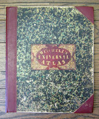
A New Universal Atlas Containing Maps of the various Empires, Kingdoms, State and Republics of the World. With a Special Map of each of the United States, Plans of Cities, &c.
by Mitchell, Samuel Augustus
- Used
- Hardcover
- first
Philadelphia: S. Augustus Mitchell, 1849 Folio. (17 3/8 x 14 inches). Lithographed title with large vignette, letterpress "Table of Contents," and 73 hand-colored lithographed maps, charts and city plans. Three-quarter red morocco over marbled boards, large red morocco title label on front cover, elaborately tooled and lettered in gilt. Spine and corners renewed in red leather. Boards rubbed and scuffed at edges. Maps in fine condition. Overall, a fine copy. A very nice copy of this very scarce atlas, with hand-colored maps of all the individual States and Territories, and including the rare and famous map of "Oregon, Upper California & New Mexico" showing the large yellow-colored area in California labeled "Gold Region." The Atlas concentrates on the American continent with 43 maps of the area, including a fine double-page coast-to-coast map of the United States. Samuel Augustus Mitchell and his sons were the leading publishers of maps in the United States during most of the nineteenth century. A New American Atlas, published in 1831, was Mitchell's first work. In 1846 he published his first edition of the present work. He continued to publish the Atlas until 1850, when he sold the copyright to Cowperthwait & Co. It was with this 1849 edition that "New Mexico" was added to the title of the map, as well as the words, "Gold Region," added in a large yellow area in "Upper or New California." As Wheat states, "We find S. Augustus Mitchell in Philadelphia publishing, in 1849, a revised version of his Texas, Oregon, and California map, taking advantage of Frémont's later work and displaying a large, colored Gold Region." Also, many routes are shown by red hand-colored lines, including Frémont's routes. [Wheat: Mapping the Transmississippi West: 630, p.284; text, p.82; not noted in Wheat's Maps of the Gold Region]..
-
Bookseller
Argonaut Book Shop
 (US)
(US)
- Book Condition Used
- Binding Hardcover
- Publisher S. Augustus Mitchell
- Place of Publication Philadelphia
- Date Published 1849
- Keywords Gold Rush California Maps Cartography Atlases Atlas Samuel Augustus Mitchell

More Photos
Asia Distinguished in its Principall Parts uiz Turky in Asia, Arabia, Persia, India, China, Tartaria, The Islands of Japan, of the Philippines, of the Moluckes, of the Sundaes, of Ceylan, and of the Maldivies, where are set down the Empires, Monarchies...
by Sanson, (Nicolas)/Berry, William
- Used
- Condition
- Used - Gut
- Binding
- Unknown
- Quantity Available
- 1
- Seller
-
Velbert, Germany
- Item Price
-
€5,390.00
Show Details
Item Price
€5,390.00
![Stockton Looking East. San Joaquin County, Cal. Original Bird's Eye View. [LITHOGRAPH]](https://d3525k1ryd2155.cloudfront.net/h/929/544/257544929.0.m.jpg)
Stockton Looking East. San Joaquin County, Cal. Original Bird's Eye View. [LITHOGRAPH]
- Used
- Fine
- Condition
- Used - Fine
- Binding
- Unknown
- Quantity Available
- 1
- Seller
-
San Francisco, California, United States
- Item Price
-
€3,079.05
Show Details
Description:
San Francisco: Lithographed by W. W. Elliott Map/Print. Illus. by Sketched by C. P. Cook. Fine. No Binding. Lithograph. No date (c.1890). 24x38 inches. Lithographed in black on white. Top border edge just a bit rough, but a fine crisp copy. A magnificent bird's-eye view showing all of the city of Stockton, California and the surrounding country. All of the streets and roads are labeled. Surrounding the view are 26 insets showing public and commercial buildings. Includes promotional text for the city as well as an index of significant buildings and places, keyed by number to the view. At the bottom border, "Compliments of E.A. Crennan & Co., Real Estate Auctioneers, Stockton, California." W.W. Elliott is best known for his views in a number of the county histories produced in the 1870's and 1880's. Unlike many lithographers of similar views of that period, Elliott had a knack for artistic shading which gave his images a wonderful quality of depth and clarity. This lithograph…
Read More Item Price
€3,079.05
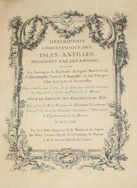
(History of Cartography, Geographic description of the Antilles): Description geographique des isles Antilles possédées par les Anglois
by Bellin, Jacques Nicolas
- Used
- Very Good
- Hardcover
- first
- Condition
- Used - Very Good
- Edition
- First Edition
- Binding
- Hardcover
- Quantity Available
- 1
- Seller
-
Crozet, Virginia, United States
- Item Price
-
€7,176.56
Show Details
Description:
A Paris: De l'imprimerie de Didot, 1758. This 10.5 inch quarto is in very good condition, sound hinges, 171 pp. with all 22 maps (several folding), plans and views in very good or better condition on heavy paper. Contemporary calf boards with original marbeled pastedowns, two title pages (one decorative with attribution to Bellin), "Tables des Titres" and "Table des Cartes, Plans et Vues." Six compartment, banded spine, with red, gilt title label.Triple (French), gilt fillets on front and rear boards. Bellin was the first chief hydrographic engineer of the French Hydrographic Office (see Tooley's Dictionary of Mapmakers, revised ed.). Ref: Beinecke, Lesser Antilles Collection, 215; Sabin 4553. This is an extremely nice copy.. First Edition. Full-Leather. Very Good.
Item Price
€7,176.56

More Photos
Avrupa-i Osmani Haritasi (Wall map of the Ottoman Europe), extra ordinary copy of an Ottoman lieutenant
- Used
- Very Good
- Condition
- Used - Very Good
- Quantity Available
- 1
- Seller
-
Riyadh, Saudi Arabia
- Item Price
-
€6,631.80
Show Details
Description:
205 x 137 cm. extra ordinary Ottoman wall map of the Ottoman Europe prınted ın colors, folding paper on cloth. Signatures by the first lieutenant M. İhsan.
Item Price
€6,631.80

More Photos
The Edinburgh Geographical and Historical Atlas
by John Hamilton
- Used
- Hardcover
- Condition
- Used - Very good +
- Binding
- Hardcover
- Quantity Available
- 1
- Seller
-
London, Ontario, Canada
- Item Price
-
€7,105.50
Show Details
Description:
Edinburgh: John Hamilton, ca. 1831. Leatherbound. Very good +. 16, 288, 4 p. 49 cm. 68 hand-coloured maps, many fold-out, and one fold-out of Mountain Chains with b&w engraving. Plate 32 missing as stipulated in Contents. Scales differ. Rebound in half leather by Keith Felton. Gilt trim. Original boards. Occasional dampstains and thumbing. Tear in fold of plate 61. Repairs to edges and corners of Contents page. Earlier repairs to edges of Table of Mountain Chains, Chart of the World, fold-out map of the Russian Empire. Title continues: "Comprehending A Sketch of the History of Geography; A View of the Principles of Mathematical, Physical, Civil, and Political Geography; An Account of the Geography, Statistics, and History of Each Continent, State, and Kingdom, Delineated. And a Tabular View of the Principal Mountain Chains in the World. Engraved on Sixty-nine Copperplates, and Compiled from Materials Drawn from the Newest and most Authentic Sources." This magnificent atlas was published about 1831…
Read More Item Price
€7,105.50
More Photos
Asia Distinguished in its Principall Parts uiz Turky in Asia, Arabia, Persia, India, China, Tartaria, The Islands of Japan, of the Philippines, of the Moluckes, of the Sundaes, of Ceylan, and of the Maldivies, where are set down the Empires, Monarchies...
by Sanson, (Nicolas)/Berry, William
- Used
- Condition
- Used - Gut
- Binding
- Unknown
- Quantity Available
- 1
- Seller
-
Velbert, Germany
- Item Price
-
€5,390.00
Show Details
Description:
London: William Berry, 1680. ...Kingdoms, and States, which are found there at present/Described by Sanson/Corrected and amended By William Berry (=Kopftitel); Text der figürlich reich verzierten Kartusche oben rechts: Asia Divided into its Principall Regions in which may be seen the extent of the Empires Monarchies Kingdoms and States which at present divide Asia/To the Most serene and Most Sacred Majesty of Charles II./By the Grace of God King of Great Britain, France and Ireland/This Map of Asia is humbly Dedicated and Presented By Your Majesties Loyal Subject and Servand William Berry; Text der reich verzierten Kartusche links oben: Scale (es folgen Maßstäbe verschiedener Länder)/London/Sold by William Berry at the Sign of the Globe between Charing-Cross and White-Hall/1680; SW-Kupferstich-Landkarte nach (Nicolas) Sanson (d'Abbeville) gestochen von William Berry; ca. 51 x 39 cm; Falzspuren, einige Tintenflecken, hauptsächlich ausserhalb des Druckbildes, mässige…
Read More Item Price
€5,390.00
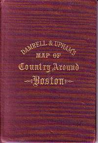
Damrell & Upham's Map of Country Around Boston
- Used
- Good
- Hardcover
- Condition
- Used - Good
- Binding
- Hardcover
- Quantity Available
- 1
- Seller
-
Houlton, Maine, United States
- Item Price
-
€118.42
Show Details
Description:
The Boston Map Store, 1889 IN GOOD CONDITION. Folds out to 32 inches by 22 inches. Hand coloured map of Boston and the Country Adjacent, from actual Surveys. Shows crease tears and stains.
Item Price
€118.42
Stockton Looking East. San Joaquin County, Cal. Original Bird's Eye View. [LITHOGRAPH]
- Used
- Fine
- Condition
- Used - Fine
- Binding
- Unknown
- Quantity Available
- 1
- Seller
-
San Francisco, California, United States
- Item Price
-
€3,079.05
Show Details
Description:
San Francisco: Lithographed by W. W. Elliott Map/Print. Illus. by Sketched by C. P. Cook. Fine. No Binding. Lithograph. No date (c.1890). 24x38 inches. Lithographed in black on white. Top border edge just a bit rough, but a fine crisp copy. A magnificent bird's-eye view showing all of the city of Stockton, California and the surrounding country. All of the streets and roads are labeled. Surrounding the view are 26 insets showing public and commercial buildings. Includes promotional text for the city as well as an index of significant buildings and places, keyed by number to the view. At the bottom border, "Compliments of E.A. Crennan & Co., Real Estate Auctioneers, Stockton, California." W.W. Elliott is best known for his views in a number of the county histories produced in the 1870's and 1880's. Unlike many lithographers of similar views of that period, Elliott had a knack for artistic shading which gave his images a wonderful quality of depth and clarity. This lithograph…
Read More Item Price
€3,079.05
(History of Cartography, Geographic description of the Antilles): Description geographique des isles Antilles possédées par les Anglois
by Bellin, Jacques Nicolas
- Used
- Very Good
- Hardcover
- first
- Condition
- Used - Very Good
- Edition
- First Edition
- Binding
- Hardcover
- Quantity Available
- 1
- Seller
-
Crozet, Virginia, United States
- Item Price
-
€7,176.56
Show Details
Description:
A Paris: De l'imprimerie de Didot, 1758. This 10.5 inch quarto is in very good condition, sound hinges, 171 pp. with all 22 maps (several folding), plans and views in very good or better condition on heavy paper. Contemporary calf boards with original marbeled pastedowns, two title pages (one decorative with attribution to Bellin), "Tables des Titres" and "Table des Cartes, Plans et Vues." Six compartment, banded spine, with red, gilt title label.Triple (French), gilt fillets on front and rear boards. Bellin was the first chief hydrographic engineer of the French Hydrographic Office (see Tooley's Dictionary of Mapmakers, revised ed.). Ref: Beinecke, Lesser Antilles Collection, 215; Sabin 4553. This is an extremely nice copy.. First Edition. Full-Leather. Very Good.
Item Price
€7,176.56
More Photos
Avrupa-i Osmani Haritasi (Wall map of the Ottoman Europe), extra ordinary copy of an Ottoman lieutenant
- Used
- Very Good
- Condition
- Used - Very Good
- Quantity Available
- 1
- Seller
-
Riyadh, Saudi Arabia
- Item Price
-
€6,631.80
Show Details
Description:
205 x 137 cm. extra ordinary Ottoman wall map of the Ottoman Europe prınted ın colors, folding paper on cloth. Signatures by the first lieutenant M. İhsan.
Item Price
€6,631.80

Stock Photo: Cover May Be Different
Description of Oregon and California, Embracing an Account of the Gold Regions
by Mitchell, Samuel Augustus
- Used
- Condition
- UsedVeryGood
- ISBN 10 / ISBN 13
- 9781245627153 / 1245627155
- Quantity Available
- 1
- Seller
-
Philadelphia, Pennsylvania, United States
- Item Price
-
€19.17
Show Details
Description:
UsedVeryGood. signs of little wear on the cover.
Item Price
€19.17
Stock Photo: Cover May Be Different
Description of Oregon and California, Embracing an Account of the Gold Regions
by Mitchell, Samuel Augustus
- Used
- Condition
- New
- ISBN 10 / ISBN 13
- 9781245627153 / 1245627155
- Quantity Available
- 1
- Seller
-
Philadelphia, Pennsylvania, United States
- Item Price
-
€19.36
Show Details
Description:
UsedLikeNew. Remainder mark
Item Price
€19.36

Stock Photo: Cover May Be Different
New Traveller's Guide Through the United States
by Mitchell, Samuel Augustus
- Used
- Condition
- UsedVeryGood
- ISBN 10 / ISBN 13
- 9781179651392 / 1179651391
- Quantity Available
- 1
- Seller
-
Bensalem, Pennsylvania, United States
- Item Price
-
€20.59
Show Details
Description:
UsedVeryGood. signs of little wear on the cover.
Item Price
€20.59

Stock Photo: Cover May Be Different
Mitchell's New Traveller's Guide Through the United States, Containing the Principal Cities, Towns, &C. Alphabetically Arranged: Together with the Rai
by Mitchell, Samuel Augustus
- Used
- Condition
- UsedVeryGood
- ISBN 10 / ISBN 13
- 9781273018886 / 1273018885
- Quantity Available
- 1
- Seller
-
Bensalem, Pennsylvania, United States
- Item Price
-
€20.59
Show Details
Description:
UsedVeryGood. signs of little wear on the cover.
Item Price
€20.59
Stock Photo: Cover May Be Different
Mitchell's New Traveller's Guide Through the United States, Containing the Principal Cities, Towns, &C. Alphabetically Arranged: Together with the Rai
by Mitchell, Samuel Augustus
- Used
- Condition
- New
- ISBN 10 / ISBN 13
- 9781273018886 / 1273018885
- Quantity Available
- 1
- Seller
-
Bensalem, Pennsylvania, United States
- Item Price
-
€20.80
Show Details
Description:
UsedLikeNew. Remainder mark
Item Price
€20.80
Stock Photo: Cover May Be Different
New Traveller's Guide Through the United States
by Mitchell, Samuel Augustus
- Used
- Condition
- New
- ISBN 10 / ISBN 13
- 9781179651392 / 1179651391
- Quantity Available
- 1
- Seller
-
Bensalem, Pennsylvania, United States
- Item Price
-
€20.80
Show Details
Description:
UsedLikeNew. Remainder mark
Item Price
€20.80

Stock Photo: Cover May Be Different
An Easy Introduction to the Study of Geography: Designed for the Instruction of Children in Schools and Families: Illustrated by One Hundred and Twenty Engravings, and Fourteen Maps
by Mitchell, Samuel Augustus
- Used
- Condition
- UsedVeryGood
- ISBN 10 / ISBN 13
- 9781141004478 / 114100447X
- Quantity Available
- 1
- Seller
-
Bensalem, Pennsylvania, United States
- Item Price
-
€22.01
Show Details
Description:
UsedVeryGood. Minor shelf wear
Item Price
€22.01
Stock Photo: Cover May Be Different
An Easy Introduction to the Study of Geography: Designed for the Instruction of Children in Schools and Families: Illustrated by One Hundred and Twenty Engravings, and Fourteen Maps
by Mitchell, Samuel Augustus
- Used
- Condition
- New
- ISBN 10 / ISBN 13
- 9781141004478 / 114100447X
- Quantity Available
- 1
- Seller
-
Bensalem, Pennsylvania, United States
- Item Price
-
€22.24
Show Details
Description:
UsedLikeNew. Remainder mark
Item Price
€22.24
Stock Photo: Cover May Be Different
An Easy Introduction to the Study of Geography: Designed for the Instruction of Children in Schools and Families: Illustrated by One Hundred and Twenty Engravings, and Fourteen Maps
by Mitchell, Samuel Augustus
- New
- Condition
- New
- ISBN 10 / ISBN 13
- 9781141004478 / 114100447X
- Quantity Available
- 1
- Seller
-
Bensalem, Pennsylvania, United States
- Item Price
-
€22.46
Show Details
Description:
New. .
Item Price
€22.46

Map of North America Engraved to Illustrate Mitchell's New Intermediate Geography
by Mitchell, Samuel Augustus
- Used
- Condition
- Used - Very Good -
- Jacket Condition
- No Jacket
- Quantity Available
- 1
- Seller
-
truth or consequences, New Mexico, United States
- Item Price
-
€18.00
Show Details
Description:
Philadelphia, Pennsylvania: J. H. Butler, 1874. Paper Back. Very Good -/No Jacket. 4to - over 9¾" - 12" tall. Map of North America from Mitchell's New Intermediate Geography (believed pub.1874 --- book 3). Hand-colored map w/age-darkend paper; chips & tears on edges. includes U.S., 'British America', 'Russian America', & Mexico.
Item Price
€18.00

More Photos
The Sky and the Forest
by Forester, C.S
- Used
- Very Good
- Hardcover
- first
- Condition
- Used - Very Good
- Jacket Condition
- Very Good
- Edition
- First Edition
- Binding
- Hardcover
- Quantity Available
- 1
- Seller
-
Salem, Oregon, United States
- Item Price
-
€33.05€16.53Save €17.44!
Show Details
Description:
C.S. Forester: The Sky and the Forest. Little, Brown and Company, Boston. Stated First Edition First Printing Thus August, 1948. Cover price $2.75. Used. VG BOOK/VG UNCLIPPED DUST JACKET. A story of a central Africa. By C.S. Forester, author of the Admiral Hornblower series.
Item Price
€33.05€16.53
Save €17.44
!

More Photos
Old Decorative Maps and Charts
by Humphreys, Arthur L
- Used
- Very Good
- Hardcover
- first
- Condition
- Used - Very Good
- Jacket Condition
- No Jacket
- Edition
- First Edition
- Binding
- Hardcover
- Quantity Available
- 1
- Seller
-
Sumner, Iowa, United States
- Item Price
-
€42.63
Show Details
Description:
London: London: Halton & Truscott Smith, LTD>. Limited Edition of 1500 copies of which this is number No. 906---Clean, no marks, pages pristine. 79 maps dated 1482-1776 from engravings in the MacPherson Collection. Top Edge Gilt--No DJ Covers rubbed and very slight lean to spine----interior in excellent condition. . Very Good. Hardcover. First Edition. 1926.
Item Price
€42.63

More Photos
Plat Book: Pierce County, Wisconsin
by Rhame, A. E
- Used
- Fine
- Paperback
- Condition
- Used - Fine
- Binding
- Paperback
- Quantity Available
- 1
- Seller
-
Woodruff, Wisconsin, United States
- Item Price
-
€44.21
Show Details
Description:
1930. Soft Cover. Fine. Unpaginated. Tan colored book is in Fine condition, no sign of wear.
Item Price
€44.21
![Alaska and Klondike Region; [With inset of Klondike Region on the Upper Yukon detail] [From an...](https://d3525k1ryd2155.cloudfront.net/h/062/537/1339537062.0.m.jpg)
Alaska and Klondike Region; [With inset of Klondike Region on the Upper Yukon detail] [From an atlas, "Gazetteer of Alaska and Yukon Region " pp. 105 and 106]
by Miller, J. Martin
- Used
- Very Good
- Condition
- Used - Very Good
- Edition
- Unknown
- Quantity Available
- 1
- Seller
-
Sebastopol, California, United States
- Item Price
-
€36.95
Show Details
Description:
Chicago: J. Martin Miller, 1899. Unknown. Map. Very Good. [Map copyright 1899, printing date of Atlas later] [19.875x15.125in]; Colored map of Alaska with steamer routes from Portland and Seattle, insets of the Klondike Region on the Upper Yukon and Western portion of Aleutian Islands; On verso index of places and names with two large black and white images; Age toning to all edges, water stain marks on bottom, slight printing offset of colors, small chips and closed tears to lower edge;.
Item Price
€36.95

Zemepis Sveta - Monsunova Asie
by De La Blache, P. Vidal; Gallois, L
- Used
- Hardcover
- Condition
- Used - Very Good Condition
- Jacket Condition
- No Dust Jacket
- Binding
- Hardcover
- Quantity Available
- 1
- Seller
-
Oak Point, Texas, United States
- Item Price
-
€56.84
Show Details
Description:
Aventinum, Prague, Czechoslovakia, 1930. Hardcover. Very Good Condition/No Dust Jacket. Text entirely in Czech. Geography book on Asia with numerous photographs and maps. 1931 edition also available. Size: 4mo - over 9 3/4" - 12" tall. 400 pp. Pages are yellowed, but are tight and clean. Moderate shelfwear along the spine. Corners are lightly bumped. Quantity Available: 1. Shipped Weight: 3-5 pounds. Category: Travel & Places; Non-English Language::Czech; Pictures of this item not already displayed here available upon request. Inventory No: 001227. . Additional shipping charges may apply.
Item Price
€56.84

Zemepis Sveta - Monsunova Asie
by De La Blache, P. Vidal; Gallois, L
- Used
- Hardcover
- Condition
- Used - Very Good Condition
- Jacket Condition
- No Dust Jacket
- Binding
- Hardcover
- Quantity Available
- 1
- Seller
-
Oak Point, Texas, United States
- Item Price
-
€56.84
Show Details
Description:
Aventinum, Prague, Czechoslovakia, 1931. Hardcover. Very Good Condition/No Dust Jacket. Text entirely in Czech. Geography book on Asia with numerous photographs and maps. 1930 edition also available. Size: 4mo - over 9 3/4" - 12" tall. 400 pp. Pages are yellowed, but are tight and clean. Moderate shelfwear along the spine. Corners are lightly bumped. Quantity Available: 1. Shipped Weight: 3-5 pounds. Category: Travel & Places; Non-English Language::Czech; Pictures of this item not already displayed here available upon request. Inventory No: 001228. . Additional shipping charges may apply.
Item Price
€56.84

Last Tales
by Dinesen, Isak
- Used
- Very Good
- Hardcover
- first
- Condition
- Used - Very Good
- Jacket Condition
- Good+
- Edition
- First Edition
- Binding
- Hardcover
- Quantity Available
- 1
- Seller
-
Salem, Oregon, United States
- Item Price
-
€113.69€56.84Save €60.00!
Show Details
Description:
Dinesen, Isak: Last Tales, A Collection of Twelve New Tales of Compelling Beauty 1957, Random House. First Edition. Stated First Printing Thus. Used. Very Good/Good+ original red dust jacket, price-clipped. Jacket states 11/57 on front flap. 5 3/4 X
Item Price
€113.69€56.84
Save €60.00
!

The Adventure of Wrangel Island
by Vilhjalmur Stefansson
- Used
- Good
- Hardcover
- first
- Condition
- Used - Good
- Jacket Condition
- No DJ Included
- Edition
- First Edition
- Binding
- Hardcover
- Quantity Available
- 1
- Seller
-
Salem, Oregon, United States
- Item Price
-
€118.32€59.17Save €62.44!
Show Details
Description:
The Adventure of Wrangel Island, Alaska (1925 Macmillan 1st Edition) HISTORY OF ALASKA. EXLIB. Good Condition/ No DJ included. Fold-out map affixed to binding at the back of the book has never been opened. The story of the (unsuccessful) attempted colonization of Wrangel Island Alaska. 413 pages plus appendix, Index. Titling is still bright. A clean, solid copy. Scarce.
Item Price
€118.32€59.17
Save €62.44
!

Seven Pillars Of Wisdom, A Triumph
by Lawrence, T.E
- Used
- Good
- Hardcover
- first
- Condition
- Used - Good
- Jacket Condition
- No DJ Included
- Edition
- First American Edition
- Binding
- Hardcover
- Quantity Available
- 1
- Seller
-
Salem, Oregon, United States
- Item Price
-
€118.38€59.19Save €62.47!
Show Details
Description:
T.E. Lawrence. SEVEN PILLARS OF WISDOM, A TRIUMPH. AUTOBIOGRAPHY. Privately Printed, 1926. First Published for general circulation 1935. First American Edition. States MCMXXXVI on the title page. Doubleday, Doran & Company, Inc. Garden City, NY. GOOD CONDITION/ NO DUST JACKET IS INCLUDED. 672 pages, indexed. Beige buckram boards. Spine has darkened a bit. 6 7/8 X 9 ½.
Item Price
€118.38€59.19
Save €62.47
!

North America from the Best Authorities, Russell, ca.1800
by Russell
- Used
- Condition
- Used
- Quantity Available
- 1
- Seller
-
Plymouth, Devon, United Kingdom
- Item Price
-
€23.96
Show Details
Description:
Russell, J. : A General Map of North America from the Best Authorities. Nd but ca.1800. From "A New Geographical, Historical and Commercial Grammar and Present State of Several Kingdoms of the World." Copper engraving. Size approx 200 x 230mm. Two neat folds. Some age colouring to edges, otherwise very clean and bright.
Item Price
€23.96