Description:
n.p.: n.p., 1685. Loose leaf. Fine. Original hand colored copper engraving depicting the Equator and lines of latitude superimposed over Europe, Asia, Africa and Antarctica. Image size: 4 1/4 x 5 1/2 inches. Framed and conserved. Frame size: 11 7/8 x 13 3/4 inches. A fine hand colored 17th Century map of Europe, Asia, Africa and Antarctica.
Carte Generale du Monde, ou Description du Monde Terrestre & Aquatique by van Luchenburg, Jan - [1729]
by van Luchenburg, Jan
![Carte Generale du Monde, ou Description du Monde Terrestre & Aquatique by van Luchenburg, Jan - [1729]](https://d3525k1ryd2155.cloudfront.net/h/193/072/471072193.379.m.jpg)
Carte Generale du Monde, ou Description du Monde Terrestre & Aquatique
by van Luchenburg, Jan
- Used
- Fine
Amsterdam: Jean Covens et Corneille Mortier, [1729]. Loose leaf. Fine. Pierre Mortier, Jan van Luchenburg, Jean Covens, Corneille Mortier. Image size: 16 x 18 1/2 inches. Pierre Mortier's unique world map drawn on Mercator's projection with CALIFORNIA AS AN ISLAND and the "Detroit d'Anian" connected by dotted lines through the NORTHWEST PASSAGE to Buttons Bay located to the west of Hudson Bay. In the Pacific is a small coastline of New Zealand. The northeast coast of Asia is severely truncated. Australia's northern coast is shown connected to New Guinea, along with a part of Van Diemen's Land. Across the top of the map are five spheres depicting Day and Night, the Flood, the phases of the moon, and a double hemisphere of the globe depicting the Western and Eastern hemispheres. The map was precisely engraved by Jan van Luchenburg, with his name at the lower left and the Covens and Mortier imprint at the lower right. Text in French and Dutch. A clean and well struck copy in fine condition, professionally conserved matted (dark blue) and framed. See Shirley #427, #622. Frame size: 22 1/8 x 25 inches. A fine Covens & Mortier world map with depictions of the legendary Northwest Passage and California as an Island.
-
Bookseller
St. Wulfstans Books
 (US)
(US)
- Illustrator Pierre Mortier, Jan van Luchenburg, Jean Covens, Corneille Mortier
- Format/Binding Loose leaf
- Book Condition Used - Fine
- Quantity Available 1
- Publisher Jean Covens et Corneille Mortier
- Place of Publication Amsterdam
- Date Published [1729]
- Keywords world map framed mercator travel engraving illustrated 18th

More Photos
Paralleles de Latitude, from Description de L'Univers
by [Mallet, Allain Mannesson]
- Used
- Fine
- Condition
- Used - Fine
- Binding
- Unknown
- Quantity Available
- 1
- Seller
-
Fayetteville, Arkansas, United States
- Item Price
-
€261.85
Show Details
Item Price
€261.85

More Photos
Cercles de Longitude, from Description de L'Univers
by [Mallet, Allain Mannesson]
- Used
- Fine
- Condition
- Used - Fine
- Binding
- Unknown
- Quantity Available
- 1
- Seller
-
Fayetteville, Arkansas, United States
- Item Price
-
€261.85
Show Details
Description:
n.p.: n.p., 1685. Loose leaf. Fine. Original hand colored copper engraving depicting the Equator and lines of longitude (including the Prime Meridian) superimposed over Europe, Asia, Africa and Antarctica. Image size: 4 1/4 x 5 1/2 inches. Professionally conserved, matted and framed. Frame size: 11 7/8 x 13 3/4 inches. A fine hand colored 17th Century map of Europe, Asia, Africa and Antarctica.
Item Price
€261.85

More Photos
Chios. "Chios Maris Aegæ ieiusdem nominis Insulae Civitas
by Braun & Hogenberg
- Used
- Condition
- Used
- Binding
- Unknown
- Quantity Available
- 1
- Seller
-
Nafplion, Greece
- Item Price
-
€1,200.00
Show Details
Description:
Greece: Cologne G von Kempen 1588. Copper engraved view of Chios from the fourth volume of Braun & Hogenberg's "Civitas Orbis Terrarum. " Latin text to verso; black & white as issued. The engraving shows the port and capital of Chios, seen from the east in a bird's-eye view. The town is represented as divided into the strongly fortified Byzantine Kastro and the town itself, which is defended on the landward side by massive watchtowers with a moat and a drawbridge. Windmills line the coast; A canon fire s out to sea from a tower on the sea wall; numerous ships and galleys. Decorative title cartouche The city is often locally referred to as "Chora" (Χώρα; literally meaning "town") or "Kastro" (Κάστρο) to distinguish it from the entirety of the island with which it shares the name. Originally the site of an ancient settlement, the town was first built at the north side of a natural harbour. By the 16th century, the walled town had been further fortified by successive rulers into a massive…
Read More Item Price
€1,200.00

More Photos
Travels in the Interior Districts of Africa: Performed under the direction and patronage of the african association, in the years 1795, 1796, and 1797. with an appendix, containing illustrations of Africa by Major Rennel
by PARK, Mungo
- Used
- very good
- Hardcover
- Condition
- Used - Very Good
- Edition
- 2nd
- Binding
- Hardcover
- Quantity Available
- 1
- Seller
-
Cuernavaca, Morelos, Mexico
- Item Price
-
€1,498.73
Show Details
Description:
London, W.Bulmer and Co., 17994º. xxviii,(2),372 pp., xcii. Bound to style in a fine later calf. Title-and tomelabels with gilt lettering. Blindtoolings to bands and compartments of spine. Engraved portrait as frontispiece, 2 engraved plates with music, 5 engraved plates (of which 3 are views) and 3 large folded engraved maps. One map strenghtened in foldings and edges, one map with a closed tear to folding. Wide-margined, a few margins slightly brownspotted. Light offsetting to title and portrait.
Second edition - the same year as the first - of this classic work of travel litterature.
"Until the publicationof Park's book in 1799 hardly anything was known of the interior of Africa, apart from the north-east region and coastal areas....the real opening up of Africa by the white races began with the African Association, founded in 1788 with the express purpose of exploring Africa and furthering British tradee and political influence onthe continent...Parks travels had an immediate success and was… Read More
Item Price
€1,498.73

More Photos
Hudson River and the Hudson River Railroad: with a complete map and wood cut views of the principal objects of interest upon the line
by HUDSON RIVER RAILROAD
- Used
- Condition
- Used - Wrappers chipped at edges, professionally rebacked, some unobtrusive offsetting on map
- Binding
- Unknown
- Quantity Available
- 1
- Seller
-
Ardsley, New York, United States
- Item Price
-
€942.60
Show Details
Description:
New York: Wm. C. Locke & Co, 1851. Wrappers chipped at edges, professionally rebacked, some unobtrusive offsetting on map. 8vo. 50 pages. Large folding map on three joined sheets (21 x 1788 cm; 8.25 x 61.75 inches). 11 woodblock illustrations in text (and with 2 more not recorded in the index but always present). Original printed wrappers with woodblock vignette. SCARCE Hudson River Railroad travel guide published the first year in which the full line was completed. It covers points of interest along the route, with woodblocks illustrating the text. Topics include: the history of the Hudson River, the history of the construction of the Hudson River Railroad, and the cities, towns and villages along the Hudson, from New York City all the way to Troy. Concerning the West Point Foundry at Cold Spring, the guide states: "the iron foundry [was] established here by Gouverneur Kemble. The works are situated about a mile west of the village, upon a small stream which tumbles rapidly down the mountains,…
Read More Item Price
€942.60

More Photos
A Large Draught of the North Part of China Shewing the Passages and the Chanells into the Harbour of Chusan
by THORNTON, John (1641-1708) & Samuel (fl.1703-39)
- Used
- Condition
- Used
- Binding
- Unknown
- Quantity Available
- 1
- Seller
-
New York, New York, United States
- Item Price
-
€1,131.12
Show Details
Description:
London: William Mount & Thomas Page, 1734. Copper-engraved sea chart, in excellent condition, apart from an expertly repaired centre fold, and mild creases where the map folded. A very fine sea chart of China's Zhejiang Province, from the celebrated Third Book of 'The English Pilot.' This elegant and large sea chart captures China's modern day Zhejiang province. Located on the East China sea, just below the Yangtze Delta, this region was of major interest to European traders during the eighteenth-century. It features the major port of Zhousan (Chusan), and was the location of the entrance of the Grand Canal of China. The canal, construction of which began in the 5th-century B.C., was then the oldest and longest man-made waterway in the world, which allowed barges to travel hundreds to Beijing. In 1671, the London cartographer John Seller (fl.1664-97) commenced work on The English Pilot, a work that intended to challenge Dutch hegemony in the sea atlas market. Intended to be published in four books…
Read More Item Price
€1,131.12
Property Map of Lake Hopatcong, New Jersey, Prepared by Hudson Maxim for the Morris Canal Investigation Commission, November 16, 1912, Compiled from Various Maps and Actual Surveys by P. E. Boomer, C. E.
by Maxim, Hudson; & P. E. Boomer
- Used
- Paperback
- first
- Condition
- Used - Near Fine condition
- Edition
- First Edition
- Binding
- Paperback
- Quantity Available
- 1
- Seller
-
Henderson, Nevada, United States
- Item Price
-
€1,409.19
Show Details
Description:
Borough of Hopatcong, New Jersey?, 1912. Near Fine condition. SEE PHOTO. This is a beautiful and very scarce color map of Lake Hopatcong, New Jersey. When unfolded it measures 18" tall by 38" wide. Some folds have been neatly reinforced on the blank side with archival-quality document repair tape. Buildings are represented by red squares, water in green. Some of the properties and locations depicted are: Port Morris, Landing, Roxbury Township, Borough of Mount Arlington, Byram Township, Nolans Point, Atlas Powder Co., Brookland, Borough of Hopatcong, Byram Cove, Henderson Bay, Byram Bay, Maxim Park, Jefferson Township, Woodport, Hurdtown, Hurd Mining Co., W. M. Force Estate, John P. Lawless, Mary Ingram estate, Aaron Peck estate, Raccoon Island, Halsey Island, Bertrand Island, Theodore King, Gertrude Otten, Violet Littell, Robert Dunlap estate, etc. Full title: "Property Map of Lake Hopatcong, New Jersey, Prepared by Hudson Maxim for the Morris Canal Investigation Commission,…
Read More Item Price
€1,409.19
More Photos
Paralleles de Latitude, from Description de L'Univers
by [Mallet, Allain Mannesson]
- Used
- Fine
- Condition
- Used - Fine
- Binding
- Unknown
- Quantity Available
- 1
- Seller
-
Fayetteville, Arkansas, United States
- Item Price
-
€261.85
Show Details
Description:
n.p.: n.p., 1685. Loose leaf. Fine. Original hand colored copper engraving depicting the Equator and lines of latitude superimposed over Europe, Asia, Africa and Antarctica. Image size: 4 1/4 x 5 1/2 inches. Framed and conserved. Frame size: 11 7/8 x 13 3/4 inches. A fine hand colored 17th Century map of Europe, Asia, Africa and Antarctica.
Item Price
€261.85
More Photos
Cercles de Longitude, from Description de L'Univers
by [Mallet, Allain Mannesson]
- Used
- Fine
- Condition
- Used - Fine
- Binding
- Unknown
- Quantity Available
- 1
- Seller
-
Fayetteville, Arkansas, United States
- Item Price
-
€261.85
Show Details
Description:
n.p.: n.p., 1685. Loose leaf. Fine. Original hand colored copper engraving depicting the Equator and lines of longitude (including the Prime Meridian) superimposed over Europe, Asia, Africa and Antarctica. Image size: 4 1/4 x 5 1/2 inches. Professionally conserved, matted and framed. Frame size: 11 7/8 x 13 3/4 inches. A fine hand colored 17th Century map of Europe, Asia, Africa and Antarctica.
Item Price
€261.85
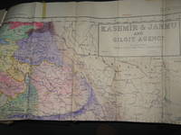
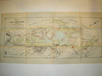
Survey of Pakistan Kashmir
- Used
- very good
- Paperback
- first
- Condition
- Used - Very Good
- Edition
- 1st Edition
- Binding
- Paperback
- Quantity Available
- 1
- Seller
-
Bath, Maine, United States
- Item Price
-
€923.75
Show Details
Description:
Jammer & Gilgit Agency, 1940 Government of Pakistan Full color Map 1 Inch = 16 miles. Extremely RARE OCLC locates 0 copies. 0 copies LOC. Oblong, no tears, or markings.. Oblong. 1st Edition. Soft cover. Very Good.
Item Price
€923.75

More Photos
The Sky and the Forest
by Forester, C.S
- Used
- very good
- Hardcover
- first
- Condition
- Used - Very Good
- Jacket Condition
- Very Good
- Edition
- First Edition
- Binding
- Hardcover
- Quantity Available
- 1
- Seller
-
Salem, Oregon, United States
- Item Price
-
€32.89€16.45Save €17.44!
Show Details
Description:
C.S. Forester: The Sky and the Forest. Little, Brown and Company, Boston. Stated First Edition First Printing Thus August, 1948. Cover price $2.75. Used. VG BOOK/VG UNCLIPPED DUST JACKET. A story of a central Africa. By C.S. Forester, author of the Admiral Hornblower series.
Item Price
€32.89€16.45
Save €17.44
!
![Alaska and Klondike Region; [With inset of Klondike Region on the Upper Yukon detail] [From an...](https://d3525k1ryd2155.cloudfront.net/h/062/537/1339537062.0.m.jpg)
Alaska and Klondike Region; [With inset of Klondike Region on the Upper Yukon detail] [From an atlas, "Gazetteer of Alaska and Yukon Region " pp. 105 and 106]
by Miller, J. Martin
- Used
- very good
- Condition
- Used - Very Good
- Edition
- Unknown
- Quantity Available
- 1
- Seller
-
Sebastopol, California, United States
- Item Price
-
€36.76
Show Details
Description:
Chicago: J. Martin Miller, 1899. Unknown. Map. Very Good. [Map copyright 1899, printing date of Atlas later] [19.875x15.125in]; Colored map of Alaska with steamer routes from Portland and Seattle, insets of the Klondike Region on the Upper Yukon and Western portion of Aleutian Islands; On verso index of places and names with two large black and white images; Age toning to all edges, water stain marks on bottom, slight printing offset of colors, small chips and closed tears to lower edge;.
Item Price
€36.76

Last Tales
by Dinesen, Isak
- Used
- very good
- Hardcover
- first
- Condition
- Used - Very Good
- Jacket Condition
- Good+
- Edition
- First Edition
- Binding
- Hardcover
- Quantity Available
- 1
- Seller
-
Salem, Oregon, United States
- Item Price
-
€113.11€56.56Save €60.00!
Show Details
Description:
Dinesen, Isak: Last Tales, A Collection of Twelve New Tales of Compelling Beauty 1957, Random House. First Edition. Stated First Printing Thus. Used. Very Good/Good+ original red dust jacket, price-clipped. Jacket states 11/57 on front flap. 5 3/4 X
Item Price
€113.11€56.56
Save €60.00
!

Zemepis Sveta - Monsunova Asie
by De La Blache, P. Vidal; Gallois, L
- Used
- Hardcover
- Condition
- Used - Very Good Condition
- Jacket Condition
- No Dust Jacket
- Binding
- Hardcover
- Quantity Available
- 1
- Seller
-
Oak Point, Texas, United States
- Item Price
-
€56.56
Show Details
Description:
Aventinum, Prague, Czechoslovakia, 1931. Hardcover. Very Good Condition/No Dust Jacket. Text entirely in Czech. Geography book on Asia with numerous photographs and maps. 1930 edition also available. Size: 4mo - over 9 3/4" - 12" tall. 400 pp. Pages are yellowed, but are tight and clean. Moderate shelfwear along the spine. Corners are lightly bumped. Quantity Available: 1. Shipped Weight: 3-5 pounds. Category: Travel & Places; Non-English Language::Czech; Pictures of this item not already displayed here available upon request. Inventory No: 001228. . Additional shipping charges may apply.
Item Price
€56.56

Zemepis Sveta - Monsunova Asie
by De La Blache, P. Vidal; Gallois, L
- Used
- Hardcover
- Condition
- Used - Very Good Condition
- Jacket Condition
- No Dust Jacket
- Binding
- Hardcover
- Quantity Available
- 1
- Seller
-
Oak Point, Texas, United States
- Item Price
-
€56.56
Show Details
Description:
Aventinum, Prague, Czechoslovakia, 1930. Hardcover. Very Good Condition/No Dust Jacket. Text entirely in Czech. Geography book on Asia with numerous photographs and maps. 1931 edition also available. Size: 4mo - over 9 3/4" - 12" tall. 400 pp. Pages are yellowed, but are tight and clean. Moderate shelfwear along the spine. Corners are lightly bumped. Quantity Available: 1. Shipped Weight: 3-5 pounds. Category: Travel & Places; Non-English Language::Czech; Pictures of this item not already displayed here available upon request. Inventory No: 001227. . Additional shipping charges may apply.
Item Price
€56.56

The Adventure of Wrangel Island
by Vilhjalmur Stefansson
- Used
- good
- Hardcover
- first
- Condition
- Used - Good
- Jacket Condition
- No DJ Included
- Edition
- First Edition
- Binding
- Hardcover
- Quantity Available
- 1
- Seller
-
Salem, Oregon, United States
- Item Price
-
€117.72€58.87Save €62.44!
Show Details
Description:
The Adventure of Wrangel Island, Alaska (1925 Macmillan 1st Edition) HISTORY OF ALASKA. EXLIB. Good Condition/ No DJ included. Fold-out map affixed to binding at the back of the book has never been opened. The story of the (unsuccessful) attempted colonization of Wrangel Island Alaska. 413 pages plus appendix, Index. Titling is still bright. A clean, solid copy. Scarce.
Item Price
€117.72€58.87
Save €62.44
!

Seven Pillars Of Wisdom, A Triumph
by Lawrence, T.E
- Used
- good
- Hardcover
- first
- Condition
- Used - Good
- Jacket Condition
- No DJ Included
- Edition
- First American Edition
- Binding
- Hardcover
- Quantity Available
- 1
- Seller
-
Salem, Oregon, United States
- Item Price
-
€117.78€58.89Save €62.47!
Show Details
Description:
T.E. Lawrence. SEVEN PILLARS OF WISDOM, A TRIUMPH. AUTOBIOGRAPHY. Privately Printed, 1926. First Published for general circulation 1935. First American Edition. States MCMXXXVI on the title page. Doubleday, Doran & Company, Inc. Garden City, NY. GOOD CONDITION/ NO DUST JACKET IS INCLUDED. 672 pages, indexed. Beige buckram boards. Spine has darkened a bit. 6 7/8 X 9 ½.
Item Price
€117.78€58.89
Save €62.47
!

North America from the Best Authorities, Russell, ca.1800
by Russell
- Used
- Condition
- Used
- Quantity Available
- 1
- Seller
-
Plymouth, Devon, United Kingdom
- Item Price
-
€23.53
Show Details
Description:
Russell, J. : A General Map of North America from the Best Authorities. Nd but ca.1800. From "A New Geographical, Historical and Commercial Grammar and Present State of Several Kingdoms of the World." Copper engraving. Size approx 200 x 230mm. Two neat folds. Some age colouring to edges, otherwise very clean and bright.
Item Price
€23.53

Asia from the Best Authorities, Russell, ca.1800
by Russell
- Used
- Condition
- Used
- Quantity Available
- 1
- Seller
-
Plymouth, Devon, United Kingdom
- Item Price
-
€23.53
Show Details
Description:
Russell, J. : Asia from the Best Authorities. Nd but ca.1800. From "A New Geographical, Historical and Commercial Grammar and Present State of Several Kingdoms of the World". Copper engraving. Size approx 200 x 230mm. Two neat folds. Some age colouring to edges, otherwise clean and bright. Includes Arabia, India, Borneo, Japan, China and eastern Russia.
Item Price
€23.53
![MAP OF UTAH [Territory]](https://d3525k1ryd2155.cloudfront.net/h/836/461/1485461836.0.m.jpg)
More Photos
MAP OF UTAH [Territory]
- Used
- Condition
- Used - Very Good-
- Edition
- Original
- Quantity Available
- 1
- Seller
-
Williamsburg, Virginia, United States
- Item Price
-
€61.27
Show Details
Description:
New York, Richmond, Chicago, & Toledo: H. H. Hardesty, 1885. Original color lithographed map printed by Rand, McNally & Company, Engravers and published in HARDESTY'S HISTORICAL AND GEOGRAPHICAL ENCYCLOPEDIA: SPECIAL VIRGINIA EDITION. 19 3/8 inches by 13 1/4 inches on a 21" X 14 1/2" sheet. The map depicts the Territory of Utah in its final form--large areas had been removed and ceded to Nevada, Colorado, Wyoming, and Nebraska since Utah became a U. S. Territory in 1850. The issue of polygamy prevented statehood until it was finally granted in 1896. This map features railroads and topography and uses color to set off counties from each other. Unlike most atlas maps of the period, this map identifies most small towns. The map is guaranteed to be moe than 135 years old. The map is in about very good condition: generally clean and bright, with slight toning of paper and one faint water stain near the center-left edge of the map.. Original. Single Sheet. Very Good-. Elephant…
Read More Item Price
€61.27