Description:
New York.: The Macmillan Company., 1924. Reprint. 1st printing 1921.. Hard cover. Very good. No dust jacket. With aging to covers; random cover soiling, edge wear. Well-bound.. 1 503 p. Light green cloth over boards, darker green titles, cover art. Tan end papers. 8x11in. B&W photos, maps. Full color map plates also. Appendix: populations by countries, cities, also some elevations, rivers, lakes. Index and pronouncing vocabulary.
Search Results: Geography from Hedgehog's Whimsey Books
You searched for:
- Subject: Geography from Hedgehog's Whimsey Books
Results 1 - 20 of 31

Advanced Geography
by McMurray, Frank M, and Parkins, A.E.
- Used
- Hardcover
- first
- Condition
- Used - Very good. No dust jacket. With aging to covers; random cover soiling, edge wear. Well-bound.
- Edition
- Reprint. 1st printing 1921.
- Binding
- Hardcover
- Quantity Available
- 1
- Seller
-
Newport, New Hampshire, United States
- Item Price
-
€17.01€4.73 shipping to USA
Show Details
Item Price
€17.01
€4.73
shipping to USA
American Universal Geography, for Schools and Academies. on the Principles of Analysis and Comparison
by Blake, Rev. J. L.
- Used
- Hardcover
- Condition
- Used - Poor. No dust jacket as issued. Numerous moisture stains. Red staining to cover. Pieces missing from some pages. Foxing. Soiling
- Edition
- Second Edition. Stereotyped by Lyman Thurston & Co.
- Binding
- Hardcover
- Quantity Available
- 1
- Seller
-
Newport, New Hampshire, United States
- Item Price
-
€127.60€4.73 shipping to USA
Show Details
Description:
Boston / Baltimore: Russell, Odiorne / Joseph Jewett, 1833. Second Edition. Stereotyped by Lyman Thurston & Co.. Hard cover. Poor. No dust jacket as issued. Numerous moisture stains. Red staining to cover. Pieces missing from some pages. Foxing. Soiling. Readable throughout.. 1 144 p. Includes: illustrations, maps. Full-page maps in color. Thin leather spine, printed paper over boards. Illustrated by Copperplate and Stereotype Maps. Questions follow each map to aid learning. Charts showing mountain heights and river lengths of the world; populations. Chart: US states, population by men, women, slaves. Chart: Indian populations. Regions of America list most important cities of each state and other area histories. Brief sections on fossils, volcanoes, races and religions of the world. List on front cover: locations sold. Publisher promo on back: Education books (Emerson's, Blake's).
Item Price
€127.60
€4.73
shipping to USA
Atlas of Medieval and Modern History
by Shepherd, William R.
- Used
- Hardcover
- Condition
- Used - Very good. No dust jacket. Minor edge wear to map pages. Glue stains to loose pen&ink Ex Libris bookplate.
- Edition
- Printed in Germany.
- Binding
- Hardcover
- Quantity Available
- 1
- Seller
-
Newport, New Hampshire, United States
- Item Price
-
€22.68€4.73 shipping to USA
Show Details
Description:
New York.: Henry Holt and Company., 1932. Printed in Germany.. Hard cover. Very good. No dust jacket. Minor edge wear to map pages. Glue stains to loose pen&ink Ex Libris bookplate.. 1 v p., 80 p. of col. maps (part fold. ), 42 p. 27 cm. Abbreviations. Index by location. Supplements. Geography; Single and multiple fold-out pages of colorful maps. An abbreviated 80 separate maps, a smaller version for students who earlier were using the Historical Atlas of 226 maps. The maps herein correspond to the larger version. Author-editor Shepherd was Seth Low Professor of History in Columbia University, New York.
Item Price
€22.68
€4.73
shipping to USA

Stock Photo: Cover May Be Different
Bible Lands (DK Eyewitness Books #30)
by Tubb, Jonathan N, and Hills, Alan (Photographer)
- Used
- Hardcover
- first
- Condition
- Used - Very good. No dust jacket. Near fine. Slight cover surface wear.
- Edition
- First edition. 1st American edition. 1st printing.
- Binding
- Hardcover
- ISBN 10 / ISBN 13
- 9780789457707 / 0789457709
- Quantity Available
- 1
- Seller
-
Newport, New Hampshire, United States
- Item Price
-
€41.59€4.73 shipping to USA
Show Details
Description:
New York.: DK Publishing (Dorling Kindersley)., 1991. First edition. 1st American edition. 1st printing.. Hard cover. Very good. No dust jacket. Near fine. Slight cover surface wear.. 1 Glossy color photo illustrated paper over boards. 64 p. 29cm. Color photos. Audience: Children/juvenile. Youth and family visually informative series, this one focusing on the Middle East, its cultural and historic identities, ancient civilizations, geography, wars and weaponry, archeology, artifacts, economies. Old Stone Age to 15000 B.C. to the Early Arab Period, 1099 A.D.
Item Price
€41.59
€4.73
shipping to USA
Butler's Complete Geography
by Redway, Jaques W.
- Used
- Hardcover
- Condition
- Used - Good. No dust jacket. Many pages with old crescent water stains into text and maps. Some lighter, not so noticeable. Covers: spi
- Binding
- Hardcover
- Quantity Available
- 1
- Seller
-
Newport, New Hampshire, United States
- Item Price
-
€17.01€4.73 shipping to USA
Show Details
Description:
Philadelphia: E. H. Butler and Company, 1887. Hard cover. Good. No dust jacket. Many pages with old crescent water stains into text and maps. Some lighter, not so noticeable. Covers: spine end wear, Random soiling.. 0 141 p. Includes: illustrations, maps. Illustrations from steel engravings; color maps; charts and text of information, U.S. and all other regions of the world. Dark cloth covered boards; off-white front titles. The known world of the late 19th century, and how it got that way.
Item Price
€17.01
€4.73
shipping to USA
Chicago Unfolds StreetMap
by VanDam Inc.
- Used
- Paperback
- Condition
- Used - Very good. No dust jacket as issued. Rubbed covers; price sticker residue. Otherwise fine.
- Edition
- Circa 1989, no date found.
- Binding
- Paperback
- ISBN 10 / ISBN 13
- 9780399515422 / 0399515429
- Quantity Available
- 1
- Seller
-
Newport, New Hampshire, United States
- Item Price
-
€165.41€4.73 shipping to USA
Show Details
Description:
East Rutherford NJ.: Perigee Books.. Circa 1989, no date found.. Wraps. Very good. No dust jacket as issued. Rubbed covers; price sticker residue. Otherwise fine.. 1 Trade paperback (US). Glued binding. Audience: General/trade. 'Batwing' unfolding city street maps, 1980s; patented kinetic sculpture. Two detailed 13x16.75 inches scaled maps housed in sturdy glossy 5x9in lift-up w/ stapled binding. Inovative, handy, durable. At center, 8-page street index plus National 800-number directory. Stephan Van Dam, cartographer, creator, and multiple patent holder has a permanent unfolding map at the Museum of Modern Art in NYC. His early maps are collectible; later unfold products are smaller in dimension and of different materials.
Item Price
€165.41
€4.73
shipping to USA
A Complete Course in Geography: Physical, Industrial, and Political with a Special Geography for Each State
by Swinton, William
- Used
- Hardcover
- first
- Condition
- Used - Fair. No dust jacket. Binding tight. Bumped lower corners. Edge damp stain. Random frequent spotting.
- Edition
- 1st copyright 1875.
- Binding
- Hardcover
- Quantity Available
- 1
- Seller
-
Newport, New Hampshire, United States
- Item Price
-
€22.68€4.73 shipping to USA
Show Details
Description:
New York / Chicago.: Ivison, Blakeman, Taylor, and Company., 1878. 1st copyright 1875.. Hard cover. Fair. No dust jacket. Binding tight. Bumped lower corners. Edge damp stain. Random frequent spotting.. 1 141 p. Includes: illustrations, maps, index. Black leather over spine. Black paper illustrated covers over boards, ornate titles. Eagle art on back. Color maps; Pen&Ink artwork. Geographical descriptions by country, region, state. Mathematical, Physical, Political Geographies. At end: General Review of World; A System of Map-drawing; Statistical Tables; Pronouncing Vocabulary; 28 maps listed at back. Not a contemporary reprint. Developed as a "Class-Book for Intermediate and Grammar Grades" (from copyright page.
Item Price
€22.68
€4.73
shipping to USA

The Comprehensive Self-pronouncing Dictionary Gazetteer and Atlas of the World: Under One Alphabetical Arrangement (and more).
by Noah Webster; Charles Morris
- Used
- Condition
- Used
- Edition
- Abbreviated.
- Quantity Available
- 1
- Seller
-
Newport, New Hampshire, United States
- Item Price
-
€14.18€4.73 shipping to USA
Show Details
Description:
Appears to be a publisher's advance editions with incomplete sections (e.g. 17 pages in the "E" dictionary section of places). Other sections abbreviated. Flag and map pages in color. Volume dimentions for this sample edition: 24cm tall by 18 cm wide. Front board has proposed spine folded inward, with high quality materials plus gold titles, black line artwork against textured light green cloth over boards. Faux linen green and white end papers. Back page bold "Publisher's Guarentee". Corners show wear. Colors vibrant.
Item Price
€14.18
€4.73
shipping to USA
Dallas Unfolds StreetMap
by VanDam Inc.
- Used
- Paperback
- Condition
- Used - Very good. No dust jacket as issued. Surface rubbing, price sticker residue, otherwise fine.
- Edition
- No date found, post 1984.
- Binding
- Paperback
- ISBN 10 / ISBN 13
- 9780399515439 / 0399515437
- Quantity Available
- 1
- Seller
-
Newport, New Hampshire, United States
- Item Price
-
€165.41€4.73 shipping to USA
Show Details
Description:
East Rutherford NJ.: Perigee Books.. No date found, post 1984.. Wraps. Very good. No dust jacket as issued. Surface rubbing, price sticker residue, otherwise fine.. 1 Unfolding street map; card stock covers. Audience: General/trade. 'Batwing' unfolding city street maps, 1980s; patented kinetic sculpture. Two detailed 13x16.75 inches scaled maps housed in sturdy glossy 5x9in lift-up w/ stapled binding. Inovative, handy, durable. At center, 8-page street index plus National 800-number directory. Stephan Van Dam, cartographer, creator, and multiple patent holder has a permanent unfolding map at the Museum of Modern Art in NYC. His early maps are collectible; later unfold products are smaller in dimension and of different materials.
Item Price
€165.41
€4.73
shipping to USA
Detroit Unfolds StreetMap
by VanDam, Inc.
- Used
- Paperback
- Condition
- Used - Very good. No dust jacket as issued. Cover surface rubs; sticker residue; otherwise fine.
- Edition
- Circa 1989, no date found.
- Binding
- Paperback
- ISBN 10 / ISBN 13
- 9780399515446 / 0399515445
- Quantity Available
- 1
- Seller
-
Newport, New Hampshire, United States
- Item Price
-
€165.41€4.73 shipping to USA
Show Details
Description:
East Rutherford NJ.: Perigee Books.. Circa 1989, no date found.. Wraps. Very good. No dust jacket as issued. Cover surface rubs; sticker residue; otherwise fine.. 1 Sturdy card stock covers, stapled binding. Audience: General/trade. 'Batwing' unfolding city street maps, 1980s; patented kinetic sculpture. Two detailed 13x16.75 inches scaled maps housed in sturdy glossy 5x9in lift-up w/ stapled binding. Innovative, handy, durable. At center, 8-page street index plus National 800-number directory. Stephan Van Dam, cartographer, creator, and multiple patent holder has a permanent unfolding map at the Museum of Modern Art in NYC. His early maps are collectible; later unfold products are smaller in dimension and of different materials.
Item Price
€165.41
€4.73
shipping to USA
Stock Photo: Cover May Be Different
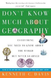
Don't Know Much About Geography: Everything You Need to Know About the World But Never Learned
by Davis, Kenneth C
- Used
- Paperback
- Condition
- Used - Very good. No dust jacket as issued.
- Edition
- 7th printing.
- Binding
- Paperback
- ISBN 10 / ISBN 13
- 9780380713790 / 0380713799
- Quantity Available
- 1
- Seller
-
Newport, New Hampshire, United States
- Item Price
-
€4.25€4.73 shipping to USA
Show Details
Description:
Avon Books / Hearst Corporation, 1993. 7th printing.. Trade paperback. Very good. No dust jacket as issued.. 0 400 p. B&W Illustrations. Bikini: Which came first: the swimsuit or the atoll? What is a Butte? Includes Weights & Measures, Nation List, Bibliography, Index. Chapter from 'Don't Know Much about the Civil War'.
Item Price
€4.25
€4.73
shipping to USA
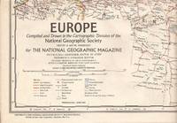
Europe, National Geographic Map: Folded Wall Map
by Chamberlin, Wellman (Chief Cartography by), and Grosvenor, Melvin Bell (Chief Editing by)
- Used
- first
- Condition
- Used - Very good. Near fine.
- Edition
- First edition.
- Quantity Available
- 1
- Seller
-
Newport, New Hampshire, United States
- Item Price
-
€4.73€4.73 shipping to USA
Show Details
Description:
Washington DC.: National Geographic Society, Cartographic Division., 1969. First edition.. Very good. Near fine.. 1 Color map, 26 in. w x 30 in. high, folded down to 6x9 in. Showing Iceland in North Atlantic to Northern Africa southward. East to portion of U.S.S.R. (Prior to end of Union of Socialist Republic, and prior to unification of Germany. Inclusive of Scandinavian nations to central north, south to Tunisia and northern Libya and U.A.R. (Egypt); portion of Middle East nations, most of Turkey. Mediterranean nations at center. Scale 1: 6 or 102.4 miles to the inch. Published for Insert into the National Geographic Magazine.
Item Price
€4.73
€4.73
shipping to USA
Frye's Complete Geography: New England Edition
by Frye, Alexis Everett, And Davis, William Morris (New England Pages)
- Used
- Hardcover
- Condition
- Used - Very good. No dust jacket. Loss of consistent cloth color to spine and fold of boards (moderately speckled). Stitched binding st
- Binding
- Hardcover
- Quantity Available
- 1
- Seller
-
Newport, New Hampshire, United States
- Item Price
-
€36.86€4.73 shipping to USA
Show Details
Description:
Boston / London: Ginn & Company, Publishers, 1900. Hard cover. Very good. No dust jacket. Loss of consistent cloth color to spine and fold of boards (moderately speckled). Stitched binding strong. Clean inside. Minor corner wear.. 0 184 p. Includes: illustrations, maps, index. Main section, plus supplements and map section. Sturdy tan cloth-covered boards; dark green stamped globe, sailing ships; stamped front titles. Rear blind stamp, globe. Supplement, 1899, Cuba, Puerto Rico, Hawaii, Philippines, Guam. Full-page color map plates A-X. Supplement: The New England States, 1895, 31p. Engravings from photographs throughout text, also color maps. Designed for student interest, reference and learning. From the 3-generation home of teachers in New Hampshire. Excellent condition inside, save for small lower corner missing chip, p.143-44. At publication date, Frye was Supt. of Schools in Cuba, Davis was Prof. of Physical Geography, Harvard University.
Item Price
€36.86
€4.73
shipping to USA
Geography of the USSR; a Regional Survey
by Shabad, Theodore
- Used
- Hardcover
- Condition
- Used - Good. No dust jacket. Contents clean. Binding tight. Covers have edgewear, bumps. blemishes.
- Edition
- Reinforced binding.
- Binding
- Hardcover
- Quantity Available
- 1
- Seller
-
Newport, New Hampshire, United States
- Item Price
-
€7.09€4.73 shipping to USA
Show Details
Description:
New York: Columbia University Press, 1951. Reinforced binding.. Hard cover. Good. No dust jacket. Contents clean. Binding tight. Covers have edgewear, bumps. blemishes.. 1 xxxii, 584 p. 24 cm. Includes B&W Maps. Brown cloth covered boards. Unadorned gold spine titles. An academic compilation of the United Soviet Socialist Republics, gathered and coordinated during the USSR 5-year plan preceeding its puplication in 1951. 27 chapters, 57 maps. Statistical tables; Selected bibliography; Comprehensive Index.
Item Price
€7.09
€4.73
shipping to USA

Guide Map Gold Head Branch State Park
- Used
- Condition
- Used - Very good.
- Quantity Available
- 1
- Seller
-
Newport, New Hampshire, United States
- Item Price
-
€9.45€4.73 shipping to USA
Show Details
Description:
Keystone Heights FL.: Florida Park Service., 1954. Very good.. "EWG 2/16/50".. 1 2 p. Pen&Ink 2-sides of single 8.5x14 in. white paper. Side 1: vertical typewritten letter welcoming Visitors, listing rules, general information, policies, and contact notes. Side 2 turns horizontally picturing a hand-designed detailed map of the Park. Gold Head Branch State Park. Graphic Scale 3/4 inch to 1000 feet. Quarter-fold to 7.25x4.25 in. A Florida key map and a vicinity map are separately outlined.
Item Price
€9.45
€4.73
shipping to USA
Los Angeles Unfolds StreetMap
by VanDam Inc.
- Used
- Paperback
- Condition
- Used - Very good. No dust jacket as issued. Rubbed covers; front price sticker residue; otherwise fine.
- Edition
- Circa 1989, no date found.
- Binding
- Paperback
- ISBN 10 / ISBN 13
- 9780399515453 / 0399515453
- Quantity Available
- 1
- Seller
-
Newport, New Hampshire, United States
- Item Price
-
€165.41€4.73 shipping to USA
Show Details
Description:
East Rutherford NJ.: Perigee Books.. Circa 1989, no date found.. Wraps. Very good. No dust jacket as issued. Rubbed covers; front price sticker residue; otherwise fine.. 1 Card stock glossy covers; stapled binding. Audience: General/trade. 'Batwing' unfolding city street maps, 1980s; patented kinetic sculpture. Two detailed 13x16.75 inches scaled maps housed in sturdy glossy 5x9in lift-up w/ stapled binding. Inovative, handy, durable. At center, 8-page street index plus National 800-number directory. Stephan Van Dam, cartographer, creator, and multiple patent holder has a permanent unfolding map at the Museum of Modern Art in NYC. His early maps are collectible; later unfold products are smaller in dimension and of different materials.
Item Price
€165.41
€4.73
shipping to USA

Map of DeLand Florida
- Used
- Condition
- Used - Very good.
- Quantity Available
- 1
- Seller
-
Newport, New Hampshire, United States
- Item Price
-
€11.34€4.73 shipping to USA
Show Details
Description:
Daytona Beach FL.: Champion Map Corporation., 1984. Very good.. 1 Shades of red and blue ink. 36x27 in. folds down to 6x9.25 in. Street lists. "Pull-out" enlarged sections. Folding wall-size map, not topographical but outlining water bodies, rivers. Published with the National Association of Realtors, 1984.
Item Price
€11.34
€4.73
shipping to USA
The New Hammond-Dell World Atlas (New Revised Edition / A Laurel Edition)
- Used
- Paperback
- Condition
- Used - Very good. No dust jacket as issued. Moderate cover creasing includes corners. Single spine crease. Back spine corner small mois
- Edition
- LX124.
- Binding
- Paperback
- Quantity Available
- 1
- Seller
-
Newport, New Hampshire, United States
- Item Price
-
€11.34€4.73 shipping to USA
Show Details
Description:
Dell Publishing Company / C.S. Hammond & Co. Inc., 1960. LX124.. Mass-market paperback. Very good. No dust jacket as issued. Moderate cover creasing includes corners. Single spine crease. Back spine corner small moisture stain. Interior maps fine.. 1 255 p. Includes: illustrations, maps, index. Mass-market (rack) paperback. Green page block edges. Glued binding. Info charts. Designed, produced by Western Printing & Lithographing Co. Audience: General/trade. Gazetteer-Index of the World, 1959. Illustrated Geography and Gazetteer of the World. Social and Economic Tables. Full color maps, p. 97-160. Gazetteer of the United States and Possessions (Pen&Ink State maps showing resources and products. World Statistics: Earth and Solar System; Oceans, Seas, Lakes, Mountains, Longest Rivers, Agriculture, Minerals maps; Index and Principal Cities.
Item Price
€11.34
€4.73
shipping to USA
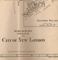
New Map of the City of New London (Connecticut) Showing Streets, Car Lines and Railroads
- Used
- Hardcover
- Condition
- Used - Very good. Age-toning to folder. Some folds wrinkled.
- Edition
- Robert A Welcke, Photo-Litho, NY.
- Binding
- Hardcover
- Quantity Available
- 1
- Seller
-
Newport, New Hampshire, United States
- Item Price
-
€17.01€4.73 shipping to USA
Show Details
Description:
New Haven CT.: The Price & Lee Co., 1927. Robert A Welcke, Photo-Litho, NY.. Vellum. Very good. Age-toning to folder. Some folds wrinkled.. 1 24x24in. Pen&Ink w/ Street Index. Multiple folds to attach inside manila card stock folder, 4.25x6.75in. map Company marketing on back and inside front. Pocket size map folder. Scale 1.25 inches to 1000 feet.
Item Price
€17.01
€4.73
shipping to USA
The New York Times Atlas of the World: In Collaboration with The Times of London
by Bartholomew, John, and Son, Ltd. (Text and maps by)
- Used
- Hardcover
- Condition
- Used - Very good. No dust jacket. Signed by previous owner. Minor edge wear. Back cover: a few small blemishes.
- Binding
- Hardcover
- Quantity Available
- 1
- Seller
-
Newport, New Hampshire, United States
- Item Price
-
€14.18€4.73 shipping to USA
Show Details
Description:
New York NY.: New York Times Book Co. / Quadrangle., 1972. Hard cover. Very good. No dust jacket. Signed by previous owner. Minor edge wear. Back cover: a few small blemishes.. 1 Dark blue cloth over boards. Blind-stamped front titles. Gold spine titles. Blue top page block. Illustrations, Maps. 11x15 in. End papers, map plate keys. "Maps prepared and printed in Great Britain by John Bartholomew & Son Limited, Edinburgh." "Conurbation maps compiled and drawn by Fairey Surveys Limited, Maidenhead; A.W. Gatrell; and Hunting Surveys Limited." "Comparative tables of Pinyin and Wade.
Item Price
€14.18
€4.73
shipping to USA

Didn’t find what you’re looking for?
Try adding this search to your want list. Millions of books are added to our site everyday and when we find one that matches your search, we’ll send you an email. Best of all, it’s free.
Add to Want List

Are you a frequent reader or book collector?
Join the Bibliophile's Club and save 10% on every purchase, every day — up to $20 savings per order!

Social Responsibility
Did you know that since 2004, Biblio has used its profits to build 16 public libraries in rural villages of South America?
