Description:
Somerset, England: Hydrographer of the Navy, 1965 16pp. Two punch holes at spine edge for binder use. Wraps are toning. Top tip of both wraps have a 2" horizontal crease. Spine edge of both wraps have many creases. Spine is rubbed. Lower tip of front wrap has a 2" diagonal crease. Text is unmarked.. Revised. Paperback. Good.
The Solent and Adjacent waters: Tidal Stream Atlas N.P. 337 by Hydrographer of the Navy - 1962
by Hydrographer of the Navy

The Solent and Adjacent waters: Tidal Stream Atlas N.P. 337
by Hydrographer of the Navy
- Used
- Paperback
Somerset, England: Hydrographer of the Navy, 1962 16pp. Two punch holes at spine edge for binder use. Wraps have toned. Front wrap has many light damp stains. Spine is rubbed. Staples are rusty. Spine edge of both wraps have many creases. Top tip of rear wrap and last page have a 4" diagonal crease. Top tip of both wraps have a 2" horizontal crease. Wraps have light edgewear. Tips are bumped. Former owner notation in pencil at the top tip of many pages.. Revised. Paperback. Good Minus.
-
Bookseller
Recycled Records and Books
 (US)
(US)
- Format/Binding Paperback
- Book Condition Used - Good Minus
- Quantity Available 1
- Edition Revised
- Binding Paperback
- Publisher Hydrographer of the Navy
- Place of Publication Somerset, England
- Date Published 1962

Approaches to portland: Tidal Stream Atlas N.P. 257
by Hydrographer of the Navy
- Used
- good
- Paperback
- Condition
- Used - Good
- Edition
- Revised
- Binding
- Paperback
- Quantity Available
- 1
- Seller
-
Milwaukee , Wisconsin, United States
- Item Price
-
€9.38
Show Details
Item Price
€9.38
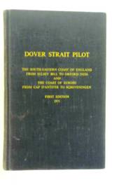
Dover Strait Pilot. Comprising The Sourth-Eastern Coast of England From Selsy Bill to Orford Ness and The Coast of Europe From Cap D'Antifer to Scheveningen
by Hydrographer of the Navy
- Used
- Acceptable
- Hardcover
- first
- Condition
- Used - Acceptable
- Binding
- Hardcover
- Quantity Available
- 1
- Seller
-
Goring-by-Sea, West Sussex, United Kingdom
- Item Price
-
€9.64
Show Details
Description:
Hydrographer of the Navy, 1971. Hardcover. Acceptable. 1971. First Edition. 490 pages. No dust jacket. This is an ex-Library book. Blue cloth boards with lettering. Contains black and white illustrations and folded map. Ex-library copy, with expected inserts and inscriptions. Clean pages and illustrations with light tanning and mild foxing throughout. Pen markings to front free endpaper. Binding remains firm. Boards have moderate edge-wear with bumping to corners and rubbing to surfaces. Lettering is darkened. Moderate sunning to spine and edges with crushing to spine ends. Moderate splits to spine ends and corners causing cloth to be frayed. Visible wear marks to boards.
Item Price
€9.64

Dover Strait Pilot. Comprising The Sourth-Eastern Coast of England from Selsey Bill to Orford Ness and the Coast of Europe from Cap D'Antifer to Scheveningen. N.P. No. 28 (with Supplement No. 7, 1979)
by The Hydrographer of the Navy
- Used
- Hardcover
- first
- Condition
- Used
- Binding
- Hardcover
- Quantity Available
- 1
- Seller
-
Neuendorf, Germany
- Item Price
-
€9.00
Show Details
Description:
The Hydrographer of the Navy, London, 1971. N.P. No. 28. First Edition 1971. With Supplement No. 7, 1979. Vorwort von G. P. D. Hall. Englischsprachige Hardcoverausgabe, Leineneinband, XIV, 490 Seiten nebst Supplement, 135 Seiten. Gutes Exemplar (good Condition).
Item Price
€9.00

AZIMUTHS OF CELESTIAL BODIES Whose Declinations Range from 24 to 70 Degrees for Latitudes Extending to 70 Degrees from the Equator, H.O. 120
by Hydrographer of the Navy
- Used
- Hardcover
- Condition
- Used
- Binding
- Hardcover
- Quantity Available
- 1
- Seller
-
Concord, California, United States
- Item Price
-
€13.01
Show Details
Description:
U. S. Navy, Washington, 1931, Seventh Edition. Quarto, hardcover, VG in blue boards with gilt lettering. No dj. 288 pp. Originally prepared in 1902 for ships of higher speed. Tables of true bearings of the celestial bodies, the tables supply the navigator information for finding the true course for sailing etc.
Item Price
€13.01
Admiralty List of Lights and Fog Signals and Visual Time Signals. Volume E 1980. Mediterranean Black and Red Seas
by Hydrographer of the Navy
- Used
- Paperback
- first
- Condition
- Used - Good+
- Edition
- First.
- Binding
- Paperback
- Quantity Available
- 1
- Seller
-
Bere Alston, Devon, United Kingdom
- Item Price
-
€10.56
Show Details
Description:
Somerset: Hydrographer of the Navy, 1980. First. . Paperback. Good+. 8vo. Lettering to top of front cover. Creasing to corners.
Item Price
€10.56

Dover Strait Pilot. South-East Coast of England, Bognor Regis to Southwold and North-West Coast of Europe, Cap d'Antifer to Scheveningen. N.P. No. 28
by The Hydrographer of the Navy
- Used
- Hardcover
- Condition
- Used
- Binding
- Hardcover
- Quantity Available
- 1
- Seller
-
Neuendorf, Germany
- Item Price
-
€12.00
Show Details
Description:
The Hydrographer of the Navy, London, 1981. N.P. No. 28. Second Edition 1981. Vorwort von D. W. Haslam. Englischsprachige Hardcoverausgabe, Leineneinband mit goldgeprägtem Rücken- und Deckeltitel, 412 Seiten. Gutes Exemplar (good Condition).
Item Price
€12.00

SAILING DIRECTIONS FOR THE PACIFIC ISLANDS VOLUME I of 1952 : H.O. Pub. No. 165A
by Hydrographer of the Navy
- Used
- good
- first
- Condition
- Used - Good
- Edition
- First Thus
- Quantity Available
- 1
- Seller
-
Seattle, Washington, United States
- Item Price
-
€18.85
Show Details
Description:
Hydrographic Office of the Navy, 1952. First Thus. Binder with 9 Rings. Good. Binder is worn, stained, and soiled, name on bottom of page block. Title page stained blue from inside of binder; bottom ring broken; last few pages appear to be water damaged. Includes cautions in descriptions. Size: Oversize.
Item Price
€18.85
Channel Pilot. The Isle of Scilly and the South Coast of England, From Cape Cornwall to Selsy Bill. The North-West and North Coasts of France, From, But Excluding Pointe De Penmarc"h to Cap D"Antifer. N.P. 27
by Hydrographer of the Navy
- Used
- good
- Hardcover
- Condition
- Used - Good
- Binding
- Hardcover
- Quantity Available
- 1
- Seller
-
Hyattsville, Maryland, United States
- Item Price
-
€18.85
Show Details
Description:
Hydrographer of the Navy. hardcover. Good. 0x0x0. 713 unmarked pages faded spine fold out map a little separation at front gutter. No dj. "From The Harry Juday Sailing collection
Item Price
€18.85
Channel Pilot
by Hydrographer of the Navy
- Used
- very good
- Hardcover
- Signed
- Condition
- Used - Very Good
- Jacket Condition
- No Jacket
- Edition
- Second Edition 1977
- Binding
- Hardcover
- Quantity Available
- 1
- Seller
-
Peter Tavy, United Kingdom
- Item Price
-
€11.83
Show Details
Description:
Hydrographer of the Navy, 1977. Isles of Scilly and south coast of England, from Cape Cornwall to Bognor Regis, and north-west and north coasts of France from, Pointe de Penmarc'h to Cap d' Antifer. Please email for further details. Donald Pinn. Second Edition 1977. Blue Cloth. Very Good/No Jacket. Illus. by Diagrams,Maps & Illustrations. 4to - over 9¾" - 12". Hardback.
Item Price
€11.83

The Mariner's Handbook NP 100. With Supplement
by The Hydrographer of the Navy - compiled by Lieutnant-Commander C. J. de C. Scott RN
- Used
- Hardcover
- Condition
- Used
- Binding
- Hardcover
- ISBN 10 / ISBN 13
- 9780707712321 / 0707712327
- Quantity Available
- 1
- Seller
-
Neuendorf, Germany
- Item Price
-
€19.00
Show Details
Description:
Hydrographic Department, Ministry of Defence, Taunton, Somerset, 1989. Sixth Edition 1989. Großformatige englischsprachige Hardcoverausgabe, Leineneinband mit goldgeprägtem Rücken- und Deckeltitel, VIII, 225 Seiten mit zahlreichen Abbildungen und Karten. Gutes Exemplar (good Condition).
Item Price
€19.00