Description:
The Boston Map Store, 1889 IN GOOD CONDITION. Folds out to 32 inches by 22 inches. Hand coloured map of Boston and the Country Adjacent, from actual Surveys. Shows crease tears and stains.
Road Maps and Tour Book of Western North Carolina, Containing Maps of the Main Travelled Highways of Western North Carolina, together with the Highways from Greenville and Spartanburg, South Carolina, into Asheville and also Brief Descriptions of the Counties and Cities in the Section Covered by the Maps by The North Carolina Good Roads Association - 1916
by The North Carolina Good Roads Association

Road Maps and Tour Book of Western North Carolina, Containing Maps of the Main Travelled Highways of Western North Carolina, together with the Highways from Greenville and Spartanburg, South Carolina, into Asheville and also Brief Descriptions of the Counties and Cities in the Section Covered by the Maps
by The North Carolina Good Roads Association
- Used
- very good
- Paperback
- first
Lynchburg, VA: J. P. Bell Co., Inc., 1916. First Edition First Printing . Soft cover. Very Good. 8vo - over 7¾ - 9¾" tall. Narrow Octavo. 159 pages. Bound in flexible burgundy leather with front cover and spine titles in gilt. The book is held in a removable clear mylar cover for protection. Light to moderate wear to the binding. A sound copy with secure hinges. Frontis photo of Grandfather Mountain. There is an early inscription on the rear flyleaf (owner inscribed upside-down). There is an owner's inscription on page 121 reading "George Greer / Lenoir, N.C. / Caldwell County / North Carolina." This has transferred to the facing page and is on one of the photographs. The rest of the book is a bit toned but clean. Illustrated with maps and small thumbnail photographs of road views along the route presented. The region covered is as far east as Greensboro, High Point, Salisbury, and Charlotte as well as up in the mountains. Several different sections devoted to the region in and around Asheville. The guide also includes advertisements for hotels, gas stations, and automobile repair shops along the way. Scarce.
-
Bookseller
Pages Past Used and Rare Books
 (US)
(US)
- Format/Binding Soft cover
- Book Condition Used - Very Good
- Quantity Available 1
- Edition First Edition First Printing
- Binding Paperback
- Publisher J. P. Bell Co., Inc.
- Place of Publication Lynchburg, VA
- Date Published 1916
- Size 8vo - over 7� - 9�" tall
- Keywords 1916; The North Carolina Good Roads Association; Road Maps; Tour Book; Western; N.C.; Greensboro; High Point; Salisbury; Charlotte; Asheville; Winston-Salem.
- Size 8vo - over 7� - 9�" tall
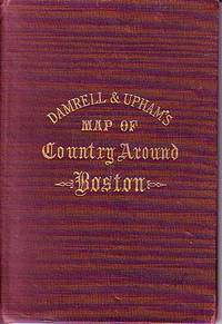
Damrell & Upham's Map of Country Around Boston
- Used
- good
- Hardcover
- Condition
- Used - Good
- Binding
- Hardcover
- Quantity Available
- 1
- Seller
-
Houlton, Maine, United States
- Item Price
-
€117.58
Show Details
Item Price
€117.58

Nolli.
by Austin, Alice.
- Used
- Signed
- Condition
- Used
- Edition
- Edition of 60
- Binding
- Unknown
- Quantity Available
- 1
- Seller
-
Hoover, Alabama, United States
- Item Price
-
€141.09
Show Details
Description:
Philadelphia, Pennsylvania:: Alice Austin,, 2010.. Edition of 60. 5 x 5.25"; 11 pages plus title. A one-sheet book printed by offset lithography in six colors. Required six runs through the Heidelberg Kors press at the Borowsky Center for Publication Arts. Laid in an illustrated letter fold wrapper. Signed and numbered by Austin and Snyder. Alice Austin: "Nolli, an exploration of textural layers of Rome by Alice Austin and Jon Snyder, was inspired by the Giambattista Nolli map of Rome, 1748. This project is the result of research done as a visiting artist at the American Academy in Rome. The front and back covers show elements from the Nolli map combined with a photo of a litho of the Roman fragments of the city map. The red line that continues throughout the book is the city wall and is shown on the reverse side of the map in white. The first page is a detail photo of the Nolli map. The second page is a watercolor of Bramante's Tempietto [a small commemorative martyrium]. The third…
Read More Item Price
€141.09

More Photos
SMITH'S MAP OF PHILADELPHIA AND VICINITY
by Gannett, Henry; Chief Topographer, U. S. Geological Survey
- Used
- Hardcover
- first
- Condition
- Used - Good+
- Edition
- First Edition Thus; Second Printing
- Binding
- Hardcover
- Quantity Available
- 1
- Seller
-
Fairfield, New Jersey, United States
- Item Price
-
€164.60
Show Details
Description:
Philadelphia: J. L. Smith. Good+. 1904. First Edition Thus; Second Printing. Hardcover. U. S. Geological Survey, surveyed in 1894, edition of 1902, printed in 1904. This is a 30 1/2" x 38 1/2" USGS map that J. L. Smith of Philadelphia, sometime after issue, sectioned (4 sections x 6 sections) and mounted on linen to create a folding pocket map. It is mounted in a 10 x 5.5 inch dark brown embossed and gilded hardcover folder that bears the title "Smith's Map of Philadelphia and Vicinity". The map covers the area north and west well past Norristown and south into Delaware, as well as a good part of New Jersey beyond Camden. It shows the local road network and was made for local travel. The inside cover has original owner's signature. Cover graded G+ due to rubbing along the spine edges & corners. The map is in VG condition. ; Fold out cloth Map; Small 4to 9" - 11" tall .
Item Price
€164.60

More Photos
Britannicae Insulae: Antique map of Great Britain
by Robert de Vaugondy
- Used
- very good
- Condition
- Used - Very Good
- Quantity Available
- 1
- Seller
-
Providence, Seychelles
- Item Price
-
€164.60
Show Details
Description:
FULL TITLE: Britannicae, Insulae in quibus Albion Seu Britannia Major, et Ivernia seu Britannia Minor juxta Ptolemaei mentem divisae tùm in suas majores partes, tùm in populos exhibentur, à Nicolao sanson Christ, Regis Geographo, Revisae, et ad observationes astronomicas redactae, accurante Robert de Vaugondy filio, gum Privilegio Regis'DATE PRINTED: 1750 IMAGE SIZE: Approx 50.0 x 55.0cm, 19.5 x 21.5 inches (Large); Please note that this is a folding map.TYPE: Large antique 18th-century atlas map, printed on thick, good quality paper. partially hand-colored.CONDITION: Good; suitable for framing. Please check the scan for any blemishes prior to making your purchase. Virtually all antiquarian maps and prints are subject to some normal aging due to use and time which is not obtrusive unless otherwise stated. We offer a no-questions-asked return policy.AUTHENTICITY: This is an authentic historic map, published at the date stated above. It is not a modern copy.VERSO: Short map title printed on the…
Read More Item Price
€164.60

More Photos
A Guide to Hayti (Haiti)
by Redpath, James
- Used
- very good
- Hardcover
- first
- Condition
- Used - Very Good
- Jacket Condition
- No Jacket
- Edition
- First Edition First Printing
- Binding
- Hardcover
- Quantity Available
- 1
- Seller
-
Greensboro, North Carolina, United States
- Item Price
-
€611.39
Show Details
Description:
Boston: Haitian Bureau of Emigration, 1861. First Edition First Printing . Hardcover. Very Good/No Jacket. 8vo - over 7¾ - 9¾" tall. Octavo. 180, 12 pages. Hardcover bound in original full taupe publisher's cloth. The binding has been rebacked with the original spine laid down and with the corners reinforced. New endpapers. A sound copy; the binding is a little tight. Text is toned. Complete with the frontis portrait and a large folding color map. A piece of paper (the 20th century binder's notes) were taped onto the Dedication page resulting in browning on that page and the facing page. This shows up a bit on the title page as well.
Item Price
€611.39

Sea Chart of Milford Haven,
by Greenville Collins
- Used
- very good
- Condition
- Used - Very Good
- Edition
- Original 18th Century, Hand Coloured Sea Chart
- Quantity Available
- 1
- Seller
-
Plymouth, Devon, United Kingdom
- Item Price
-
€118.02
Show Details
Description:
Collins, Greenville : Chart of Milford Haven, from Great Britain's Coasting Pilot, ca.1760. Copper engraved chart. Map size approx 560mm x 440mm. Wide margins, hand coloured, good impression on heavy paper, showing the Welsh coast at Milford Haven. Compass rose, rhumb lines, scale. Cartouche with cherub, dedicated to Sir Hugh Owen. Light water stain to top margin just touching printed area, otherwise a very good, bright and attractive chart.
Item Price
€118.02

Netherlands. Greenville Collins. 1753: Original 18th Century, Hand Coloured Sea Chart. Coast line of Flanders at Calles [Calais] to Der Scheling [Terschelling]of the West Frisian Islands and then Eastern England Margate in Kent to Burnham Flats in Norfolk. Much detail is given of the Thames es
by Greenville Collins
- Used
- very good
- Condition
- Used - Very Good
- Quantity Available
- 1
- Seller
-
Plymouth, Devon, United Kingdom
- Item Price
-
€212.44
Show Details
Description:
Collins, Capt. Greenville: Netherlands, Untitled chart of Holland, Flanders and Eastern England. Ca 1753. Copper engraved chart. Size approx 600mm x 480mm. Good margins, hand coloured, good impression on heavy paper. Coast line of Flanders at Calles [Calais] to Der Scheling [Terschelling]of the West Frisian Islands and then Eastern England Margate in Kent to Burnham Flats in Norfolk. Much detail is given of the Thames estuary and Rotterdam soundings. Depth soundings and rhumb lines indicated. A compass rose is set at the centre of the Chart. Title cartouche "To the Honourable Sir john Ashby Kt. Admiral of the Blew/ This is most humbly dedicated and presented by Capt G Collins". Some age soiling to edges, one small tear, without loss and repaired to centre fold area. A scarce, attractive sea chart in good, bright condition suitable for display.
Item Price
€212.44

Circa 1950 Fairchild Aerial Camera Panoramic View Of Palm Springs, California, Two Palm Springs Airports
by Fairchild Aerial Surveys
- Used
- Condition
- Used
- Binding
- Unknown
- Quantity Available
- 1
- Seller
-
Van Nuys, California, United States
- Item Price
-
€164.60
Show Details
Description:
Fairchild Aerial Surveys, Los Angeles, 1950; Large circa 1950 Fairchild Surveys aerial photo of Palm Springs, California, from a time when it was a much cherished rural outpost, and long before today’s ghastly urban sprawl. Of special interest is the inclusion of both of Palm Springs’ historic airports, each clearly visible in the photo: the original Palm Springs Air Port (Stevens Airfield), built in the early twenties, and the subsequent airfield, constructed approximately 1 mile to the east, which began construction in 1939 as the Palm Springs Army Airfield and gradually evolved into the present day Palm Springs Airport. Image size 20" long by 10" high, covering a land area of approximately 9 miles by 5 miles. Fairchild imprint and North indicator at upper right corner. From the office of Culver Nichols, legendary Palm Springs realtor who was instrumental in the movement to incorporate the city in 1936, and a significant figure in the Palm Springs area real estate boom. Archivally…
Read More Item Price
€164.60

More Photos
Circa 1950 Fairchild Aerial Camera Panoramic View Cathedral City, Rancho Mirage, Palm Desert, Palm Desert Air Park, California
by Fairchild Aerial Surveys
- Used
- Condition
- Used
- Binding
- Unknown
- Quantity Available
- 1
- Seller
-
Van Nuys, California, United States
- Item Price
-
€164.60
Show Details
Description:
Fairchild Aerial Surveys, Los Angeles, 1950; Large circa 1950 Fairchild Aerial Surveys photo showing Cathedral City, Rancho Mirage, and Palm Desert, California. Shows Tamarisk Country Club, Thunderbird Country Club, and the bygone Palm Desert Air Park, famed "Airport Of The Stars," frequent destination of celebrity aviators such as Dwight Eisenhower, Bob Cummings, Robert Taylor, and Edgar Bergen. Large image size of 20" long by 10" high corresponds to a land area of approximately 9 miles by 4 miles. Fairchild imprint and North indicator at upper right corner. From the office of Culver Nichols, legendary realtor who was instrumental in the movement to incorporate the city of Palm Springs in 1936, and who was a significant figure in the Palm Springs area real estate boom. Archivally hinged and matted with 100% rag acid-free museum board, ready for framing. Outside matte dimensions 24" x 14". Excellent condition, no chips or tears. Scarce.
Item Price
€164.60
More Photos
A Guide to Hayti (Haiti)
by Redpath, James
- Used
- very good
- Hardcover
- first
- Condition
- Used - Very Good
- Jacket Condition
- No Jacket
- Edition
- First Edition First Printing
- Binding
- Hardcover
- Quantity Available
- 1
- Seller
-
Greensboro, North Carolina, United States
- Item Price
-
€611.39
Show Details
Description:
Boston: Haitian Bureau of Emigration, 1861. First Edition First Printing . Hardcover. Very Good/No Jacket. 8vo - over 7¾ - 9¾" tall. Octavo. 180, 12 pages. Hardcover bound in original full taupe publisher's cloth. The binding has been rebacked with the original spine laid down and with the corners reinforced. New endpapers. A sound copy; the binding is a little tight. Text is toned. Complete with the frontis portrait and a large folding color map. A piece of paper (the 20th century binder's notes) were taped onto the Dedication page resulting in browning on that page and the facing page. This shows up a bit on the title page as well.
Item Price
€611.39

More Photos
The Sky and the Forest
by Forester, C.S
- Used
- very good
- Hardcover
- first
- Condition
- Used - Very Good
- Jacket Condition
- Very Good
- Edition
- First Edition
- Binding
- Hardcover
- Quantity Available
- 1
- Seller
-
Salem, Oregon, United States
- Item Price
-
€32.82€16.41Save €17.44!
Show Details
Description:
C.S. Forester: The Sky and the Forest. Little, Brown and Company, Boston. Stated First Edition First Printing Thus August, 1948. Cover price $2.75. Used. VG BOOK/VG UNCLIPPED DUST JACKET. A story of a central Africa. By C.S. Forester, author of the Admiral Hornblower series.
Item Price
€32.82€16.41
Save €17.44
!
![Alaska and Klondike Region; [With inset of Klondike Region on the Upper Yukon detail] [From an...](https://d3525k1ryd2155.cloudfront.net/h/062/537/1339537062.0.m.jpg)
Alaska and Klondike Region; [With inset of Klondike Region on the Upper Yukon detail] [From an atlas, "Gazetteer of Alaska and Yukon Region " pp. 105 and 106]
by Miller, J. Martin
- Used
- very good
- Condition
- Used - Very Good
- Edition
- Unknown
- Quantity Available
- 1
- Seller
-
Sebastopol, California, United States
- Item Price
-
€36.68
Show Details
Description:
Chicago: J. Martin Miller, 1899. Unknown. Map. Very Good. [Map copyright 1899, printing date of Atlas later] [19.875x15.125in]; Colored map of Alaska with steamer routes from Portland and Seattle, insets of the Klondike Region on the Upper Yukon and Western portion of Aleutian Islands; On verso index of places and names with two large black and white images; Age toning to all edges, water stain marks on bottom, slight printing offset of colors, small chips and closed tears to lower edge;.
Item Price
€36.68

Zemepis Sveta - Monsunova Asie
by De La Blache, P. Vidal; Gallois, L
- Used
- Hardcover
- Condition
- Used - Very Good Condition
- Jacket Condition
- No Dust Jacket
- Binding
- Hardcover
- Quantity Available
- 1
- Seller
-
Oak Point, Texas, United States
- Item Price
-
€56.44
Show Details
Description:
Aventinum, Prague, Czechoslovakia, 1931. Hardcover. Very Good Condition/No Dust Jacket. Text entirely in Czech. Geography book on Asia with numerous photographs and maps. 1930 edition also available. Size: 4mo - over 9 3/4" - 12" tall. 400 pp. Pages are yellowed, but are tight and clean. Moderate shelfwear along the spine. Corners are lightly bumped. Quantity Available: 1. Shipped Weight: 3-5 pounds. Category: Travel & Places; Non-English Language::Czech; Pictures of this item not already displayed here available upon request. Inventory No: 001228. . Additional shipping charges may apply.
Item Price
€56.44

Last Tales
by Dinesen, Isak
- Used
- very good
- Hardcover
- first
- Condition
- Used - Very Good
- Jacket Condition
- Good+
- Edition
- First Edition
- Binding
- Hardcover
- Quantity Available
- 1
- Seller
-
Salem, Oregon, United States
- Item Price
-
€112.87€56.44Save €60.00!
Show Details
Description:
Dinesen, Isak: Last Tales, A Collection of Twelve New Tales of Compelling Beauty 1957, Random House. First Edition. Stated First Printing Thus. Used. Very Good/Good+ original red dust jacket, price-clipped. Jacket states 11/57 on front flap. 5 3/4 X
Item Price
€112.87€56.44
Save €60.00
!

Zemepis Sveta - Monsunova Asie
by De La Blache, P. Vidal; Gallois, L
- Used
- Hardcover
- Condition
- Used - Very Good Condition
- Jacket Condition
- No Dust Jacket
- Binding
- Hardcover
- Quantity Available
- 1
- Seller
-
Oak Point, Texas, United States
- Item Price
-
€56.44
Show Details
Description:
Aventinum, Prague, Czechoslovakia, 1930. Hardcover. Very Good Condition/No Dust Jacket. Text entirely in Czech. Geography book on Asia with numerous photographs and maps. 1931 edition also available. Size: 4mo - over 9 3/4" - 12" tall. 400 pp. Pages are yellowed, but are tight and clean. Moderate shelfwear along the spine. Corners are lightly bumped. Quantity Available: 1. Shipped Weight: 3-5 pounds. Category: Travel & Places; Non-English Language::Czech; Pictures of this item not already displayed here available upon request. Inventory No: 001227. . Additional shipping charges may apply.
Item Price
€56.44

The Adventure of Wrangel Island
by Vilhjalmur Stefansson
- Used
- good
- Hardcover
- first
- Condition
- Used - Good
- Jacket Condition
- No DJ Included
- Edition
- First Edition
- Binding
- Hardcover
- Quantity Available
- 1
- Seller
-
Salem, Oregon, United States
- Item Price
-
€117.47€58.74Save €62.44!
Show Details
Description:
The Adventure of Wrangel Island, Alaska (1925 Macmillan 1st Edition) HISTORY OF ALASKA. EXLIB. Good Condition/ No DJ included. Fold-out map affixed to binding at the back of the book has never been opened. The story of the (unsuccessful) attempted colonization of Wrangel Island Alaska. 413 pages plus appendix, Index. Titling is still bright. A clean, solid copy. Scarce.
Item Price
€117.47€58.74
Save €62.44
!

Seven Pillars Of Wisdom, A Triumph
by Lawrence, T.E
- Used
- good
- Hardcover
- first
- Condition
- Used - Good
- Jacket Condition
- No DJ Included
- Edition
- First American Edition
- Binding
- Hardcover
- Quantity Available
- 1
- Seller
-
Salem, Oregon, United States
- Item Price
-
€117.53€58.77Save €62.47!
Show Details
Description:
T.E. Lawrence. SEVEN PILLARS OF WISDOM, A TRIUMPH. AUTOBIOGRAPHY. Privately Printed, 1926. First Published for general circulation 1935. First American Edition. States MCMXXXVI on the title page. Doubleday, Doran & Company, Inc. Garden City, NY. GOOD CONDITION/ NO DUST JACKET IS INCLUDED. 672 pages, indexed. Beige buckram boards. Spine has darkened a bit. 6 7/8 X 9 ½.
Item Price
€117.53€58.77
Save €62.47
!

North America from the Best Authorities, Russell, ca.1800
by Russell
- Used
- Condition
- Used
- Quantity Available
- 1
- Seller
-
Plymouth, Devon, United Kingdom
- Item Price
-
€23.60
Show Details
Description:
Russell, J. : A General Map of North America from the Best Authorities. Nd but ca.1800. From "A New Geographical, Historical and Commercial Grammar and Present State of Several Kingdoms of the World." Copper engraving. Size approx 200 x 230mm. Two neat folds. Some age colouring to edges, otherwise very clean and bright.
Item Price
€23.60

Asia from the Best Authorities, Russell, ca.1800
by Russell
- Used
- Condition
- Used
- Quantity Available
- 1
- Seller
-
Plymouth, Devon, United Kingdom
- Item Price
-
€23.60
Show Details
Description:
Russell, J. : Asia from the Best Authorities. Nd but ca.1800. From "A New Geographical, Historical and Commercial Grammar and Present State of Several Kingdoms of the World". Copper engraving. Size approx 200 x 230mm. Two neat folds. Some age colouring to edges, otherwise clean and bright. Includes Arabia, India, Borneo, Japan, China and eastern Russia.
Item Price
€23.60
![MAP OF UTAH [Territory]](https://d3525k1ryd2155.cloudfront.net/h/836/461/1485461836.0.m.jpg)
More Photos
MAP OF UTAH [Territory]
- Used
- Condition
- Used - Very Good-
- Edition
- Original
- Quantity Available
- 1
- Seller
-
Williamsburg, Virginia, United States
- Item Price
-
€61.14
Show Details
Description:
New York, Richmond, Chicago, & Toledo: H. H. Hardesty, 1885. Original color lithographed map printed by Rand, McNally & Company, Engravers and published in HARDESTY'S HISTORICAL AND GEOGRAPHICAL ENCYCLOPEDIA: SPECIAL VIRGINIA EDITION. 19 3/8 inches by 13 1/4 inches on a 21" X 14 1/2" sheet. The map depicts the Territory of Utah in its final form--large areas had been removed and ceded to Nevada, Colorado, Wyoming, and Nebraska since Utah became a U. S. Territory in 1850. The issue of polygamy prevented statehood until it was finally granted in 1896. This map features railroads and topography and uses color to set off counties from each other. Unlike most atlas maps of the period, this map identifies most small towns. The map is guaranteed to be moe than 135 years old. The map is in about very good condition: generally clean and bright, with slight toning of paper and one faint water stain near the center-left edge of the map.. Original. Single Sheet. Very Good-. Elephant…
Read More Item Price
€61.14