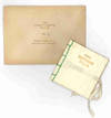

Map of London and the Suburbs, shewing the existing and proposed railways. [20 miles round] arranged by W.R. Botham, of the London and North Western Railway. Drawn and engraved by John Dower [...]
by Dower, John:
- Used
- Hardcover
- Condition
- See description
- Seller
-
London, United Kingdom
Payment Methods Accepted
About This Item
London, W.H. Smith &: Son, 1853. Wood engraved folding map, sheet size 39.5x 55 cm, black and white with 24 proposed lines for the 1852-52 Parliamentary session numbered and printed in red, and with explanatory text in the borders, laid on linen, minor wear at fold intersections; folding into publisher’s brown cloth covers, a little worn and faded, with a 24 page booklet detailing the proposals pasted to the front pastedown. The map appears to have been a one-off, inspired by the flurry of activity surrounding the relocation of the Crystal Palace from its original site in Hyde Park to Sydenham, ‘the immediate cause of several of the new lines’. However, it also details Charles Pearson’s latest propsals for the ‘City Railway Terminus Company’, which a decade later had evolved into the world’s first underground passenger railway. Hyde only identifies this edition of the map (it does not appear to have been revised and updated) and only locates the British Library copy. We have been able to locate examples in just four institutions: two in the UK and two in North America. OCLC 33824518/556421296/1072024276. Hyde, Printed Maps of Victorian London, 33. Map
Reviews
(Log in or Create an Account first!)
Details
- Bookseller
- Bryars and Bryars
(GB)
- Bookseller's Inventory #
- 9441
- Title
- Map of London and the Suburbs, shewing the existing and proposed railways. [20 miles round] arranged by W.R. Botham, of the London and North Western Railway. Drawn and engraved by John Dower [...]
- Author
- Dower, John:
- Book Condition
- Used
- Binding
- Hardcover
- Publisher
- Son
- Place of Publication
- London, W.H. Smith &
- Date Published
- 1853
- Bookseller catalogs
- London;
Terms of Sale
Bryars and Bryars
Books may be returned within seven days of receipt if not entirely as described. All items remain the property of the vendor until payment has been received in full. Payment must be made in Pounds Sterling drawn on a UK bank.
About the Seller
Bryars and Bryars
Biblio member since 2006
London
About Bryars and Bryars
Our shop is located in Cecil Court, a charming Victorian backwater in the heart of London's theatreland which boasts over 20 specialist book, map and print shops. Open: Mon-Sat 11-6. Nearest tube: Leicester Square (Exit 1, Charing Cross Road south, towards National Gallery).
Glossary
Some terminology that may be used in this description includes:


