Click for full-size.


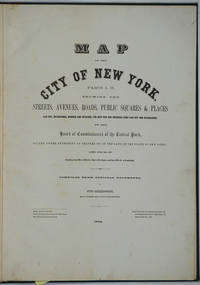
Map of the City of New York. Parts I & II. Showing the Streets, Avenues, Roads, Public Squares & Places Laid Out, Established, Widened and Retained, the New Pier and Bulkhead Lines Laid Out and Established, by the Board of Commissioners of the Central Park. Atlas
by [New York City; Upper West Side; Maps] Sackersdorff, Otto
- Used
- Hardcover
- Condition
- Very good + condition
- Seller
-
Garrison, New York, United States
Payment Methods Accepted
About This Item
New York, 1872. Hardcover. Very good + condition. Maps of Manhattan's west side, prior to the completion of Central Park, which was finished in 1876. The maps were compiled by longtime New York City Department of Public Works map clerk and city surveyor Otto Sackersdorff, noted for his 'Maps of Farms, Commonly called The Blue Book, 1815". The Blue Book was not published until 1868, as a demonstration of northern economic might at the end of the Civil War.
The real estate maps show property lines, existing roads, parks, shorelines, wetlands, and the Manhattan grid, extending from west of 8th Avenue at 59th Street and Columbus Circle up to 222nd Street and Spuyten Duyvil & Kingsbridge. Parks and major thoroughfares include: Central Park, St. Nicholas Avenue, Fort Washington Park, Kingsbridge Road, and High Bridge Park.
Folio, 15 x 20 1/2", 14 maps in total: 1 full page and 13 double page (28 x 20") hand colored lithographed map sheets. Each map contiguous with one another. Period quarter green gilt leather and dark green buckram boards. Spine gently rubbed; the maps exceptionally bright and clean.
Previous owner inscription, in pencil, E. B. Van Winkle from Chas. H. Myers, July 1875. Van Winkle was a civil engineer with an interest in road construction and drainage, having written a report on the drainage of the 23rd & 24th wards of New York City. Myers was an Assistant Engineer in Charge of Sewers for New York City.
OCLC: 41175506 at Princeton and OCLC: 40671892 at Columbia and the New York Public Library.
Reviews
(Log in or Create an Account first!)
Details
- Bookseller
- Antipodean Books, Maps & Prints
 (US)
(US)
- Bookseller's Inventory #
- 26020
- Title
- Map of the City of New York. Parts I & II. Showing the Streets, Avenues, Roads, Public Squares & Places Laid Out, Established, Widened and Retained, the New Pier and Bulkhead Lines Laid Out and Established, by the Board of Commissioners of the Central Park. Atlas
- Author
- [New York City; Upper West Side; Maps] Sackersdorff, Otto
- Format/Binding
- Hardcover
- Book Condition
- Used - Very good + condition
- Quantity Available
- 1
- Place of Publication
- New York
- Date Published
- 1872
- Bookseller catalogs
- NEW YORK CITY;
Terms of Sale
Antipodean Books, Maps & Prints
30 day return guarantee, with full refund including shipping costs for up to 10 days after delivery if an item arrives mis-described or damaged.
About the Seller
Antipodean Books, Maps & Prints
Biblio member since 2009
Garrison, New York
About Antipodean Books, Maps & Prints
Booksellers for over 40 years, members of prominent trade associations (ABAA, ILAB, ANZAAB, IMCOS, ANZMS, PBFA). We are located at Garrison NY, a stone's throw from the Metro North Hudson line train, just over 1 hr. from NYC on the banks of the Hudson River. Books, maps, prints & ephemera bought & sold.
Glossary
Some terminology that may be used in this description includes:
- Buckram
- A plain weave fabric normally made from cotton or linen which is stiffened with starch or other chemicals to cover the book...
- Spine
- The outer portion of a book which covers the actual binding. The spine usually faces outward when a book is placed on a shelf....
- Folio
- A folio usually indicates a large book size of 15" in height or larger when used in the context of a book description. Further,...
- Gilt
- The decorative application of gold or gold coloring to a portion of a book on the spine, edges of the text block, or an inlay in...
This Book’s Categories

Collecting Classic Supernatural Fiction
Classic supernatural fiction is distinct from contemporary horror because it is more literate and often relies upon poetic subtlety rather than unpleasant gratuity to create an atmosphere. Enter if you dare!

Mary Shelley - Mother of Science Fiction
“I have love in me the likes of which you can scarcely imagine and rage the likes of which you would not believe. If I cannot satisfy the one, I will indulge the other.” - Learn more about Mary Shelley, the author of Frankenstein