Description:
Amsterdam: Schenk and Valk, 1708. Very good, minimal foxing, early color (with more recent enhancement) copperplate from this 1708 (original version published in 1660 by Jansson) Schenk/Valk issue of (Andreas Cellarius') "Harmonia Macrocosmica Seu Atlas Universalis Et Novus." The striking image measures 43 x 52 cm on a sheet 51 x 60 cm. Numerous cherubim surrond the circular view, as does an outer circle of a number of signs of the zodiac. There are a couple of pinhole defects, repaired verso, with no significant loss of imate. Ref: Koeman, Atlantes Neerlandici, Cel.3..
THE KINGDOME OF GREAT BRITAINE AND IRELAND by Speed, John - [c. 1614]
by Speed, John
![THE KINGDOME OF GREAT BRITAINE AND IRELAND by Speed, John - [c. 1614]](https://d3525k1ryd2155.cloudfront.net/h/992/372/225372992.0.m.jpg)
THE KINGDOME OF GREAT BRITAINE AND IRELAND
by Speed, John
- Used
[London]: , [c. 1614]. second edition.. Right margin trimmed close with thick tape also verso of margins, otherwise a fine impression.. 14-3/4 x 19-3/4-37.4 x 50.1 cm.. Shirley (British Isles 1477-1650)#343; Skelton #10 A lovely early view of Great Britian, Scotland and Ireland. Insets of London (after an earlier view by Visscher) upper left and Edinburgh and the Orkney islands upper right Two medallion portraits featuring Britannia and King Coel flank either side. The text has been reset from the earlier 1611 edition
-
Bookseller
Webster's Fine Books & Maps, ABAC, ILAB
 (CA)
(CA)
- Book Condition Used - Right margin trimmed close with thick tape also verso of margins, otherwise a fine impression.
- Quantity Available 1
- Edition second edition.
- Place of Publication [London]:
- Date Published [c. 1614]
- Keywords Speed, London, Middlesex, England, Britain, Thames

(Celestial chart, lunar orbits and eclipses): Theoria Lunae, Eius Motum Per Eccentricum Et Epicyclum Demonstrans
by Valk, Gerard and Schenk, Petrus [Cellarius, Andreas]
- Used
- Condition
- Used
- Binding
- Unknown
- Quantity Available
- 1
- Seller
-
Crozet, Virginia, United States
- Item Price
-
€2,532.16
Show Details
Item Price
€2,532.16
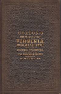
Colton's New Topographical Map of the States of Virginia, Maryland and Delaware, showing also eastern Tennessee, and parts of other adjoining states; all the Fortifications, Military Stations, Rail Roads, Common Roads and other internal improvements.; [Cover reads: Colton's Map of the States of Virginia, Maryland and Delaware...]
by Colton, J.H.
- Used
- very good
- Hardcover
- Condition
- Used - Very Good
- Binding
- Hardcover
- Quantity Available
- 1
- Seller
-
Charlottesville, Virginia, United States
- Item Price
-
€2,839.80
Show Details
Description:
New York: J.H. Colton, 1864. Brown pebbled cloth cover stamped in blind and gilt is in pristine condition. 82 x 110 cm unfolded; 10 x 16 cm folded. Full original hand coloring on onion-skin paper. Very Good. Professionally repaired tear around section attaching to the board, and extending beneath the cartouche (hardly noticeable from the front), minor spotting beneath the cartouche. Note that this is not backed with linen as some folding maps are; the paper is nearly onion skin and while not brittle is fragile. We do not recommend that it be flattened for framing. A highly important folding pocket map to be used in the field during the Civil War, in extraordinary condition. LC Civil War Maps 48.2. OCLC lists only five locations for the 1864 edition: LC, Yale, Penn State, Library of Virginia and Wake Forest. Americana Exchange records only one auction record in the last 15 years, and only two before that.
Item Price
€2,839.80

More Photos
Mapping the Transmississippi West, 1540–1861,
by Wheat, Carl Irving (1892-1966)
- Used
- near fine
- Hardcover
- first
- Condition
- Used - Near Fine
- Edition
- First
- Binding
- Hardcover
- Quantity Available
- 1
- Seller
-
Fort Worth, Texas, United States
- Item Price
-
€2,603.15
Show Details
Description:
From the Spanish discovery to the opening of the Civil War5 volumes in 6. Volume One: The Spanish Entrada to the Louisiana Purchase 1540-1804 xiv+264 pages with color frontispiece map and 275 maps (many folding) and index; Volume Two: From Lewis and Clark to Fremont 1804-1845 xiii+281 pages with colored frontispiece map, 143 additional maps (some folding) and index. Volume Three: From the Mexican War to the Boundary Surveys 1846-1854 xiii+349 pages with colored frontispiece map, 322 additional maps and index; Volume Four: From the Pacific Railroad Surveys to the Onset of the Civil War 1855-1860 xiii+260 pages with color frontispiece map, an additional 127 maps (some folding) and index; Volume Five From the Civil War to the Geological Survey, Part One: xviii+222 pages with color frontispiece map and an additional 152 maps; Volume Five From the Civil War to the Geological Survey, Part Two: [223]-487 pages with 124 maps and index. Folio (14 1/2" x 10 1/2") bound in quarter green leather with gilt…
Read More Item Price
€2,603.15

Mapa De Los Ferro Carriles De La República Argentina Y De Los Paises Limítrofes.: Construido segun los datos é instrucciones suministrados por el Presidente de la Direccion Dor Don Luis Faraoz por el Ingeniero Geógrafo Don José Chavanne.
by Chavannes, José.
- Used
- near fine
- Condition
- Used - Near Fine
- Jacket Condition
- none
- Quantity Available
- 1
- Seller
-
Cranston, Rhode Island, United States
- Item Price
-
€2,839.80
Show Details
Description:
Buenos Aires, Dirección de Ferro Carriles Nacionales, 1892. Color topographical printed map in four parts of eighteen sections each, backed with linen. Scale: 1: 1,000,000. The map encompasses approximately 41° South latitude to approx. 20° S. latitude, and approx. 53° West longitude to a little beyond 73° W. latitude. This includes Chile along its entire western border, in some cases to the Pacific, and parts of Bolivia, Paraguay, and Uruguay. Railroad lines are shown as far south as Bahía Nueva in Chubut on the east coast and a bit inland from Valdivia (Chile) in the west; in the north Asunción is the farthest inland reach, and both completed and projected sections of the Transandine (Valparaiso to Buenos Aires) line are shown (the last tunnel was completed in 1909). Development of railways in the Argentine dates from 1857 and was mostly supported by private companies largely controlled in England, about 15% being owned and operated by the government. Produced following an investment…
Read More Item Price
€2,839.80
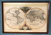
Mappe-Monde Geo-Hydrographique, ou Description Generale du Globe Terrestre et Aquatique en Deux Plans-Hemispheres; ou Sont Exactement Remarquees en General Toutes Les Parties De La Terre et de L'Eau, Suivant les Relations Les Plus Nouvelles. Par le S. Sanson, Geographe Ordinaire du Roy. 1684.
by Jaillot (Alexis-Hubert)
- Used
- Condition
- Used
- Binding
- Unknown
- Quantity Available
- 1
- Seller
-
Sidney, British Columbia, Canada
- Item Price
-
€3,313.10
Show Details
Description:
Paris, 1684. . Large double-hemisphere map, 36 x 25 inches (framed: 38 x 26.5 inches). Attractively coloured, decorative cartouche and embellishments. Modest wear at fold, some light marginal stains, an attractive copy. This map has been mounted on cardboard via an unknown process, but there is no evidence of damage. This looks to be Shirley's state 4 of the first plate, with Cordier's name beneath the left hemisphere (Cordier Sculp.) and a date of 1684. The first plate exists in four states, dated 1674, 1679, 1681, and 1684 (this one). An enlarged version of a previous map by Nicolas Sanson, beautiful and striking. Wheat 65, citing the 1684 edition.
Item Price
€3,313.10
(Celestial chart, lunar orbits and eclipses): Theoria Lunae, Eius Motum Per Eccentricum Et Epicyclum Demonstrans
by Valk, Gerard and Schenk, Petrus [Cellarius, Andreas]
- Used
- Condition
- Used
- Binding
- Unknown
- Quantity Available
- 1
- Seller
-
Crozet, Virginia, United States
- Item Price
-
€2,532.16
Show Details
Description:
Amsterdam: Schenk and Valk, 1708. Very good, minimal foxing, early color (with more recent enhancement) copperplate from this 1708 (original version published in 1660 by Jansson) Schenk/Valk issue of (Andreas Cellarius') "Harmonia Macrocosmica Seu Atlas Universalis Et Novus." The striking image measures 43 x 52 cm on a sheet 51 x 60 cm. Numerous cherubim surrond the circular view, as does an outer circle of a number of signs of the zodiac. There are a couple of pinhole defects, repaired verso, with no significant loss of imate. Ref: Koeman, Atlantes Neerlandici, Cel.3..
Item Price
€2,532.16
Colton's New Topographical Map of the States of Virginia, Maryland and Delaware, showing also eastern Tennessee, and parts of other adjoining states; all the Fortifications, Military Stations, Rail Roads, Common Roads and other internal improvements.; [Cover reads: Colton's Map of the States of Virginia, Maryland and Delaware...]
by Colton, J.H.
- Used
- very good
- Hardcover
- Condition
- Used - Very Good
- Binding
- Hardcover
- Quantity Available
- 1
- Seller
-
Charlottesville, Virginia, United States
- Item Price
-
€2,839.80
Show Details
Description:
New York: J.H. Colton, 1864. Brown pebbled cloth cover stamped in blind and gilt is in pristine condition. 82 x 110 cm unfolded; 10 x 16 cm folded. Full original hand coloring on onion-skin paper. Very Good. Professionally repaired tear around section attaching to the board, and extending beneath the cartouche (hardly noticeable from the front), minor spotting beneath the cartouche. Note that this is not backed with linen as some folding maps are; the paper is nearly onion skin and while not brittle is fragile. We do not recommend that it be flattened for framing. A highly important folding pocket map to be used in the field during the Civil War, in extraordinary condition. LC Civil War Maps 48.2. OCLC lists only five locations for the 1864 edition: LC, Yale, Penn State, Library of Virginia and Wake Forest. Americana Exchange records only one auction record in the last 15 years, and only two before that.
Item Price
€2,839.80
More Photos
Mapping the Transmississippi West, 1540–1861,
by Wheat, Carl Irving (1892-1966)
- Used
- near fine
- Hardcover
- first
- Condition
- Used - Near Fine
- Edition
- First
- Binding
- Hardcover
- Quantity Available
- 1
- Seller
-
Fort Worth, Texas, United States
- Item Price
-
€2,603.15
Show Details
Description:
From the Spanish discovery to the opening of the Civil War5 volumes in 6. Volume One: The Spanish Entrada to the Louisiana Purchase 1540-1804 xiv+264 pages with color frontispiece map and 275 maps (many folding) and index; Volume Two: From Lewis and Clark to Fremont 1804-1845 xiii+281 pages with colored frontispiece map, 143 additional maps (some folding) and index. Volume Three: From the Mexican War to the Boundary Surveys 1846-1854 xiii+349 pages with colored frontispiece map, 322 additional maps and index; Volume Four: From the Pacific Railroad Surveys to the Onset of the Civil War 1855-1860 xiii+260 pages with color frontispiece map, an additional 127 maps (some folding) and index; Volume Five From the Civil War to the Geological Survey, Part One: xviii+222 pages with color frontispiece map and an additional 152 maps; Volume Five From the Civil War to the Geological Survey, Part Two: [223]-487 pages with 124 maps and index. Folio (14 1/2" x 10 1/2") bound in quarter green leather with gilt…
Read More Item Price
€2,603.15
Mapa De Los Ferro Carriles De La República Argentina Y De Los Paises Limítrofes.: Construido segun los datos é instrucciones suministrados por el Presidente de la Direccion Dor Don Luis Faraoz por el Ingeniero Geógrafo Don José Chavanne.
by Chavannes, José.
- Used
- near fine
- Condition
- Used - Near Fine
- Jacket Condition
- none
- Quantity Available
- 1
- Seller
-
Cranston, Rhode Island, United States
- Item Price
-
€2,839.80
Show Details
Description:
Buenos Aires, Dirección de Ferro Carriles Nacionales, 1892. Color topographical printed map in four parts of eighteen sections each, backed with linen. Scale: 1: 1,000,000. The map encompasses approximately 41° South latitude to approx. 20° S. latitude, and approx. 53° West longitude to a little beyond 73° W. latitude. This includes Chile along its entire western border, in some cases to the Pacific, and parts of Bolivia, Paraguay, and Uruguay. Railroad lines are shown as far south as Bahía Nueva in Chubut on the east coast and a bit inland from Valdivia (Chile) in the west; in the north Asunción is the farthest inland reach, and both completed and projected sections of the Transandine (Valparaiso to Buenos Aires) line are shown (the last tunnel was completed in 1909). Development of railways in the Argentine dates from 1857 and was mostly supported by private companies largely controlled in England, about 15% being owned and operated by the government. Produced following an investment…
Read More Item Price
€2,839.80
Mappe-Monde Geo-Hydrographique, ou Description Generale du Globe Terrestre et Aquatique en Deux Plans-Hemispheres; ou Sont Exactement Remarquees en General Toutes Les Parties De La Terre et de L'Eau, Suivant les Relations Les Plus Nouvelles. Par le S. Sanson, Geographe Ordinaire du Roy. 1684.
by Jaillot (Alexis-Hubert)
- Used
- Condition
- Used
- Binding
- Unknown
- Quantity Available
- 1
- Seller
-
Sidney, British Columbia, Canada
- Item Price
-
€3,313.10
Show Details
Description:
Paris, 1684. . Large double-hemisphere map, 36 x 25 inches (framed: 38 x 26.5 inches). Attractively coloured, decorative cartouche and embellishments. Modest wear at fold, some light marginal stains, an attractive copy. This map has been mounted on cardboard via an unknown process, but there is no evidence of damage. This looks to be Shirley's state 4 of the first plate, with Cordier's name beneath the left hemisphere (Cordier Sculp.) and a date of 1684. The first plate exists in four states, dated 1674, 1679, 1681, and 1684 (this one). An enlarged version of a previous map by Nicolas Sanson, beautiful and striking. Wheat 65, citing the 1684 edition.
Item Price
€3,313.10

Stock Photo: Cover May Be Different
Tiger Claws : A Novel of India
by Speed, John
- Used
- Condition
- Used - Good
- ISBN 10 / ISBN 13
- 9780312325510 / 0312325517
- Quantity Available
- 1
- Seller
-
Mishawaka, Indiana, United States
- Item Price
-
€5.40
Show Details
Description:
St. Martin's Press. Used - Good. Former library book; may include library markings. Used book that is in clean, average condition without any missing pages.
Item Price
€5.40

Stock Photo: Cover May Be Different
The Temple Dancer : A Novel of India
by Speed, John
- Used
- Condition
- Used - Very Good
- ISBN 10 / ISBN 13
- 9780312325497 / 0312325495
- Quantity Available
- 1
- Seller
-
Mishawaka, Indiana, United States
- Item Price
-
€5.42
Show Details
Description:
St. Martin's Press. Used - Very Good. Used book that is in excellent condition. May show signs of wear or have minor defects.
Item Price
€5.42

Stock Photo: Cover May Be Different
The Temple Dancer : A Novel of India
by Speed, John
- Used
- Condition
- Used - Good
- ISBN 10 / ISBN 13
- 9780312325480 / 0312325487
- Quantity Available
- 1
- Seller
-
Reno, Nevada, United States
- Item Price
-
€5.56
Show Details
Description:
St. Martin's Press. Used - Good. Former library book; may include library markings. Used book that is in clean, average condition without any missing pages.
Item Price
€5.56

Stock Photo: Cover May Be Different
The Counties of Britain: A Tudor Atlas
by Speed, John
- Used
- good
- Paperback
- Condition
- Used - Good
- Binding
- Paperback
- ISBN 10 / ISBN 13
- 9781857936124 / 1857936124
- Quantity Available
- 1
- Seller
-
Seattle, Washington, United States
- Item Price
-
€6.26
Show Details
Description:
Trafalgar Square Publishing, 1995. Paperback. Good. Missing dust jacket; Pages can have notes/highlighting. Spine may show signs of wear. ~ ThriftBooks: Read More, Spend Less.Dust jacket quality is not guaranteed.
Item Price
€6.26

The Counties of Britain : A Tudor Atlas
by John Speed
- Used
- Acceptable
- Paperback
- Condition
- Used - Acceptable
- Binding
- Paperback
- ISBN 10 / ISBN 13
- 9781857936124 / 1857936124
- Quantity Available
- 2
- Seller
-
Seattle, Washington, United States
- Item Price
-
€6.26
Show Details
Description:
Pavilion Books, 1995. Paperback. Acceptable. Disclaimer:A readable copy. All pages are intact, and the cover is intact. Pages can include considerable notes-in pen or highlighter-but the notes cannot obscure the text. At ThriftBooks, our motto is: Read More, Spend Less.Dust jacket quality is not guaranteed.
Item Price
€6.26

The Counties of Britain : A Tudor Atlas
by John Speed
- Used
- good
- Paperback
- Condition
- Used - Good
- Binding
- Paperback
- ISBN 10 / ISBN 13
- 9781857936124 / 1857936124
- Quantity Available
- 1
- Seller
-
Seattle, Washington, United States
- Item Price
-
€6.26
Show Details
Description:
Pavilion Books, 1995. Paperback. Good. Disclaimer:A copy that has been read, but remains in clean condition. All pages are intact, and the cover is intact. The spine may show signs of wear. Pages can include limited notes and highlighting, and the copy can include previous owner inscriptions. At ThriftBooks, our motto is: Read More, Spend Less.Dust jacket quality is not guaranteed.
Item Price
€6.26

The Counties of Britain: A Tudor Atlas.
by Speed, John
- Used
- very good
- Hardcover
- Condition
- Used - Very Good
- Binding
- Hardcover
- ISBN 10 / ISBN 13
- 9781851451319 / 1851451315
- Quantity Available
- 2
- Seller
-
Seattle, Washington, United States
- Item Price
-
€6.47
Show Details
Description:
Pavilion Books, 1992. Hardcover. Very Good. May have limited writing in cover pages. Pages are unmarked. ~ ThriftBooks: Read More, Spend Less.Dust jacket quality is not guaranteed.
Item Price
€6.47

The Temple Dancer: A Novel of India
by Speed, John
- Used
- very good
- Paperback
- Condition
- Used - Very Good
- Binding
- Paperback
- ISBN 10 / ISBN 13
- 9780312325497 / 0312325495
- Quantity Available
- 1
- Seller
-
Seattle, Washington, United States
- Item Price
-
€6.49
Show Details
Description:
Griffin, 2007. Paperback. Very Good. May have limited writing in cover pages. Pages are unmarked. ~ ThriftBooks: Read More, Spend Less.Dust jacket quality is not guaranteed.
Item Price
€6.49

The Temple Dancer : A Novel of India
by John Speed
- Used
- Acceptable
- Paperback
- Condition
- Used - Acceptable
- Binding
- Paperback
- ISBN 10 / ISBN 13
- 9780312325497 / 0312325495
- Quantity Available
- 1
- Seller
-
Seattle, Washington, United States
- Item Price
-
€6.49
Show Details
Description:
St. Martin's Press, 2007. Mass Market Paperback. Acceptable. Readable copy. Pages may have considerable notes/highlighting. ~ ThriftBooks: Read More, Spend Less.Dust jacket quality is not guaranteed.
Item Price
€6.49
Stock Photo: Cover May Be Different
Tiger Claws : A Novel of India
by Speed, John
- Used
- Condition
- Used - Like New
- ISBN 10 / ISBN 13
- 9780312325510 / 0312325517
- Quantity Available
- 1
- Seller
-
Reno, Nevada, United States
- Item Price
-
€6.68
Show Details
Description:
St. Martin's Press. Used - Like New. Used book that is in almost brand-new condition.
Item Price
€6.68

More Photos
The Sky and the Forest
by Forester, C.S
- Used
- very good
- Hardcover
- first
- Condition
- Used - Very Good
- Jacket Condition
- Very Good
- Edition
- First Edition
- Binding
- Hardcover
- Quantity Available
- 1
- Seller
-
Salem, Oregon, United States
- Item Price
-
€33.03€19.81Save €13.96!
Show Details
Description:
C.S. Forester: The Sky and the Forest. Little, Brown and Company, Boston. Stated First Edition First Printing Thus August, 1948. Cover price $2.75. Used. VG BOOK/VG UNCLIPPED DUST JACKET. A story of a central Africa. By C.S. Forester, author of the Admiral Hornblower series.
Item Price
€33.03€19.81
Save €13.96
!
![Alaska and Klondike Region; [With inset of Klondike Region on the Upper Yukon detail] [From an...](https://d3525k1ryd2155.cloudfront.net/h/062/537/1339537062.0.m.jpg)
Alaska and Klondike Region; [With inset of Klondike Region on the Upper Yukon detail] [From an atlas, "Gazetteer of Alaska and Yukon Region " pp. 105 and 106]
by Miller, J. Martin
- Used
- very good
- Condition
- Used - Very Good
- Edition
- Unknown
- Quantity Available
- 1
- Seller
-
Sebastopol, California, United States
- Item Price
-
€36.92
Show Details
Description:
Chicago: J. Martin Miller, 1899. Unknown. Map. Very Good. [Map copyright 1899, printing date of Atlas later] [19.875x15.125in]; Colored map of Alaska with steamer routes from Portland and Seattle, insets of the Klondike Region on the Upper Yukon and Western portion of Aleutian Islands; On verso index of places and names with two large black and white images; Age toning to all edges, water stain marks on bottom, slight printing offset of colors, small chips and closed tears to lower edge;.
Item Price
€36.92

Zemepis Sveta - Monsunova Asie
by De La Blache, P. Vidal; Gallois, L
- Used
- Hardcover
- Condition
- Used - Very Good Condition
- Jacket Condition
- No Dust Jacket
- Binding
- Hardcover
- Quantity Available
- 1
- Seller
-
Oak Point, Texas, United States
- Item Price
-
€56.80
Show Details
Description:
Aventinum, Prague, Czechoslovakia, 1931. Hardcover. Very Good Condition/No Dust Jacket. Text entirely in Czech. Geography book on Asia with numerous photographs and maps. 1930 edition also available. Size: 4mo - over 9 3/4" - 12" tall. 400 pp. Pages are yellowed, but are tight and clean. Moderate shelfwear along the spine. Corners are lightly bumped. Quantity Available: 1. Shipped Weight: 3-5 pounds. Category: Travel & Places; Non-English Language::Czech; Pictures of this item not already displayed here available upon request. Inventory No: 001228. . Additional shipping charges may apply.
Item Price
€56.80

Zemepis Sveta - Monsunova Asie
by De La Blache, P. Vidal; Gallois, L
- Used
- Hardcover
- Condition
- Used - Very Good Condition
- Jacket Condition
- No Dust Jacket
- Binding
- Hardcover
- Quantity Available
- 1
- Seller
-
Oak Point, Texas, United States
- Item Price
-
€56.80
Show Details
Description:
Aventinum, Prague, Czechoslovakia, 1930. Hardcover. Very Good Condition/No Dust Jacket. Text entirely in Czech. Geography book on Asia with numerous photographs and maps. 1931 edition also available. Size: 4mo - over 9 3/4" - 12" tall. 400 pp. Pages are yellowed, but are tight and clean. Moderate shelfwear along the spine. Corners are lightly bumped. Quantity Available: 1. Shipped Weight: 3-5 pounds. Category: Travel & Places; Non-English Language::Czech; Pictures of this item not already displayed here available upon request. Inventory No: 001227. . Additional shipping charges may apply.
Item Price
€56.80

North America from the Best Authorities, Russell, ca.1800
by Russell
- Used
- Condition
- Used
- Quantity Available
- 1
- Seller
-
Plymouth, Devon, United Kingdom
- Item Price
-
€23.68
Show Details
Description:
Russell, J. : A General Map of North America from the Best Authorities. Nd but ca.1800. From "A New Geographical, Historical and Commercial Grammar and Present State of Several Kingdoms of the World." Copper engraving. Size approx 200 x 230mm. Two neat folds. Some age colouring to edges, otherwise very clean and bright.
Item Price
€23.68

Asia from the Best Authorities, Russell, ca.1800
by Russell
- Used
- Condition
- Used
- Quantity Available
- 1
- Seller
-
Plymouth, Devon, United Kingdom
- Item Price
-
€23.68
Show Details
Description:
Russell, J. : Asia from the Best Authorities. Nd but ca.1800. From "A New Geographical, Historical and Commercial Grammar and Present State of Several Kingdoms of the World". Copper engraving. Size approx 200 x 230mm. Two neat folds. Some age colouring to edges, otherwise clean and bright. Includes Arabia, India, Borneo, Japan, China and eastern Russia.
Item Price
€23.68
![MAP OF UTAH [Territory]](https://d3525k1ryd2155.cloudfront.net/h/836/461/1485461836.0.m.jpg)
More Photos
MAP OF UTAH [Territory]
- Used
- Condition
- Used - Very Good-
- Edition
- Original
- Quantity Available
- 1
- Seller
-
Williamsburg, Virginia, United States
- Item Price
-
€61.53
Show Details
Description:
New York, Richmond, Chicago, & Toledo: H. H. Hardesty, 1885. Original color lithographed map printed by Rand, McNally & Company, Engravers and published in HARDESTY'S HISTORICAL AND GEOGRAPHICAL ENCYCLOPEDIA: SPECIAL VIRGINIA EDITION. 19 3/8 inches by 13 1/4 inches on a 21" X 14 1/2" sheet. The map depicts the Territory of Utah in its final form--large areas had been removed and ceded to Nevada, Colorado, Wyoming, and Nebraska since Utah became a U. S. Territory in 1850. The issue of polygamy prevented statehood until it was finally granted in 1896. This map features railroads and topography and uses color to set off counties from each other. Unlike most atlas maps of the period, this map identifies most small towns. The map is guaranteed to be moe than 135 years old. The map is in about very good condition: generally clean and bright, with slight toning of paper and one faint water stain near the center-left edge of the map.. Original. Single Sheet. Very Good-. Elephant…
Read More Item Price
€61.53

Philips Special Map of the Nile, The Advance on Khartum and the Environs of Omdurman. Cc1900
by George Philips and Son,
- Used
- Condition
- Used
- Quantity Available
- 1
- Seller
-
Plymouth, Devon, United Kingdom
- Item Price
-
€30.78
Show Details
Description:
Philips Special map of the Nile illustrating the Advance on Khartum [Khartoum] with an enlargement of the environs of Omdurman [Omdur]. George Philips and Son, London and Liverpool Ca 1900. 580mm x 900mm folded map. Front title wrapper has come loose, not affecting map area. Three maps are displayed within the sheet. Map1. Map of the Nile Valley 520mm x 300mm showing the approaches of Khartum. Scale 1inch to 100 Geographical miles. Coloured indicating Possessions and Protectorates of European Powers. Map 2. Special map of the Nile from Dongola to Khartum. Scale 16 miles to the inch. Coloured. In set in this map is Map3. Environs of Omdurman, Scale 5 statute miles to the inch. Some small breaks at some folds, not affecting imagery or use of map. Title label is damaged, the map is clean and bright, probably unused. A very interesting record.
Item Price
€30.78

Last Tales
by Dinesen, Isak
- Used
- very good
- Hardcover
- first
- Condition
- Used - Very Good
- Jacket Condition
- Good+
- Edition
- First Edition
- Binding
- Hardcover
- Quantity Available
- 1
- Seller
-
Salem, Oregon, United States
- Item Price
-
€113.59€68.16Save €48.00!
Show Details
Description:
Dinesen, Isak: Last Tales, A Collection of Twelve New Tales of Compelling Beauty 1957, Random House. First Edition. Stated First Printing Thus. Used. Very Good/Good+ original red dust jacket, price-clipped. Jacket states 11/57 on front flap. 5 3/4 X
Item Price
€113.59€68.16
Save €48.00
!

The Adventure of Wrangel Island
by Vilhjalmur Stefansson
- Used
- good
- Hardcover
- first
- Condition
- Used - Good
- Jacket Condition
- No DJ Included
- Edition
- First Edition
- Binding
- Hardcover
- Quantity Available
- 1
- Seller
-
Salem, Oregon, United States
- Item Price
-
€118.22€70.93Save €49.96!
Show Details
Description:
The Adventure of Wrangel Island, Alaska (1925 Macmillan 1st Edition) HISTORY OF ALASKA. EXLIB. Good Condition/ No DJ included. Fold-out map affixed to binding at the back of the book has never been opened. The story of the (unsuccessful) attempted colonization of Wrangel Island Alaska. 413 pages plus appendix, Index. Titling is still bright. A clean, solid copy. Scarce.
Item Price
€118.22€70.93
Save €49.96
!
