Description:
University Of Chicago Press, 1992-01-15. Paperback. Acceptable. 5x0x8.
The Inland Navigation, Railroads, Geology and Minerals of England & Wales by ARROWSMITH, John - 1842
by ARROWSMITH, John

The Inland Navigation, Railroads, Geology and Minerals of England & Wales
by ARROWSMITH, John
- Used
London: J. Arrowsmith, 1842. Map. Engraving with original hand-coloring. Image measures 24 1/2 x 19 1/2".<br/><br/> This beautifully color-coded and robustly labeled map describes the geology of the British Isles. The colors indicate particular rock materials in accordance with a key at top right of the map, and symbols designate mineralogical deposits. In addition to geological information, the index also includes major cities, rivers, canals, mail coach roads, and railroads. Graphs on the left side depict lines of navigation throughout the area. This map is from Arrowsmith's "London atlas of universal geography" and is in good condition with vivid colors. Some wear and staining in margins not affecting the image. Wear to original center fold. John Arrowsmith (1790-1873) was from a family of London based cartographers and publishers, and was a founding member of the Royal Geographical Society. His "London Atlas," known for its understated elegance, is considered one of the first truly "modern" atlases of the nineteenth century. This finely colored map is a lovely example of his work.<br/><br/>
-
Bookseller
Argosy Book Store
 (US)
(US)
- Book Condition Used
- Publisher J. Arrowsmith
- Place of Publication London
- Date Published 1842
- Keywords geological, minerals, british rail roads
Stock Photo: Cover May Be Different
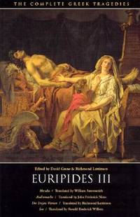
Euripides III: Hecuba, Andromache, The Trojan Women, Ion (The Complete Greek Tragedies) (Vol 5)
by Euripides; William Arrowsmith [Translator]; John Frederick Nims [Translator]; Richmond Lattimore [Translator]; Ronald Frederick Willetts [Translator]; David Grene [Editor]; Richmond Lattimore [Editor];
- Used
- Acceptable
- Paperback
- Condition
- Used - Acceptable
- Binding
- Paperback
- ISBN 10 / ISBN 13
- 9780226307824 / 0226307824
- Quantity Available
- 1
- Seller
-
Memphis, Tennessee, United States
- Item Price
-
€4.80
Show Details
Item Price
€4.80
Stock Photo: Cover May Be Different
Euripides III: Hecuba, Andromache, The Trojan Women, Ion (The Complete Greek Tragedies)
by Euripides; David Grene [Editor]; Richmond Lattimore [Editor]; William Arrowsmith [Translator]; John Frederick Nims [Translator]; Richmond Lattimore [Translator]; Ronald Frederick Willetts [Translator];
- Used
- good
- Paperback
- Condition
- Used - Good
- Binding
- Paperback
- ISBN 10 / ISBN 13
- 9780226307824 / 0226307824
- Quantity Available
- 1
- Seller
-
Memphis, Tennessee, United States
- Item Price
-
€4.80
Show Details
Description:
University Of Chicago Press, 1992-01-15. Paperback. Good. 5x0x8.
Item Price
€4.80
Stock Photo: Cover May Be Different
Euripides III: Hecuba, Andromache, The Trojan Women, Ion (The Complete Greek Tragedies)
by Euripides; David Grene [Editor]; Richmond Lattimore [Editor]; William Arrowsmith [Translator]; John Frederick Nims [Translator]; Richmond Lattimore [Translator]; Ronald Frederick Willetts [Translator];
- Used
- Acceptable
- Paperback
- Condition
- Used - Acceptable
- Binding
- Paperback
- ISBN 10 / ISBN 13
- 9780226307824 / 0226307824
- Quantity Available
- 1
- Seller
-
Kingwood, Texas, United States
- Item Price
-
€4.84
Show Details
Description:
University Of Chicago Press, 1992-01-15. paperback. Acceptable. 5x0x8.
Item Price
€4.84
Stock Photo: Cover May Be Different
Euripides III: Hecuba, Andromache, The Trojan Women, Ion (The Complete Greek Tragedies) (Vol 5)
by Euripides; David Grene [Editor]; Richmond Lattimore [Editor]; William Arrowsmith [Translator]; John Frederick Nims [Translator]; Richmond Lattimore [Translator]; Ronald Frederick Willetts [Translator];
- Used
- Acceptable
- Paperback
- Condition
- Used - Acceptable
- Binding
- Paperback
- ISBN 10 / ISBN 13
- 9780226307824 / 0226307824
- Quantity Available
- 2
- Seller
-
Houston, Texas, United States
- Item Price
-
€4.84
Show Details
Description:
University Of Chicago Press, 1992-01-15. Paperback. Acceptable. 5x0x8.
Item Price
€4.84
Stock Photo: Cover May Be Different
Euripides III: Hecuba, Andromache, The Trojan Women, Ion (The Complete Greek Tragedies) (Vol 5)
by Euripides; Editor-David Grene; Editor-Richmond Lattimore; Translator-Richmond Lattimore; Translator-William Arrowsmith; Translator-John Frederick Nims; Translator-Ronald Frederick Willetts
- Used
- Paperback
- Condition
- Used: Good
- Binding
- Paperback
- ISBN 10 / ISBN 13
- 9780226307824 / 0226307824
- Quantity Available
- 1
- Seller
-
HOUSTON, Texas, United States
- Item Price
-
€7.32
Show Details
Description:
University Of Chicago Press, 1992-01-15. Paperback. Used: Good. Excellent customer service. Prompt Customer Service.
Item Price
€7.32

Euripides III: Hecuba / Andromache / The Trojan Women / Ion (The Complete Greek Tragedies, Grene & Lattimore, eds.)
by Euripides / William Arrowsmith, trans. Hecuba / John F. Nims, trans. Andromache / Richmond Lattimore, trans. Trojan Women / Ronald F. Willetts, trans. Ion
- Used
- Paperback
- first
- Condition
- Used - vg-
- Edition
- 1st
- Binding
- Paperback
- Quantity Available
- 1
- Seller
-
Bethlehem, Pennsylvania, United States
- Item Price
-
€5.87
Show Details
Description:
Washington Square Press. 1st. 1968. vg-. Paperback. W-1069. Mass market paperback; white cover & pp are browning; 277pp; light reading crease to spine .
Item Price
€5.87

Stock Photo: Cover May Be Different
Plays: . . . and How to Produce Them
by Carter, David/ Horwood, Sharman (Illustrator)/ Arrowsmith, John (Contributor)
- New
- Paperback
- Condition
- New
- Binding
- Paperback
- ISBN 10 / ISBN 13
- 9781842432204 / 1842432206
- Quantity Available
- 1
- Seller
-
Exeter, Devon, United Kingdom
- Item Price
-
€1.18
Show Details
Description:
Oldcastle Books Ltd, 2009. Paperback. New. 224 pages. 7.50x5.50x0.25 inches.
Item Price
€1.18
Stock Photo: Cover May Be Different
Euripides III: Hecuba, Andromache, The Trojan Women, Ion (The Complete Greek Tragedies) (Vol 5)
by Euripides; David Grene [Editor]; Richmond Lattimore [Editor]; William Arrowsmith [Translator]; John Frederick Nims [Translator]; Richmond Lattimore [Translator]; Ronald Frederick Willetts [Translator];
- Used
- very good
- Paperback
- Condition
- Used - Very Good
- Edition
- Second
- Binding
- Paperback
- ISBN 10 / ISBN 13
- 9780226307824 / 0226307824
- Quantity Available
- 1
- Seller
-
Boonsboro, Maryland, United States
- Item Price
-
€8.75
Show Details
Description:
University Of Chicago Press, 1992-01-15. Second. Paperback. Very Good. Softcover. Good binding and cover. Clean, unmarked pages. Note: We have a number of other volumes in Complete Greek Tragedy series.
Item Price
€8.75
American Poetry Review Vol. 2 No. 1, Jan./Feb. 1973
by Journal. Adrienne Rich, Harvey Swados, Joyce Carol Oates, William Arrowsmith, John Logan, Paul Goodman, Stanley Kunitz, Richard Hugo, Paul Violi, Michael Benedikt, Daniel Hoffman, Donald Hall, Robert Jay Lifton, Diane Wakoski, Alvin Rosenfeld, Joseph Brod
- Used
- good
- Paperback
- Condition
- Used - Good
- Binding
- Paperback
- Quantity Available
- 1
- Seller
-
Portland, Oregon, United States
- Item Price
-
€10.85
Show Details
Description:
Philadelphia, 1973. Paperback. Good. Newsprint, tabloid format. Sunned, edgeworn, chipped and torn, tape-repaired, with outer pp. dustsoiled, address label.
Item Price
€10.85

Stock Photo: Cover May Be Different
A Practical Guide for New School Leaders
by Daresh, John C., Arrowsmith, Trevor
- Used
- Condition
- Used - Good
- ISBN 10 / ISBN 13
- 9780761942443 / 0761942440
- Quantity Available
- 2
- Seller
-
Dunfermline, Fife, United Kingdom
- Item Price
-
€5.90
Show Details
Description:
SAGE Publications, Limited. Used - Good. Ships from the UK. Former library book; may include library markings. Used book that is in clean, average condition without any missing pages.
Item Price
€5.90