Description:
[Boston: B. & J. Loring, 1801. Copper-engraved map, with original outline colour, folded and mounted on linen. Publisher's paper label to verso, in good condition apart from some slight browning. Modern cloth chemise, within a morocco-backed cloth slipcase. A very rare and highly important early map of Massachusetts. The revised and much improved first "official" edition of the most important early map of Massachusetts. In three key ways, this edition is a great improvement over Osgood Carleton's 1798 original which was rejected for official sanction by the government of the Commonwealth. Firstly, the coastline and coastal islands have been more correctly rendered, largely due to the incorporation of information from the charts of Joseph Des Barres. Secondly, roads and streams that had been left incomplete in the earlier map were extended. Thirdly, some of the clutter of the 1798 map, engraved by Carleton's partner, John Norman, was removed, and the map is more attractive and informative, with a…
Read More A COMPLETE SYSTEM OF GEOGRAPHY: Being a description of all the ... known world by Bowen, Emanuel - 1747
by Bowen, Emanuel

A COMPLETE SYSTEM OF GEOGRAPHY: Being a description of all the ... known world
by Bowen, Emanuel
- Used
- first
London: Printed for William Innys, Richard Ware, Aaron Ward, et al., 1747. First edition. Two massive full-leather folio volumes with A TOTAL OF 68 MAPS AND 2 PLATES. Lacking only 1 map in first volume. VOLUME ONE -- includes 27 of the 28 maps called for with 9 folding maps; 2 double-plate maps; 16 single-plate maps; plus 2 single plates, "Solar System" and "Artificial Sphere" (lacking only "The World in Two Hemispheres"). VOLUME TWO -- complete with 41 maps as called for with 12 folding maps; 23 double-plate maps, and 6 single-plate maps. AN ENDLESSLY FASCINATING SET BOTH FOR THE MAPS AND THE ACCOMPANYING TEXT DESCRIBING PEOPLES AND PLACES AROUND THE GLOBE. In surprisingly nice condition overall with only the "Chart of the World" (double plate, volume 1) detached from its stub. Otherwise, despite the occasional chip, light stain or tear, this set is altogether near fine with most pages surprisingly fresh and remarkably bright. Quite scarce to rare, especially so very nearly complete.
-
Bookseller
Independent bookstores
 (US)
(US)
- Book Condition Used
- Quantity Available 1
- Publisher Printed for William Innys, Richard Ware, Aaron Ward, et al.
- Place of Publication London
- Date Published 1747

More Photos
Map of Massachusetts proper compiled from Actual Surveys made by Order of the General Court, and under the inspection of agents of their appointment
by CARLETON, Osgood (fl.1792-1806)
- Used
- Condition
- Used
- Binding
- Unknown
- Quantity Available
- 1
- Seller
-
New York, New York, United States
- Item Price
-
€16,988.40
Show Details
Item Price
€16,988.40

More Photos
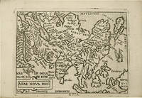
Historia de Gentibus septentrionalibus, earumqve diversis statibus, conditionibus, moribus, ritibus, superstitionibus, disciplinis, excercitiis, regimine, victu, belleis, structuris, instrumentis, ac mineris metallicis, & rebus mirabilibus, necnon uni... - [THE LARGE COMMENTARY TO "CARTA MARINA"]
by MAGNUS, OLAUS.
- Used
- Hardcover
- first
- Condition
- Used
- Binding
- Hardcover
- Quantity Available
- 1
- Seller
-
Copenhagen, Denmark
- Item Price
-
€15,410.00
Show Details
Description:
1555. Romae, (Colophon: Apud Ioannem Mariam de Viottis Parmensem, in aedibus Birgitttae), 1555. Folio. Bound to style in later (around 1950) full vellum with 4 raised bands to spine. Endpapers renewed. Old owners name on foot of titlepage. 42 unnumb. leaves + 815 pp. (p. 815 is the full page woodengraved printers device, verso blank). With 472 fine woodcuts in the text, the greatest part measuring 59x93 mm, a few half-page and some 1/3-page, among these the full-page map over Scandinavia (the smaller sized "Carta Marina"). Only few scattered brownspots, probably lightly washed by the rebinding. From ab. p. 500 the upper margins have some faint dampspots, which on ab. 25 leaves has left some small loss of paper, and on a few places the loss of a letter in the caption title, but everywhere professionally repaired with paperpulp where needed. First edition of Magnus' great work, which constitutes the first larger geographical-ethnographical description of Scandinavia and one of the most important…
Read More Item Price
€15,410.00

To glory we steer.
by Alexander Kent.
- Used
- Hardcover
- first
- Condition
- Used - Very good.
- Jacket Condition
- Very good, but priclipped.
- Binding
- Hardcover
- Quantity Available
- 1
- Seller
-
Lymm, Cheshire, United Kingdom
- Item Price
-
€113.54
Show Details
Description:
1st edition.First book published in the Bolitho series. The boards are slightly worn, but the priceclipped dustwrapper is in very good condition.
Item Price
€113.54
More Photos
Theatro del mondo.
by ORTELIUS, Abraham.
- Used
- Hardcover
- Condition
- Used
- Binding
- Hardcover
- Quantity Available
- 1
- Seller
-
Paris, France
- Item Price
-
€10,500.00
Show Details
Description:
Venetia, Per Scipion Banca, 1667.16mo [133 x 93 mm] of (4) ll., 232 pp., (8) ll. 108 full-page engraved maps.
Bound in contemporary stiff vellum. Handwritten exlibris on the half-title: " Bibliotheca Neorelli ".
Italian pocket-edition of Ortelius' atlas, illustrated with 108 full-page engraved maps.
Philips 478 ; Tooley 31.
" The commercial success of the pocket-atlas was considerable. It was translated into French and Latin (now in prose) and was reprinted several times, long after Pieter Heyns had moved into the Netherlands together with his son Zacharias in 1588. In the year of Pieter Heyn's death (1598), his son, Zacharias, then living in Amsterdam, repeated the successful best-seller of his father by publishing another Miroir du Monde, using woodcut". Koeman.
The illustration contains a world map and the continents' maps: Europe, Asia, Africa, and America. The 103 other maps represent each country for which a note has been written on the opposite page.
The first edition in Italian was printed in… Read More
Item Price
€10,500.00

More Photos
A Souvenir Of The Anchor Line Agents Excursion On The Steam Steamer California August 14 1872
by New York. Anchor Line Steamship Company
- Used
- Hardcover
- first
- Condition
- Used - Orig. green pebbled cloth. Fine
- Edition
- First edition
- Binding
- Hardcover
- Quantity Available
- 1
- Seller
-
ardsley, New York, United States
- Item Price
-
€542.68
Show Details
Description:
New York: D. Appleton & Co, 1872. First edition. Hardcover. Orig. green pebbled cloth. Fine. 112 (2) pages. Small folio, 32 x 25 cm. Engraved frontispiece of the Anchor Line offices in New York at Bowling Green, nine more engravings and five engraved vignettes, folding map of the Anchor Line's steamship routes to the United Kingdom and Continental European ports. The publication, a souvenir gave its agents to celebrate the launch of their new steamer, "California." Six hundred of their agents were onboard for the excursion. Text provides statements by various newspapers reporting the excursion, a history of the Anchor Line, a condensed history of steam, its application to navigation, a history of steam navigation followed by a short history of locomotion beginning with railroads. Included, a listing of the Anchor Line Fleet and dimensions of each ship and when each was commissioned. The publication is dedicated to the founder of the Line, Thomas Henderson of Glasgow. An almost as published copy in…
Read More Item Price
€542.68
More Photos
Map of Massachusetts proper compiled from Actual Surveys made by Order of the General Court, and under the inspection of agents of their appointment
by CARLETON, Osgood (fl.1792-1806)
- Used
- Condition
- Used
- Binding
- Unknown
- Quantity Available
- 1
- Seller
-
New York, New York, United States
- Item Price
-
€16,988.40
Show Details
Description:
[Boston: B. & J. Loring, 1801. Copper-engraved map, with original outline colour, folded and mounted on linen. Publisher's paper label to verso, in good condition apart from some slight browning. Modern cloth chemise, within a morocco-backed cloth slipcase. A very rare and highly important early map of Massachusetts. The revised and much improved first "official" edition of the most important early map of Massachusetts. In three key ways, this edition is a great improvement over Osgood Carleton's 1798 original which was rejected for official sanction by the government of the Commonwealth. Firstly, the coastline and coastal islands have been more correctly rendered, largely due to the incorporation of information from the charts of Joseph Des Barres. Secondly, roads and streams that had been left incomplete in the earlier map were extended. Thirdly, some of the clutter of the 1798 map, engraved by Carleton's partner, John Norman, was removed, and the map is more attractive and informative, with a…
Read More Item Price
€16,988.40

More Photos
FIRST JOINT REPORT OF THE ASSOCIATED DELAWARE & RARITAN CANAL CO., CAMDEN & AMBOY R.R. & TRANSPORTATION CO., NEW JERSEY R.R. & TRANSPORTATION CO., TO THE STOCKHOLDERS, APRIL. 1867
by United New Jersey Railroad and Canal Co.
- Used
- Very Good
- Paperback
- first
- Condition
- Used - Very Good
- Edition
- First Edition
- Binding
- Paperback
- Quantity Available
- 1
- Seller
-
Fairfield, New Jersey, United States
- Item Price
-
€141.57
Show Details
Description:
Philadelphia: H. G. Leisenring's Steam House. Very Good. 1867. First Edition. Soft Cover. Peach colored paper covers with black titles. Interior of booklet is tight, clean & intact. United New Jersey Railroad and Canal Co. Includes a history of the formation of the joint companies monopoly. First Joint Report. New Jersey Canals ; 8vo 8" - 9" tall; 24 pages .
Item Price
€141.57
More Photos
Historia de Gentibus septentrionalibus, earumqve diversis statibus, conditionibus, moribus, ritibus, superstitionibus, disciplinis, excercitiis, regimine, victu, belleis, structuris, instrumentis, ac mineris metallicis, & rebus mirabilibus, necnon uni... - [THE LARGE COMMENTARY TO "CARTA MARINA"]
by MAGNUS, OLAUS.
- Used
- Hardcover
- first
- Condition
- Used
- Binding
- Hardcover
- Quantity Available
- 1
- Seller
-
Copenhagen, Denmark
- Item Price
-
€15,410.00
Show Details
Description:
1555. Romae, (Colophon: Apud Ioannem Mariam de Viottis Parmensem, in aedibus Birgitttae), 1555. Folio. Bound to style in later (around 1950) full vellum with 4 raised bands to spine. Endpapers renewed. Old owners name on foot of titlepage. 42 unnumb. leaves + 815 pp. (p. 815 is the full page woodengraved printers device, verso blank). With 472 fine woodcuts in the text, the greatest part measuring 59x93 mm, a few half-page and some 1/3-page, among these the full-page map over Scandinavia (the smaller sized "Carta Marina"). Only few scattered brownspots, probably lightly washed by the rebinding. From ab. p. 500 the upper margins have some faint dampspots, which on ab. 25 leaves has left some small loss of paper, and on a few places the loss of a letter in the caption title, but everywhere professionally repaired with paperpulp where needed. First edition of Magnus' great work, which constitutes the first larger geographical-ethnographical description of Scandinavia and one of the most important…
Read More Item Price
€15,410.00
More Photos
Mail and Passenger Streamships of the Nineteenth Century; The Macpherson Collection with Iconographical and Historical Notes
by Parker, Captain H. and Bowen, Frank C.
- Used
- Very Good
- Hardcover
- Condition
- Used - Very Good
- Jacket Condition
- Poor
- Binding
- Hardcover
- Quantity Available
- 1
- Seller
-
Wilmington, Delaware, United States
- Item Price
-
€56.63
Show Details
Description:
Philadelphia: J.B. Lippincott Company, 1928. Hardcover. Very Good/Poor. 4to - over 9¾" - 12" tall. xxvii, 324pp, 16 color illustrations, 170 black and white illustrations. Tan buckram, gilt spine lettering, top edge gilt, rough-cut edges. Cover is clean and unworn, endpapers lightly foxed, a very occasional spot in margins, contents are overall very clean and sound, binding is tight, some pages still unopened. A very nice copy of a handsome publication. Dust jacket is heavily soiled, chipped and missing a large piece from rear panel.
Item Price
€56.63
More Photos
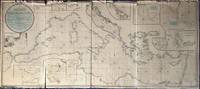
A New Chart of the Mediterranean Sea, Comprehending the Coasts from Cape St. Mary, (in Portugal) to Constantinople, and from Rabat, in Africa, to Alexandretto, or Iskenderoon, in Asia &c. Reduced from the new Spanish and French Charts made by Order of the respective Governments, From Several Documents of Lord Viscount Nelson, and other recent Authorities, By Joseph Dessiou, Master, &c.
by Dessiou (Joseph)
- Used
- Condition
- Used
- Binding
- Unknown
- Quantity Available
- 1
- Seller
-
Sidney, British Columbia, Canada
- Item Price
-
€4,719.00
Show Details
Description:
London: Laurie, 2nd August, 1819. . A large copper engraved "blueback" map on paper, backed with the usual blue manila paper. Large coloured circular-bordered title in upper left, lettered in script. Entire map with contemporary colouring in outline. Thirteen small inset maps. Imprint at bottom: Published 2nd August, 1819, by Richard Holmes Laurie, Chart Seller to the Admiralty, &c.&c. No. 53, Fleet Street, London. Image size is 173cm x 76cm, on a sheet measuring 175cm x 78cm. The map is in five sections, four the same size and one smaller. Some splitting at folds, fraying to upper edge but very little loss, very good condition generally. Beneath the title is a note on the map: "Accompanied with an enlarged Book of Sailing Directions". WorldCat lists an edition of Laurie's book of directions [not present here]: "Laurie and Whittle's New Sailing Directions for the Mediterranean Sea ... Written to accompany the New Chart of the Mediterranean Sea, and compiled from the best Authorities, aided by several…
Read More Item Price
€4,719.00

Stock Photo: Cover May Be Different
Britannia Depicta Or Ogilby Improved Road Atlas Of England And Wales ( 1720 )
by Bowen, Emanuel
- Used
- Fine
- Hardcover
- Condition
- Used - Fine
- Jacket Condition
- Good
- Edition
- Facsimile
- Binding
- Hardcover
- ISBN 10 / ISBN 13
- 9780900409394 / 0900409398
- Quantity Available
- 1
- Seller
-
Ancaster, Ontario, Canada
- Item Price
-
€23.60
Show Details
Description:
Newcastle: Frank Graham, 1970. Book. Fine. Hardcover. Facsimile. 8vo - over 7¾ - 9¾" tall. 273 Pages Illus. Dust Jacket Shows Wear From Handling With Several Tears..
Item Price
€23.60

Map of Huntingdonshire.
by HUNTINGDONSHIRE. EMANUEL BOWEN
- Used
- Condition
- Used
- Quantity Available
- 1
- Seller
-
Ilminster, Somerset, United Kingdom
- Item Price
-
€17.93
Show Details
Description:
Engraved County Map, above map, decorative cartouche with title "Road from Huntingdon to Ipswich", on reverse, road map from Huntingdon to Soham, from "Britannia Depicta", Sheet 191/192,
Item Price
€17.93
Map of Denbighshire.
by DENBIGHSHIRE. EMANUEL BOWEN
- Used
- Very Good
- Condition
- Used - Very Good
- Quantity Available
- 1
- Seller
-
Ilminster, Somerset, United Kingdom
- Item Price
-
€17.93
Show Details
Description:
No Binding. Very good. Engraved County Map, above map, decorative cartouche with title "Road from Gloucester to Coventry", on reverse, road map from St Ives to Truro, from "Britannia Depicta", Sheet 181/182, very good condition, some browning in border, No Jacket
Item Price
€17.93

Map of Flintshire.
by FLINTSHIRE. EMANUEL BOWEN
- Used
- Condition
- Used
- Quantity Available
- 1
- Seller
-
Ilminster, Somerset, United Kingdom
- Item Price
-
€17.93
Show Details
Description:
Engraved County Map, with later hand-colouring; above map, decorative cartouche with title "Road from Shrewsbury to Holywell", on reverse, road map from Shrewsbury to Wrexham, from "Britannia Depicta", Sheet 265/266, very good condition,
Item Price
€17.93
Map of Merionethshire.
by MERIONETHSHIRE. EMANUEL BOWEN
- Used
- Condition
- Used
- Quantity Available
- 1
- Seller
-
Ilminster, Somerset, United Kingdom
- Item Price
-
€17.93
Show Details
Description:
Engraved County Map, above map, decorative cartouche with title "Road from London to Montgomery", on reverse, road map from Worcester to Campden, from "Britannia Depicta", Sheet 109/110, very good condition, some browning in border,
Item Price
€17.93
Map of Westmorland.
by WESTMORLAND. EMANUEL BOWEN
- Used
- Condition
- Used
- Quantity Available
- 1
- Seller
-
Ilminster, Somerset, United Kingdom
- Item Price
-
€17.93
Show Details
Description:
Engraved County Map, above map, decorative cartouche with title "Road from York to Whitby", on reverse, road map from York to Pickering, from "Britannia Depicta", Sheet 271/272,
Item Price
€17.93

Map of Nottinghamshire.
by NOTTINGHAMSHIRE. EMANUEL BOWEN
- Used
- Condition
- Used
- Quantity Available
- 1
- Seller
-
Ilminster, Somerset, United Kingdom
- Item Price
-
€17.93
Show Details
Description:
Engraved County Map, above map, decorative cartouche with title "Road from London to Barwick", on reverse, road map from London to Ware, from "Britannia Depicta", Sheet 11/12, some marking,
Item Price
€17.93
Map of Monmouthshire.
by MONMOUTHSHIRE. EMANUEL BOWEN
- Used
- Condition
- Used
- Quantity Available
- 1
- Seller
-
Ilminster, Somerset, United Kingdom
- Item Price
-
€17.93
Show Details
Description:
Engraved County Map, above map, decorative cartouche with title "Road from Monmouth to Lanbeder", on reverse, road map from Monmouth to Abergaveny, from "Britannia Depicta", Sheet 203/204, faint stain left bottom corner,
Item Price
€17.93
Map of Bedfordshire.
by BEDFORDSHIRE. EMANUEL BOWEN
- Used
- Condition
- Used
- Quantity Available
- 1
- Seller
-
Ilminster, Somerset, United Kingdom
- Item Price
-
€17.93
Show Details
Description:
Engraved County Map, above map, decorative cartouche with title "Road from London to Oakham", on reverse, road map from Thetford to Norwich, from "Britannia Depicta", Sheet 117/118,
Item Price
€17.93

A Complete Atlas, or Distinct View of the Known World; Exhibited in Sixty-Eight Maps: ... by Emanuel Bowen,
by Emanuel Bowen
- New
- Paperback
- Condition
- New
- Binding
- Paperback
- ISBN 10 / ISBN 13
- 9781170804803 / 1170804802
- Quantity Available
- 10
- Seller
-
Southport, Merseyside, United Kingdom
- Item Price
-
€26.28
Show Details
Description:
Paperback. New.
Item Price
€26.28

More Photos
The Sky and the Forest
by Forester, C.S
- Used
- Very Good
- Hardcover
- first
- Condition
- Used - Very Good
- Jacket Condition
- Very Good
- Edition
- First Edition
- Binding
- Hardcover
- Quantity Available
- 1
- Seller
-
Salem, Oregon, United States
- Item Price
-
€32.93€16.47Save €17.44!
Show Details
Description:
C.S. Forester: The Sky and the Forest. Little, Brown and Company, Boston. Stated First Edition First Printing Thus August, 1948. Cover price $2.75. Used. VG BOOK/VG UNCLIPPED DUST JACKET. A story of a central Africa. By C.S. Forester, author of the Admiral Hornblower series.
Item Price
€32.93€16.47
Save €17.44
!

More Photos
Old Decorative Maps and Charts
by Humphreys, Arthur L
- Used
- Very Good
- Hardcover
- first
- Condition
- Used - Very Good
- Jacket Condition
- No Jacket
- Edition
- First Edition
- Binding
- Hardcover
- Quantity Available
- 1
- Seller
-
Sumner, Iowa, United States
- Item Price
-
€42.47
Show Details
Description:
London: London: Halton & Truscott Smith, LTD>. Limited Edition of 1500 copies of which this is number No. 906---Clean, no marks, pages pristine. 79 maps dated 1482-1776 from engravings in the MacPherson Collection. Top Edge Gilt--No DJ Covers rubbed and very slight lean to spine----interior in excellent condition. . Very Good. Hardcover. First Edition. 1926.
Item Price
€42.47

More Photos
Plat Book: Pierce County, Wisconsin
by Rhame, A. E
- Used
- Fine
- Paperback
- Condition
- Used - Fine
- Binding
- Paperback
- Quantity Available
- 1
- Seller
-
Woodruff, Wisconsin, United States
- Item Price
-
€44.04
Show Details
Description:
1930. Soft Cover. Fine. Unpaginated. Tan colored book is in Fine condition, no sign of wear.
Item Price
€44.04
![Alaska and Klondike Region; [With inset of Klondike Region on the Upper Yukon detail] [From an...](https://d3525k1ryd2155.cloudfront.net/h/062/537/1339537062.0.m.jpg)
Alaska and Klondike Region; [With inset of Klondike Region on the Upper Yukon detail] [From an atlas, "Gazetteer of Alaska and Yukon Region " pp. 105 and 106]
by Miller, J. Martin
- Used
- Very Good
- Condition
- Used - Very Good
- Edition
- Unknown
- Quantity Available
- 1
- Seller
-
Sebastopol, California, United States
- Item Price
-
€36.81
Show Details
Description:
Chicago: J. Martin Miller, 1899. Unknown. Map. Very Good. [Map copyright 1899, printing date of Atlas later] [19.875x15.125in]; Colored map of Alaska with steamer routes from Portland and Seattle, insets of the Klondike Region on the Upper Yukon and Western portion of Aleutian Islands; On verso index of places and names with two large black and white images; Age toning to all edges, water stain marks on bottom, slight printing offset of colors, small chips and closed tears to lower edge;.
Item Price
€36.81

Zemepis Sveta - Monsunova Asie
by De La Blache, P. Vidal; Gallois, L
- Used
- Hardcover
- Condition
- Used - Very Good Condition
- Jacket Condition
- No Dust Jacket
- Binding
- Hardcover
- Quantity Available
- 1
- Seller
-
Oak Point, Texas, United States
- Item Price
-
€56.63
Show Details
Description:
Aventinum, Prague, Czechoslovakia, 1931. Hardcover. Very Good Condition/No Dust Jacket. Text entirely in Czech. Geography book on Asia with numerous photographs and maps. 1930 edition also available. Size: 4mo - over 9 3/4" - 12" tall. 400 pp. Pages are yellowed, but are tight and clean. Moderate shelfwear along the spine. Corners are lightly bumped. Quantity Available: 1. Shipped Weight: 3-5 pounds. Category: Travel & Places; Non-English Language::Czech; Pictures of this item not already displayed here available upon request. Inventory No: 001228. . Additional shipping charges may apply.
Item Price
€56.63

Last Tales
by Dinesen, Isak
- Used
- Very Good
- Hardcover
- first
- Condition
- Used - Very Good
- Jacket Condition
- Good+
- Edition
- First Edition
- Binding
- Hardcover
- Quantity Available
- 1
- Seller
-
Salem, Oregon, United States
- Item Price
-
€113.26€56.63Save €60.00!
Show Details
Description:
Dinesen, Isak: Last Tales, A Collection of Twelve New Tales of Compelling Beauty 1957, Random House. First Edition. Stated First Printing Thus. Used. Very Good/Good+ original red dust jacket, price-clipped. Jacket states 11/57 on front flap. 5 3/4 X
Item Price
€113.26€56.63
Save €60.00
!

Zemepis Sveta - Monsunova Asie
by De La Blache, P. Vidal; Gallois, L
- Used
- Hardcover
- Condition
- Used - Very Good Condition
- Jacket Condition
- No Dust Jacket
- Binding
- Hardcover
- Quantity Available
- 1
- Seller
-
Oak Point, Texas, United States
- Item Price
-
€56.63
Show Details
Description:
Aventinum, Prague, Czechoslovakia, 1930. Hardcover. Very Good Condition/No Dust Jacket. Text entirely in Czech. Geography book on Asia with numerous photographs and maps. 1931 edition also available. Size: 4mo - over 9 3/4" - 12" tall. 400 pp. Pages are yellowed, but are tight and clean. Moderate shelfwear along the spine. Corners are lightly bumped. Quantity Available: 1. Shipped Weight: 3-5 pounds. Category: Travel & Places; Non-English Language::Czech; Pictures of this item not already displayed here available upon request. Inventory No: 001227. . Additional shipping charges may apply.
Item Price
€56.63

The Adventure of Wrangel Island
by Vilhjalmur Stefansson
- Used
- Good
- Hardcover
- first
- Condition
- Used - Good
- Jacket Condition
- No DJ Included
- Edition
- First Edition
- Binding
- Hardcover
- Quantity Available
- 1
- Seller
-
Salem, Oregon, United States
- Item Price
-
€117.87€58.94Save €62.44!
Show Details
Description:
The Adventure of Wrangel Island, Alaska (1925 Macmillan 1st Edition) HISTORY OF ALASKA. EXLIB. Good Condition/ No DJ included. Fold-out map affixed to binding at the back of the book has never been opened. The story of the (unsuccessful) attempted colonization of Wrangel Island Alaska. 413 pages plus appendix, Index. Titling is still bright. A clean, solid copy. Scarce.
Item Price
€117.87€58.94
Save €62.44
!

Seven Pillars Of Wisdom, A Triumph
by Lawrence, T.E
- Used
- Good
- Hardcover
- first
- Condition
- Used - Good
- Jacket Condition
- No DJ Included
- Edition
- First American Edition
- Binding
- Hardcover
- Quantity Available
- 1
- Seller
-
Salem, Oregon, United States
- Item Price
-
€117.93€58.97Save €62.47!
Show Details
Description:
T.E. Lawrence. SEVEN PILLARS OF WISDOM, A TRIUMPH. AUTOBIOGRAPHY. Privately Printed, 1926. First Published for general circulation 1935. First American Edition. States MCMXXXVI on the title page. Doubleday, Doran & Company, Inc. Garden City, NY. GOOD CONDITION/ NO DUST JACKET IS INCLUDED. 672 pages, indexed. Beige buckram boards. Spine has darkened a bit. 6 7/8 X 9 ½.
Item Price
€117.93€58.97
Save €62.47
!

North America from the Best Authorities, Russell, ca.1800
by Russell
- Used
- Condition
- Used
- Quantity Available
- 1
- Seller
-
Plymouth, Devon, United Kingdom
- Item Price
-
€23.90
Show Details
Description:
Russell, J. : A General Map of North America from the Best Authorities. Nd but ca.1800. From "A New Geographical, Historical and Commercial Grammar and Present State of Several Kingdoms of the World." Copper engraving. Size approx 200 x 230mm. Two neat folds. Some age colouring to edges, otherwise very clean and bright.
Item Price
€23.90