Description:
Alan Godfrey Maps. Facsimilie. The Godfrey Edition.. Very Good.
Buckingham. Seventh Series. Sheet 146. by Folding Map - 1952
by Folding Map

Buckingham. Seventh Series. Sheet 146.
by Folding Map
- Used
Ordnance Survey., 1952. Scale: 1 inch to 1 mile. Covers a little marked.. Good+.
-
Bookseller
N. G. Lawrie Books.
 (GB)
(GB)
- Book Condition Used - Good+
- Publisher Ordnance Survey.
- Date Published 1952
- Keywords Ordnance Survey Map Yorkshire Doncaster..

Sheffield Park 1903. Old Ordnance Survey Maps. Yorkshire Sheet 294.12.
by Folding Map
- Used
- very good
- Condition
- Used - Very Good
- ISBN 10 / ISBN 13
- 9780850541205 / 0850541204
- Quantity Available
- 1
- Seller
-
Sheffield, United Kingdom
- Item Price
-
€1.18
Show Details
Item Price
€1.18

Old Ordnance Survey Maps of Durham: Sheriff Hill & High Fell 1895
by Folding Map
- Used
- very good
- Condition
- Used - Very Good
- ISBN 10 / ISBN 13
- 9780907554240 / 0907554245
- Quantity Available
- 1
- Seller
-
Sheffield, United Kingdom
- Item Price
-
€1.18
Show Details
Description:
Alan Godfrey Maps. Facsimilie. The Godfrey Edition.. Very Good.
Item Price
€1.18

Greasbrough 1901. Old Ordnance Survey Maps. Yorkshire Sheet 289.02.
by Folding Map
- Used
- Fine
- Condition
- Used - Fine
- ISBN 10 / ISBN 13
- 9781841511115 / 1841511110
- Quantity Available
- 1
- Seller
-
Sheffield, United Kingdom
- Item Price
-
€1.18
Show Details
Description:
Alan Godfrey Maps. Fine.
Item Price
€1.18

Sheffield (West) 1903. Old Ordnance Survey Maps. Yorkshire Sheet 294.07.
by Folding Map
- Used
- very good
- Condition
- Used - Very Good
- ISBN 10 / ISBN 13
- 9780850540482 / 0850540488
- Quantity Available
- 1
- Seller
-
Sheffield, United Kingdom
- Item Price
-
€1.18
Show Details
Description:
Alan Godfrey Maps. Facsimilie. The Godfrey Edition.. Very Good.
Item Price
€1.18
Mexborough 1901. Old Ordnance Survey Maps. Yorkshire Sheet 284.09.
by Folding Map
- Used
- Fine
- Condition
- Used - Fine
- ISBN 10 / ISBN 13
- 9780850540499 / 0850540496
- Quantity Available
- 1
- Seller
-
Sheffield, United Kingdom
- Item Price
-
€1.18
Show Details
Description:
Alan Godfrey Maps. Fine.
Item Price
€1.18
Jarrolds' County Map of Cambridge.
by (Folding Map)
- Used
- very good
- Condition
- Used - Very Good
- Quantity Available
- 1
- Seller
-
Sheffield, United Kingdom
- Item Price
-
€2.36
Show Details
Description:
Jarrold & Sons. Reduced from the Ordnance Survey by John Bartholomew. Undated, circa 1940s. A few splits on folds.. Very Good.
Item Price
€2.36

Australia.
by Folding Map
- Used
- Condition
- Used - Very Good+
- Quantity Available
- 1
- Seller
-
Sheffield, United Kingdom
- Item Price
-
€2.36
Show Details
Description:
The National Geographic Magazine., 1963. Colour folding map.. Very Good+.
Item Price
€2.36

Arkansas, Oklahoma, Louisiana, Texas.
by Folding Map
- Used
- Condition
- Used - Very Good+
- Quantity Available
- 1
- Seller
-
Sheffield, United Kingdom
- Item Price
-
€2.36
Show Details
Description:
The National Geographic Magazine., 1974. Colour folding map.. Very Good+.
Item Price
€2.36

Southeast Asia.
by Folding Map
- Used
- Condition
- Used - Very Good+
- Quantity Available
- 1
- Seller
-
Sheffield, United Kingdom
- Item Price
-
€2.36
Show Details
Description:
The National Geographic Magazine., 1961. Colour folding map.. Very Good+.
Item Price
€2.36
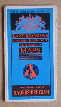
N. Yorkshire Coast. Sheet 36.
by Folding Map
- Used
- very good
- Condition
- Used - Very Good
- Quantity Available
- 1
- Seller
-
Sheffield, United Kingdom
- Item Price
-
€2.36
Show Details
Description:
London.: John Bartholomew & Son Ltd. (Undated, circa 1950s). Bartholomew's Revised Half Inch Contoured Map. Some of splits on the folds.. Very Good.
Item Price
€2.36
