Description:
Boston: Isaiah Thomas and Ebenezer T. Andrews, Printers, 1793. Leather. Good. Full Calf leather. 696, 552 pp. Eight fold out plates/maps in volume one, three in volume two, all present as called for. 1793 edition of this early geographical survey of the United States, as well as the world, containing maps relating to the United States at the time, North America and the world. This work served to heavily influence the teaching of geography and education in the US. GOOD condition. Moderate to heavy scuffing to the leather covers and extremities, with a few deep scrapes and scratches present. Minor soiling and staining. Interiors solid, with moderate toning, scattered foxing, staining and soiling. Dampstaining present to the endpapers. Ownership signatures present. A few pages creased, including dog ear creases. The Virginia map is very tattered, torn and misfolded, with a few other American maps also bearing tears ranging from small to long, along the folds. Some creasing to the maps. Sabin 50926.
The American Geography; or, a view of the present situation of the United States of America. by MORSE, Rev., Jedidiah (1761-1826)
by MORSE, Rev., Jedidiah (1761-1826)
Similar copies are shown below.
Similar copies are shown to the right.

The American Geography; or, a view of the present situation of the United States of America.
by MORSE, Rev., Jedidiah (1761-1826)
- Used
- first
Elizabeth Town: Shepard Kollock, for the Author, 1789. 8vo., (7 6/8 x 5 5/8 inches). With an errata leaf including directions to the binder and the leaf giving "Corrections Respecting France" at the end. 2 large folding engraved maps engraved by Amos Doolittle (some browning and offsetting as usual). Contemporary deerskin (rebacked to style preserving the original red morocco lettering-piece). Provenance: with the bookplate of the Free Library of Philadelphia on the front paste-down. "The time,... is anticipated when all distinctions between master and slaves shall be abolished; and when the language, manners, customs, political and religious sentiments of the mixed mass of the people who inhabit the United States, shall have become so assimilated, as that all nominal distinctions shall be lost in the general and honourable name of AMERICANS" (page 68) First edition. The two maps show: "... the States of Virginia, North Carolina, South Carolina and Georgia Comprehending the Spanish Provinces of East and West Florida, Exhibiting the boundaries as fixed by the late Treaty of Peace between the United States and the Spanish dominions..." (after Joseph Purcell); and "...the Northern and Middle States Comprehending the Western Territory and the British Dominions in North America..." Morse was both a clergyman and one of America's most influential cartographers. His "Geography Made Easy (1784) was the first published textbook on American geography in America. Morse used a questionnaire to gain the knowledge he used to compile this second work, his "American Geography". He circulated it to "such Gentlemen as are able and likely to furnish answers", reprinted it in weekly newspapers, received numerous replies as a result. He quoted from Jefferson's "Notes on the State of Virginia" (1784) and from maps by Lewis Evans, Thomas Pownall, and others. "He queried "men of Science" for information on natural history and other specialties. He obtained statistics on population from magazines and newspapers. In his published book he did not clearly identify his many sources, and he often quoted works directly. He would not use foreign publications, with the comment that "Europeans have . . . too often suffered fancy to supply the place of facts." (Elizabeth Noble Shor for ADNB). Howes M840; Evans 21978; Sabin 50924; Wheat and Brun 149 and 491. Catalogued by Kate Hunter.
-
Bookseller
Arader Galleries
 (US)
(US)
- Book Condition Used
- Publisher Elizabeth Town: Shepard Kollock, for the Author, 1789.
We have 1 copies available starting at €1,512.76.
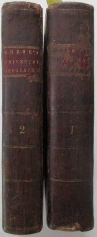
The American Universal Geography. Or, a View of the Present State of the All the Empires, Kingdoms, States and Republics in the Known World, and of the United States of America in Particular. In Two Parts, Complete
by Morse, Jedidiah and Rev. Elijah Parish
- Used
- good
- Condition
- Used - Good
- Quantity Available
- 1
- Seller
-
Dover, New Hampshire, United States
- Item Price
-
€1,512.76
Show Details
Item Price
€1,512.76