Add to Want List
Rare and Antiquarian Books

Maps and Atlases

Results 301 - 315 of 322
South Australia.

South Australia.: Original Antique Map

by John Tallis & Rapkin

  • Used
  • first
Condition
Used
Edition
1st Edition
Seller
Plymouth, Devon
Seller rating:
This seller has earned a 5 of 5 Stars rating from Biblio customers.
Item Price
€93.85
€35.00 shipping to USA

Show Details

Description:
Tallis, John: South Australia. London. [ca.1851]. From the Montgomery Martin Illustrated Atlas. Map engraved by Rapkin. Size approx 360 x 260mm. Original steel engraved map with original outline hand colouring and decorative border. 5 vignettes include Australian Dog, Natives on a Catamaran and Adelaide. Single page unfolded map in excellent, clean condition. Associated text page of the Montgomery Martin Atlas included. A good Tallis Map.
Item Price
€93.85
€35.00 shipping to USA
Isthmus of Panama.

Isthmus of Panama.: Original Antique Map.

by John Tallis & Rapkin

  • Used
  • first
Condition
Used
Edition
1st Edition
Seller
Plymouth, Devon
Seller rating:
This seller has earned a 5 of 5 Stars rating from Biblio customers.
Item Price
€93.85
€35.00 shipping to USA

Show Details

Description:
Tallis, John: Isthmus of Panama. London. [ca.1851]. From the Montgomery Martin Illustrated Atlas. Map engraved by Rapkin. Size approx 360 x 260mm. Original steel engraved map with original outline hand colouring. 2 vignettes include Gold seekers on their way over the Cordilleras and The Fort at Chagres. It also shows in red lines the proposed Canal and Rail communications routes. Decorative Border. Single page unfolded map in excellent, clean condition. Associated text page of the Montgomery Martin Atlas included.
Item Price
€93.85
€35.00 shipping to USA
Meyers Geographischer Handatlas
More Photos

Meyers Geographischer Handatlas

by Meyers

  • Used
  • very good
  • Hardcover
Condition
Used - Very Good
Edition
Revised
Binding
Hardcover
Seller
Thessaloniki, Greece
Seller rating:
This seller has earned a 5 of 5 Stars rating from Biblio customers.
Item Price
€100.00
€14.50 shipping to USA

Show Details

Description:
Hardcover. Very Good. Revised Edition of 1913 on Title Page. Maroon cloth just slightly faded, tight, small shelf wear. Former owners stamp mark, Moskoff famous Greek Jewish tobacco dealer in Thessaloniki.
Item Price
€100.00
€14.50 shipping to USA
Maps and Mapmakers of the Aegean

Maps and Mapmakers of the Aegean

by Sphyroeras, Vasilis – Avramea, Anna – Ashdrahas, Spyros

  • Used
  • as new
  • Hardcover
  • first
Condition
As New
Edition
First English language edition
Binding
Hardcover
Seller
Thessaloniki, Greece
Seller rating:
This seller has earned a 5 of 5 Stars rating from Biblio customers.
Item Price
€100.00
€14.50 shipping to USA

Show Details

Description:
Athens: Olkos, 1985. First English language edition. Hardcover. As New/as new. As new hardcover with DJ. 1st english ed. 263pages, 29X21,8cm.Translated by G. Cox, J. Solman. The charting of the Aegean Sea, or the Greek Archipelago, from the 15th up to the 19th century. Map Index; General Index. 166 color and black & white maps.
Item Price
€100.00
€14.50 shipping to USA
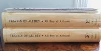
Travels of Ali Bey In Morocco, Tripoli, Cyprus, Egypt, Arabia, Syria, and Turkey. Volume One
More Photos

Travels of Ali Bey In Morocco, Tripoli, Cyprus, Egypt, Arabia, Syria, and Turkey. Volume One: Between the Years 1803 and 1807

by Ali Bey

  • Used
  • Fine
  • Hardcover
  • first
Condition
Used - Fine
Edition
1st Edition (Folios Archive Library)
Binding
Hardcover
Seller
Port Fairy, Victoria
Seller rating:
This seller has earned a 5 of 5 Stars rating from Biblio customers.
Item Price
€91.96
€55.00 shipping to USA

Show Details

Description:
Part of a Two volumes set. See Volume Two. Numerous B/W pictures, drawings, maps in separate folders. Introduction by Robin Bidwell.
Item Price
€91.96
€55.00 shipping to USA
GUIDE PLAN OF CAIRO: Together with an Index to Streets and Places of Interest
More Photos

GUIDE PLAN OF CAIRO: Together with an Index to Streets and Places of Interest

by Egyptian Ministry of Finance

  • Used
Condition
Used - Good condition; Three of the strips are torn and repaired with archival tape.
Seller
Richmond, Texas
Seller rating:
This seller has earned a 5 of 5 Stars rating from Biblio customers.
Item Price
€99.54
€5.00 shipping to USA

Show Details

Description:
Giza: The Survey of Egypt, 1927. Good condition; Three of the strips are torn and repaired with archival tape.. Appears to be second printing of the 1912 survey; 31 pages with a frontis fold-out Key Map of the Strips and five folding folding strips which make up the Guide Plan stapled into paper covers; Each strip folds out to 39 1/2" long.
Item Price
€99.54
€5.00 shipping to USA
Voyageurs, Robes Noires, et Coureurs de Bois
More Photos

Voyageurs, Robes Noires, et Coureurs de Bois

by Charles Upson Clark

  • Used
  • good
  • Hardcover
  • first
Condition
Used - Good
Edition
First Edition Thus
Binding
Hardcover
Seller
Salem, Oregon
Seller rating:
This seller has earned a 5 of 5 Stars rating from Biblio customers.
Item Price
€176.11€111.41
Save €67.92!
€5.00 shipping to USA

Show Details

Description:
Voyageurs, Robes Noires, et Coureurs de Bois. By C.U. Clark. 1934 1st Edition Columbia University Institute of French Studies, Inc. FRENCH LANGUAGE. Stories from the French Exploration of North America, selected and edited by the venerable and renowned Charles Upson Clark, Ph.D: English title is: Travellers, Black Robes, and Wood-runners. Scarce. HARDCOVER. USED. Good Condition/ No DJ Included. Navy blue cloth boards with large gilt titling. No titling remains on spine. 5 ¾ X 8. 374 pages, indexed. Time period covered is 17th and 18th Centuries. JESUITS. ANTHROPOLOGY. SOCIAL SCIENCES. HISTORY OF FRANCE. HISTORY OF CANADA. CANADIANA. ABOUT THE EDITOR: Dr. Clark was the first archaeologist in the world to translate The Badianus Manuscript, aka The Codex Barberini, an Aztec compendium on traditional herbal medicine dating from the Fourteenth Century. Will ship from Oregon.
Item Price
€176.11€111.41
Save €67.92 !
€5.00 shipping to USA
RUSSIA IN EUROPE [Original Hand-colored Lithographed Map]
More Photos

RUSSIA IN EUROPE [Original Hand-colored Lithographed Map]

by Mitchell, Samuel Augustus

  • Used
  • very good
Condition
Used - Very Good
Edition
Original
Seller
Williamsburg, Virginia
Seller rating:
This seller has earned a 5 of 5 Stars rating from Biblio customers.
Item Price
€114.30
€6.50 shipping to USA

Show Details

Description:
Philadelphia: Thomas, Cowperthwaite & Co., 1848. This map is from the 1848 edition of A NEW UNIVERSAL ATLAS CONTAINING MAPS OF THE VARIOUS EMPIRES. The atlas was based primarily on the H. S. Tanner UNIVERSAL ATLAS, the rights to which were purchased by Mitchell from Carey & Hart. The early Mitchell maps are distinguished by their vivid hand-coloring and attractive decorated borders. They are among the most sought-after ante-bellum maps published in the United States. This map is guaranteed to be authentic and more than 170 years old. It is in very good condition: clean and bright, with some toning. There is one tiny chip out of one corner of the sheet--far away from the image.. Original. Single Sheet. Very Good. Folio - over 12" - 15" tall. Map.
Item Price
€114.30
€6.50 shipping to USA
Geology and Natural Resources of Colorado

Geology and Natural Resources of Colorado

by Russell D. George

  • Used
  • Hardcover
Condition
Used - Very Good+
Binding
Hardcover
Seller
Longmont, Colorado
Seller rating:
This seller has earned a 5 of 5 Stars rating from Biblio customers.
Item Price
€109.54
€6.00 shipping to USA

Show Details

Description:
University of Colorado, 1927. VG+ in Fair brown paper wrapper. Book is As New except for all four corners being slightly bumped and rubbed. DJ is really just a light paper wrapper with the University logo on the front. This is acidic, brittle, torn, creased, and soiled. It has done its job protecting the book within. Photo is of the copy we have here at Barbed Wire Books.
Item Price
€109.54
€6.00 shipping to USA
Atlante di Roma: La forma del centro storico in scala 1:1000 nel fotopiano e nella carta numerica
More Photos

Atlante di Roma: La forma del centro storico in scala 1:1000 nel fotopiano e nella carta numerica

by Paolo Marconi, Eugenio Baldari, Bruno cussino, Luigi Prestinenza Puglisi, Gabriella Maltese, Daniele Tinacci, Licinio Ferretti

  • Used
  • Hardcover
Condition
Used - VG
Edition
Fourth
Binding
Hardcover
Seller
Germantown, New York
Seller rating:
This seller has earned a 5 of 5 Stars rating from Biblio customers.
Item Price
€100.01
€6.00 shipping to USA

Show Details

Description:
Atlante di Roma: La forma del centro storico in scala 1:1000 nel fotopiano e nella carta numericaby Paolo Marconi, Eugenio Baldari, Bruno cussino, Luigi Prestinenza Puglisi, Gabriella Maltese, Daniele Tinacci, Licinio FerrettiMarsilio, Venice, 1996. Fourth Edition. Hardcover. Square (11 1/2" x 11 1/2"). 621pp. Black Cloth. An aerial view of the historic areas of Rome in 276 square color plates. Each plate is accompanied by schematic of the section photographed. There are 45 black and white illustrations which are comprised of ancient maps of Rome as well as Technological renderings of the architecture. Accompanied by essays (i.e. A New Tool for an Improved City) bilingual- in Italian in front and English in the back. Condition: The book is lacking the jacket and embossed white titles on the spine are mostly gone - but otherwise the book and slipcase are as new. A heavy oversize volume (9 pds.) which may require additional shipping cost.
Item Price
€100.01
€6.00 shipping to USA
She: A History of Adventure
More Photos

She: A History of Adventure

by H. Rider Haggard

  • Used
  • very good
  • Hardcover
Condition
Used - Very Good
Edition
New Impression Thus
Binding
Hardcover
Seller
Salem, Oregon
Seller rating:
This seller has earned a 5 of 5 Stars rating from Biblio customers.
Item Price
€176.11€105.66
Save €73.96!
€5.00 shipping to USA

Show Details

Description:
Haggard, H. Rider. SHE. Longmans Green & Co., London. No copyright date. States New Impression, 1921 on the title page. Dedicated to fellow author Andrew Lang. USED. VG/ No DJ Included. Mallard Green boards with bright gilt titling on front board and spine. 310 pages plus adverts. 5 X 7 5/8. Summary: "A dying colleague gives Mr. Horace Holly at Cambridge University a locked box, the contents of which lead Mr. Holly to travel to Eastern Africa where he hopes to solve an ancient mystery, only to be captured by the savage Amhagger people who are ruled by a fearsome white queen, who is worshipped as "She-Who-Must-Be-Obeyed".
Item Price
€176.11€105.66
Save €73.96 !
€5.00 shipping to USA
Atlas of the Lewis & Clark Expedition
More Photos

Atlas of the Lewis & Clark Expedition

  • Used
  • Hardcover
  • first
Condition
Used
Edition
First Edition
Binding
Hardcover
Seller
San Rafael, California
Seller rating:
This seller has earned a 5 of 5 Stars rating from Biblio customers.
Item Price
€109.54
€4.75 shipping to USA

Show Details

Description:
This large atlas is Volume 1 of the eventual 13 volume set printed by the University of Nebraska Press. It includes all the maps from the Lewis & Clark expedition from St. Louis, Missouri to the mouth of the Coumbia River on the Pacific Coast and many of the return journey, including many others by earlier explorers that the expedition relied upon. Includes a preface and introduction that provides the historical context of the expedition and the short biographies of the main players along with a detailed explanation of how the maps were discovered, organized and included in the book. Due to the size of the atlas, extra shipping charges will apply, not to exceed $24. NO EXPEDITED SHIPPING ON THIS LARGE BOOK.
All proceeds benefit The Friends of the San Anselmo Library. No Expedited Shipping outside of the United States.
Item Price
€109.54
€4.75 shipping to USA
Saga of Sydney:  Actor Edward Everett Horton's personal copy)
More Photos

Saga of Sydney: Actor Edward Everett Horton's personal copy)

by Clune, Frank

  • Used
  • very good
  • Hardcover
  • first
Condition
Used - Very Good
Edition
Subscribers Edition
Binding
Hardcover
Seller
Salem, Oregon
Seller rating:
This seller has earned a 5 of 5 Stars rating from Biblio customers.
Item Price
€190.50€114.30
Save €80.00!
€5.00 shipping to USA

Show Details

Description:
Clune, Frank. Saga of Sydney. Sydney Halstead Press, 1961 Subscribers Edition with 118 illustrations and 17 maps. 508 pages. 5 3/4 X 8 3/4. Printed in Australia by Halstead Press, Sydney. Presented to beloved 20th Century American actor Edward Everett Horton at the Australia Hotel, Sydney (1891-1971) by his Australian friend Alexander Rentoul at the hotel March, 1962. Full page hand-written statement on the front end-paper. says: Mr. Horton is best-known for his unforgettable portrayal of Mr. Alexander P. Lovett "Lovey" in the timeless 1937 motion picture "Lost Horizon" directed by Frank Capra. VERY GOOD CONDITION/ NO DJ INCLUDED.
Item Price
€190.50€114.30
Save €80.00 !
€5.00 shipping to USA
Orthogonal Town Planning In Antiquity

Orthogonal Town Planning In Antiquity

by Ferdinando Castagnoli

  • Used
  • very good
  • Hardcover
  • first
Condition
Used - Very Good
Edition
First English Edition
Binding
Hardcover
Seller
Salem, Oregon
Seller rating:
This seller has earned a 5 of 5 Stars rating from Biblio customers.
Item Price
€160.87€96.52
Save €67.56!
€5.00 shipping to USA

Show Details

Description:
Orthogonal Town Planning In Antiquity. By Ferdinando Castagnoli.1971 The MIT Press, Cambridge, MA. First English Edition. ILLUSTRATED. Originally published in Rome by De Luca Editore Under the auspices of the Institute of ancient topography of the University of Rome. English translation copyright, 1971. ISBN 026203042X. 138 pages. 7 ¼ X 10 ¼. EXLIB Textbook. VG/ NO DJ is included.
Item Price
€160.87€96.52
Save €67.56 !
€5.00 shipping to USA
Old German Maps and City Views
More Photos

Old German Maps and City Views: Alte deutsche Landkarten und Städteansichten

  • Used
  • good
Condition
Used - Good
Seller
Cazenovia, New York
Seller rating:
This seller has earned a 5 of 5 Stars rating from Biblio customers.
Item Price
€104.78
€6.99 shipping to USA

Show Details

Description:
Circa 1970 boxed collection of reprints of old German and Prussian maps. This is a very handsome set containing 52 large format pieces, 10 regional maps and 42 city plans, taken from originals dated from the late 1500s to early 1700s. Maps are printed on high quality paper, some in monochrome and others in full color. Larger maps are folded. All are in good condition and suitable for framing. The collection is housed in an attractive hinged box covered in black faux leather with gold stamping and a pictorial paste on at fore. Included are some promotional materials from the publisher and an a 24 page stapled booklet with a history and description of each map. All text is in German. See photos for a list of map locations. Price includes extra shipping charges due to weight. Your purchase helps support our small village library. s Ftop
Item Price
€104.78
€6.99 shipping to USA